Map of Corona
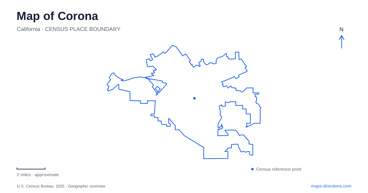
Street tiles load from OpenStreetMap when opened. The blue line shows the 2025 Census boundary.
- State
- California
- Population · July 2025
- 161,734
- Land area
- 39.9 sq mi
- Water area
- 0.0 sq mi
Corona has a street pattern that can be recognized before any landmark label is read: Grand Boulevard forms a circle around the older town grid. That shape provides a strong starting point, but the wider map tells several other stories. Citrus cultivation left buildings and industrial remnants, the southern foothills lead toward national forest land, and the Santa Ana River corridor connects the western edge with a broader regional landscape. Understanding these different settings helps place the historic center within a city that has expanded well beyond its original circle.
A circle drawn around a grid
The town began as South Riverside in 1886, when a land and water company developed property acquired from the Yorba family. Robert B. Taylor proposed the circular boulevard, and engineer H. C. Kellogg translated the idea into a street plan with a grid enclosed by the curved road. The result was a deliberately composed townsite rather than a circle that happened to emerge from later road building.
Grand Boulevard's roughly one-mile diameter is the important measurement; it is not a one-mile journey around the entire circumference. Main Street and Sixth Street provide useful references within the historic pattern. Municipal planning documents identify them as central to the early commercial district, with Sixth Street extending between the eastern and western sides of the boulevard.
Corona adopted its current name when it incorporated in 1896. The circle remains part of the city's official seal and civic identity. On a map, it also establishes a contrast between the regular central grid and the later streets beyond it. Following the curve can reveal the original town's outline even where present-day land uses no longer resemble those of the nineteenth-century settlement.
A boulevard that became a racecourse
The circular road acquired an additional history through automobile racing. Events took place in 1913, 1914, and 1916, bringing prominent drivers and large crowds to the town. The course used an existing piece of urban infrastructure, temporarily turning the perimeter boulevard into a sporting arena.
This episode helps explain why racing imagery appears alongside citrus and town-planning exhibits in local heritage interpretation. The course was inseparable from the street design. It also imposed considerable costs on an inhabited community, and the fatal accident during the 1916 event contributed to the end of the races. Grand Boulevard today should be read as a functioning city street carrying that historical association, not as a surviving dedicated motorsport facility.
Citrus history in buildings and machinery
At 510 West Foothill Parkway, the heritage park preserves five acres associated with the former Foothill Lemon Company base. Its early twentieth-century buildings now accommodate a history museum, model railroad displays, arts activities, and other community uses. Gardens and a small working lemon grove keep the agricultural setting visible alongside the indoor interpretation.
For Corona, this site supplies a tangible connection between the older citrus economy and the developed neighborhoods around it. A grove alone would show the crop; the collection of buildings helps reveal the supporting organization of a working agricultural enterprise. Their reuse also demonstrates how heritage can remain part of daily cultural activity instead of being reduced to an isolated monument.
City Park provides a different surviving fragment. The city purchased its land in 1912 after an unsuccessful attempt to grow lemons there, and the park opened in 1913. An air compressor from the Sunkist plant, formerly associated with the community's familiar whistle, is preserved at the park's front. That industrial object connects a public recreation space with the processing side of the citrus business.
From urban streets to the foothill edge
The southern landscape changes scale near the Cleveland National Forest. Municipal trail planning identifies Skyline and Hagador Canyon as important access areas at the forest's base. Skyline's approach is associated with Foothill Parkway and the meeting of Skyline and Burrero Way. This is a transition between residential streets and a larger hillside trail environment, rather than another extension of the downtown grid.
The distinction matters geographically: the circular boulevard organizes a relatively compact urban center, while foothill routes respond to slopes and canyons. A map of Corona that includes terrain makes this change much clearer. Trail alignments bend with the land, and routes into the hills require a different assessment of distance and effort from walks among city blocks.
The river and the western passage
The western side lies near the Santa Ana River, Green River Road, and the regional routes numbered 91 and 71. Planning maps place Chino Hills to the northwest and Prado Reservoir to the northeast of the Green River area, showing how several jurisdictions and natural features meet here.
That regional context completes the picture. Corona’s recognizable circle is a historical center within a much larger landscape of river infrastructure, foothills, and former agricultural land. Keeping all three in view makes the city easier to understand: the boulevard explains the founding plan, preserved citrus places explain an earlier economy, and the surrounding terrain explains why later movement and development follow different patterns.
Map and statistics: U.S. Census Bureau, 2025 Gazetteer, January 2025 generalized place boundaries and Vintage 2025 population estimates. Local references: City of Corona; Corona Heritage Foundation. Article prepared by Maps & Directions.