Map of Coral Gables
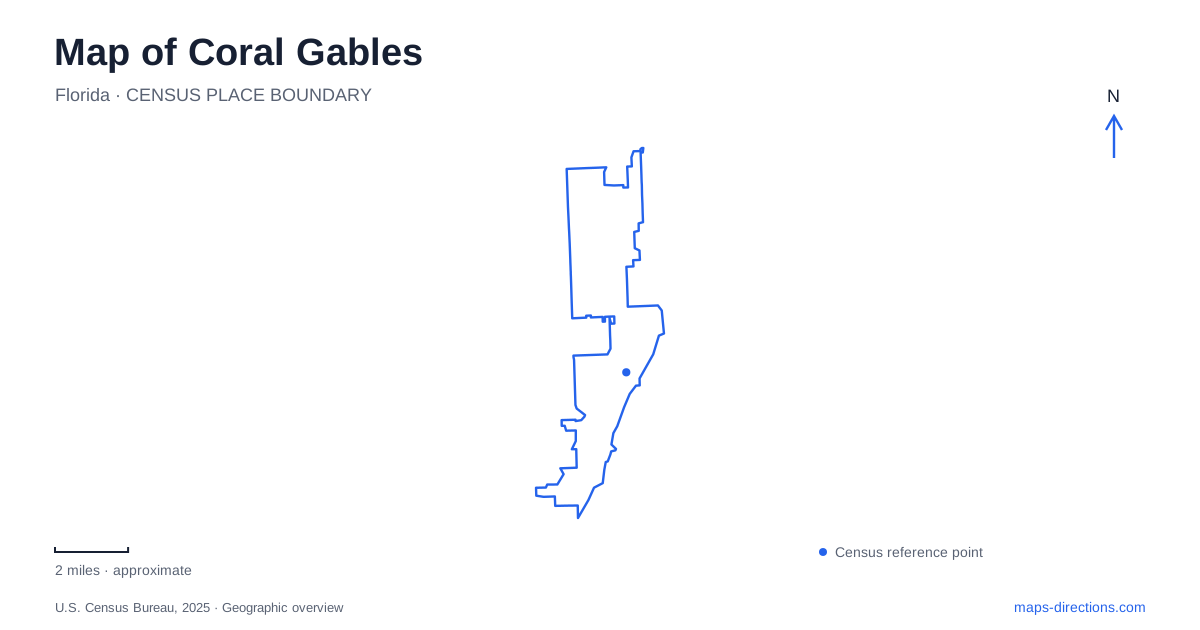
Street tiles load from OpenStreetMap when opened. The blue line shows the 2025 Census boundary.
- State
- Florida
- Population · July 2025
- 49,578
- Land area
- 12.9 sq mi
- Water area
- 24.4 sq mi
Coral Gables has several distinct landscapes within its boundaries: a compact commercial street, residential avenues shaped by a planned development, a university corridor and a bayfront park district. Coral Way, Ponce de Leon Boulevard and Old Cutler Road provide three useful reference lines. Following their separate roles explains why the downtown shops, historic swimming pool and tropical gardens belong to the same municipality without forming one continuous visitor district.
The four blocks of Miracle Mile
Miracle Mile is the section of Coral Way between LeJeune Road and Douglas Road. Its four blocks give the business district a recognizable east–west spine. On a map, the special street name therefore describes a particular stretch of a longer road, rather than an additional parallel avenue. This distinction helps when comparing an address on Coral Way with a business advertised as being on the Mile.
The streetscape reinforces that compact geography. Oaks accompany the sidewalks, palms occupy the median, and quartz paving differentiates the pedestrian space. The Miracle Theatre, built in 1948 and now home to Actors' Playhouse, provides a cultural landmark among the shops and restaurants. Looking at this short corridor at street scale reveals more than a regional map: the commercial experience is concentrated in successive blocks, with individual destinations distributed along both sides.
A family property behind the planned city
The Merrick House at 907 Coral Way introduces an earlier layer of Coral Gables. The family arrived from Massachusetts in 1899 and developed a farm with the help of Bahamian workers. Vegetables preceded the profitable grapefruit crop. When the groves began producing in 1906, the family could enlarge its wooden cottage with native coral rock. Althea Merrick adapted elements of New England houses to the local climate.
That building material came from the quarry that later became Venetian Pool. The connection is unusually tangible: two separate landmarks represent the extraction and reuse of the same local stone. At the house, a guided interior visit covers 14 rooms, while the 1.3-acre grounds include a grotto, Heritage Garden, lily pond and broad porch. The domestic setting makes the agricultural origins easier to understand than the later commercial frontage alone would suggest.
Quarry, pool and hotel landscape
Venetian Pool occupies 2701 De Soto Boulevard. Its aquifer-fed water, waterfalls and grotto features distinguish it from a conventional rectangular municipal pool. For Coral Gables, the former quarry also illustrates how an industrial excavation became part of the planned recreational landscape. The stone removed from this site helped build the surrounding community before the hollow itself acquired a different use.
Swimming admission is a separate part of a visit, with age and height requirements. Check the pool's admission calendar for maintenance days and the session you intend to attend. The pool should therefore be treated as an operated facility with an admission schedule, rather than an unrestricted water feature in a public square.
The Biltmore Hotel supplies another major landmark from the development era. Opened in 1926, it belongs to the same broad architectural story but is a different destination with its own hotel grounds and recreational facilities. Keeping the hotel and former quarry distinct makes an architecture-focused outing more coherent than grouping every historic water or garden feature under one attraction.
Ponce de Leon and the rail connection
Public transport adds a north–south framework to Coral Gables. The Ponce de Leon trolley route connects Douglas Metrorail Station with Flagler Street along the boulevard. The Grand Avenue route also begins at the station but serves the historic McFarlane Homestead District. These two corridors explain the station's role as a transfer point for different parts of the city.
A Southern Loop began in November 2025 as a one-year pilot, extending from the station toward Red Road via Ponce de Leon Boulevard and serving the University of Miami area. Its pilot status matters when interpreting a route map beyond that initial year. The university is also the setting for the Lowe Art Museum, adding a separate cultural cluster beyond the downtown theater and shopping blocks.
Old Cutler Road and the bay
Farther into the coastal landscape, Matheson Hammock Park and Marina is reached at 9610 Old Cutler Road. Its grounds wrap around the northern and western sides of Fairchild Tropical Botanic Garden. The garden's plant collections and the park's marina, trails and shoreline offer different reasons to visit this adjoining pair.
The park's artificial atoll pool exchanges water with Biscayne Bay through tidal action. That is a different water setting from the inland, aquifer-fed Venetian Pool. On a map of Coral Gables, the comparison brings the whole geography into focus: commercial Coral Way, the historic residential landscape, the university corridor and the Old Cutler waterfront each tell a different part of the place's story.
Map and statistics: U.S. Census Bureau, 2025 Gazetteer, January 2025 generalized place boundaries and Vintage 2025 population estimates. Local references: City of Coral Gables. Article prepared by Maps & Directions.