Map of Copperas Cove
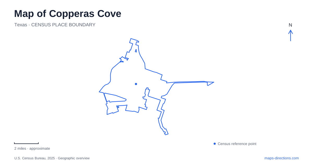
Street tiles load from OpenStreetMap when opened. The blue line shows the 2025 Census boundary.
- State
- Texas
- Population · July 2025
- 40,118
- Land area
- 18.0 sq mi
- Water area
- 0.0 sq mi
Copperas Cove has a town map shaped by a move. The early settlement formed around a rural store southwest of the later community, but the arrival of the railway drew its center toward a new townsite. That shift remains useful when locating the old stage stop, public parks, and later recreation facilities. The surrounding hills supply another part of the picture: this is a Central Texas landscape where settlement, transport, and outdoor space developed together rather than a town arranged around one unchanged historic square.
From the stage road to the railroad
The Ogletree Stagestop and Post Office stands in Ogletree Gap Park on Post Office Road. The Texas Historical Commission identifies stones in the building bearing the date 1878. Marsden Ogletree's family used the structure as a home and grain store, and it also accommodated travelers on the Lampasas-to-Belton stage route. A post office opened there in 1879, with Ogletree as postmaster. The place combined several functions that a small rural settlement needed before specialized civic and commercial buildings developed.
The railway changed that arrangement. Jesse and Charley Clements deeded a right-of-way to the Gulf, Colorado and Santa Fe Railroad in 1881; the railroad laid out a new townsite the following year. The community's center, including its post office, then moved toward the tracks. Copperas Cove therefore has two related historical reference points: the stone stage stop records the earlier settlement, while the later townsite reflects the attraction of rail service. Clements purchased the old building in 1891 for his ranch headquarters, giving it another role after its postal importance had passed.
Reading the gap as open space
Ogletree Gap Park is more than the location of the marker. The city's comprehensive plan identifies a 218-acre preserve at 1878 Post Office Road, with a large event pavilion, a restroom, and a trail for walking, running, and cycling. The plan's map places it among Post Office Road, Ogletree Pass, Buckboard Trail, and West Highway 190. These names retain the relationship between the historic site and the surrounding modern road network.
The preserve classification is especially useful when comparing it with other local parks. Its purpose is more oriented toward landscape and passive recreation than a dense collection of sports fields. On a map of Copperas Cove, the broad area around the historic building should consequently remain visible. The stage stop provides a specific destination within a larger setting that helps explain the old community's rural character.
South Park and everyday recreation
South Park, at 2602 Dennis Street, supplies a contrasting example. The city's park inventory lists a 22-acre community park with soccer fields, a playground, a covered picnic area, and a recreation trail. Aquatic facilities include a pool and splash pad. The collection concentrates active uses in a smaller public space, giving it a different function from the preserve at Ogletree Gap.
The wider regional setting is defined partly by Highway 190, between Interstate 35 and U.S. 281. The city describes this east-west position as a central feature of its location. It provides a regional framework around the local recreation sites, linking journeys through the area with the smaller street addresses used for everyday visits.
A golf course shaped by the hills
Hills of Cove Golf Course occupies rolling terrain in the northeastern part of the city, with its address at 1408 Golf Course Road. The municipally owned course began with nine holes in 1972 and expanded to eighteen in 1999. Its par-71 layout includes five par-three holes, nine par-four holes, and four par-five holes. A lighted driving range provides a separate practice setting within the facility.
For Copperas Cove, the course is another illustration of how recreation uses the local topography. Its broad footprint belongs to a designed sporting landscape, with a different circulation pattern from the walking trail at a community park. The development dates also place it in the city's later growth, well after the stage-road and railway periods represented at Ogletree Gap.
The city's own history describes a community between five hills and associates its name with mineral-tasting spring water. It also identifies the construction of Camp Hood in 1942 as a major economic turning point. These layers give Copperas Cove its distinct geography: an early rural stop, a relocated rail town, a community influenced by a nearby military installation, and public landscapes adapted to the hills around it.
Map and statistics: U.S. Census Bureau, 2025 Gazetteer, January 2025 generalized place boundaries and Vintage 2025 population estimates. Local references: Copperas Cove Chamber of Commerce; Texas Historical Commission; City of Copperas Cove. Article prepared by Maps & Directions.