Map of Coon Rapids
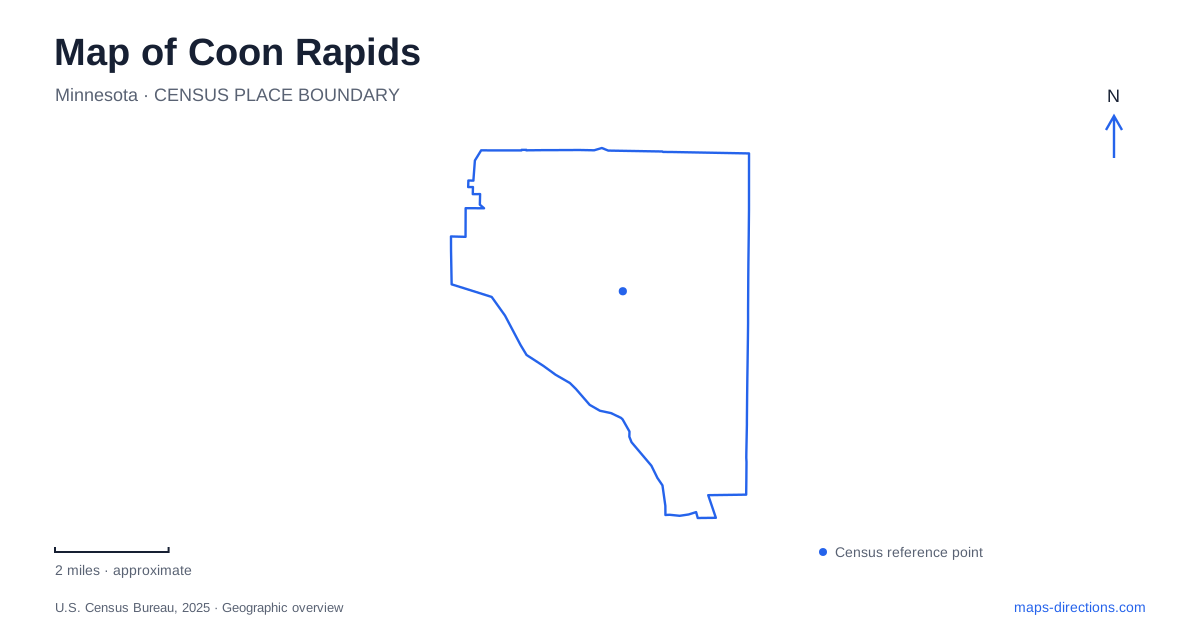
Street tiles load from OpenStreetMap when opened. The blue line shows the 2025 Census boundary.
- State
- Minnesota
- Population · July 2025
- 64,193
- Land area
- 22.6 sq mi
- Water area
- 0.7 sq mi
Coon Rapids has a river boundary, an inland creek network and recreation areas whose names can cross municipal and county lines. The Mississippi River dam is its most recognizable landmark, but it is only one part of the local geography. Brickmaking, early overland travel and the later growth of parks have also left traces. A useful map connects those histories while keeping the riverfront park, the opposite-bank facilities and inland destinations clearly distinguished.
From an overland route to industrial sites
The city's historical account links the present East River Road and boulevard corridor to the Red River ox-cart route, an important nineteenth-century trading connection. That older alignment helps explain why a road beside the river can remain significant even after highways and suburban streets have changed the wider transport pattern. Its role developed before the modern park system or the dam.
Brickmaking added another industrial layer. D. C. Dunham organized the Anoka Pressed Brick and Terra Cotta Company in 1881, and the excavation known as the Clay Hole remains a reminder of that activity. Coon Rapids was therefore more than a community that grew around a single power project. Agricultural land, a trading route and clay extraction preceded the construction work that later brought a concentrated workforce to the riverbank.
The dam's power era ended before its park era began
The dam and generating station entered service in 1914. The city's detailed dam history distinguishes the completion of the structure from the later commissioning of the powerhouse that summer. It also records the end of electricity generation on December 31, 1966. The property transferred to the park district in 1969, a later date that should not be mistaken for the last year of power production.
The Minnesota Department of Natural Resources likewise identifies 1966 as the end of hydropower use and describes subsequent changes to gates and walkways. Its rehabilitation account addresses erosion below the structure and the need to impede invasive fish. The dam is thus an active piece of river-management infrastructure as well as a historic landmark. Its present purpose cannot be understood simply by imagining the generating machinery still operating inside the former powerhouse.
Two park systems meet at the river
On the Anoka County side, Coon Rapids Dam Regional Park uses the address 9750 Egret Boulevard. The county manages its parkland, visitor facilities, parking and boat launch, including Dunn Island because the county line follows the main channel. Cenaiko Lake offers an inland fishing setting within the park, separate from fishing along the Mississippi itself.
Across the river, Mississippi Gateway Regional Park is managed by Three Rivers Park District. That district also owns and maintains the entire dam structure. The distinction is useful when reading park maps or seeking information about a closure: the county that manages a nearby picnic ground is not necessarily the operator of the gates, embankment or walkway. The opposite-bank park's newer name can also differ from older maps that used the dam name for both sides.
Follow the creeks inland
The Sand Creek and Coon Creek trail system starts at Lions Coon Creek Park and follows the waterways between Hanson and Foley boulevards, continuing north toward Bunker Hills Regional Park. This creates an inland recreational axis with a different character from the Mississippi corridor. The smaller waterways help organize routes through residential parts of the city instead of keeping every outing beside the main river.
Coon Rapids also forms part of a longer Mississippi trail corridor. The city describes connections through neighborhood parks and streets before the route enters the dam park and continues toward Fridley. A regional trail is therefore not always an uninterrupted strip immediately beside the water. Its connecting sections are part of the route's geography, and the creek trails offer a different choice from simply following the shoreline.
Bunker Hills and a smaller lakeside park
Bunker Hills combines oak savanna, sandy landforms and restored prairie with facilities for camping, walking, riding and seasonal recreation. Its administrative and activity-center address on Bunker Lake Boulevard is in Andover, while the campground visitor center uses County Parkway B and a local city address. These are separate arrival points within a large regional landscape. Bunker Beach is a water-park attraction within that wider setting, not another name for the entire regional park.
Crooked Lake Park offers a smaller alternative at 13180 Crooked Lake Boulevard. The city's park map identifies fishing piers, picnic shelters, a central gathering area and a naturalized shoreline planted as a protective buffer. Its water-access area is not lifeguarded. Compared with the regional park's extensive facilities, this is a neighborhood-scale lakeside space. Together, the dam, creek routes, sandy uplands and lake edge explain why Coon Rapids has several distinct outdoor geographies rather than one interchangeable collection of green areas.
Map and statistics: U.S. Census Bureau, 2025 Gazetteer, January 2025 generalized place boundaries and Vintage 2025 population estimates. Local references: City of Coon Rapids; Minnesota DNR; Anoka County Parks; Three Rivers Park District. Article prepared by Maps & Directions.