Map of Compton
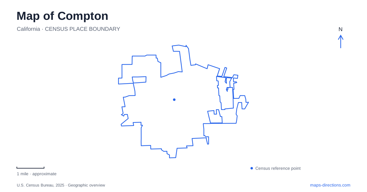
Street tiles load from OpenStreetMap when opened. The blue line shows the 2025 Census boundary.
- State
- California
- Population · July 2025
- 90,500
- Land area
- 10.0 sq mi
- Water area
- 0.1 sq mi
Compton has several histories that are easy to overlook on a regional freeway map. A preserved nineteenth-century house no longer stands where it was built. A rail platform carries artwork about the city's communities. A college campus reflects both institutional setbacks and recovery. Nearby parkland also belongs to a wider creek watershed rather than a single municipality. Looking at these specific places produces a fuller understanding than treating the city as only a name between Los Angeles and Long Beach.
An early house in a later civic setting
Heritage House began as a two-room dwelling built by A. R. Loomis in 1869 on South Acacia Street. Subsequent owners enlarged it. As other early buildings disappeared, residents organized to preserve the house as a record of the settlement period. It received California Historical Landmark designation in 1958.
In the late 1950s, the city purchased the house and moved it to the northwest corner of Willowbrook Avenue and Myrrh Street. Thus, its present map location records a preservation decision rather than the original homestead parcel. Compton's civic landscape contains an authentic old building whose geographical context has changed. That is an important distinction when comparing historic photographs or property accounts with a modern street map.
The city's 2024 restoration procurement describes work on the roof, siding, floors, porch and steps. That document establishes preservation needs, but it does not by itself confirm that repairs are complete or that the interior is routinely open. The house can be identified as a landmark without promising a tour that has not been verified. Its history is strongest when the original construction, relocation and later maintenance are kept separate.
A station that interprets its community
The civic transit area includes the A Line station and the Martin Luther King Jr. Transit Center. This is a useful regional arrival point for Compton, but it is also a place to encounter public art. Eva Cockcroft's ceramic panels examine the contributions of African American, Latino and Samoan communities, using images of family life, work, education and change.
The installation places twelve panels above platform benches, while tiled columns include residents' thoughts about the future. A separate entrance mural, Universal Musicians, was designed by high-school students. These works turn an everyday transfer point into a record of community expression. They are especially relevant to a map because they locate history within a functioning public space, rather than moving it entirely into a museum.
Transit names require some care when consulting older material. Historical city pages refer to the Blue Line, while current Metro information uses the A Line name. That is a naming change for the rail service, not evidence of two separate stations. Use the current operator's station information for an actual journey and the older terminology only when interpreting historical accounts.
The college as a distinct destination
Compton College occupies its own campus at 1111 East Artesia Boulevard. Its institutional origins date to 1927 as part of the local high-school district. Voters approved separation in 1950, leading to development of the present campus. The college's history includes a difficult accreditation period, a partnership with El Camino and a return to independent operation in 2019.
Those events help explain why older records may use different institutional names for educational activity associated with the same community. They should not be treated as interchangeable descriptions of today's governance. A visitor arriving for a class, performance or appointment also needs the campus building map, not simply the postal address. The college publishes an alphabetical building index and identifies parking and other points of interest, giving more detail than a citywide map can reasonably display.
Nearby parkland and the creek watershed
North of Compton, Earvin “Magic” Johnson Park lies in the unincorporated Willowbrook community. Its proximity makes it a relevant regional destination, but it should not be represented as a municipal park inside the city. County planning identifies boundaries associated with El Segundo Boulevard, Avalon Boulevard, Clovis Avenue and 120th Street.
The park's redevelopment also has a water-management purpose. Runoff is captured from a local drainage area within the larger creek watershed, showing how recreation land can serve environmental functions beyond its paths and lawns. The county's expanded park design includes native habitat planting, exercise space and an off-leash dog area. These are public amenities in a connected regional landscape rather than evidence that city boundaries and watershed boundaries coincide.
The moved house, transit artwork, college and nearby park tell different stories about land and institutions. Their value as map anchors is precisely that difference: one preserves a building, one supports travel and public expression, one serves education, and one combines recreation with stormwater management. Identifying each destination accurately makes the surrounding urban area easier to understand without erasing its local distinctions.
Map and statistics: U.S. Census Bureau, 2025 Gazetteer, January 2025 generalized place boundaries and Vintage 2025 population estimates. Local references: City of Compton; LA Metro; Compton College; Los Angeles County Parks; California Office of Historic Preservation. Article prepared by Maps & Directions.