Map of Commerce City
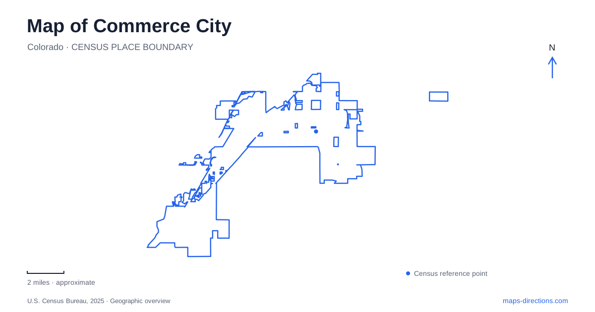
Street tiles load from OpenStreetMap when opened. The blue line shows the 2025 Census boundary.
- State
- Colorado
- Population · July 2025
- 72,345
- Land area
- 36.9 sq mi
- Water area
- 0.4 sq mi
Commerce City contains several landscapes that are easy to underestimate on a regional map. A major wildlife refuge occupies an enormous tract beside urban development, a soccer stadium forms part of a larger field complex, and a creek-side greenway links the community with neighboring cities. Recreation facilities also extend into the northern neighborhoods. Understanding these different scales is more useful than treating every park symbol as a similar destination.
The refuge as a landscape of its own
Rocky Mountain Arsenal National Wildlife Refuge covers approximately 15,000 acres. The U.S. Fish and Wildlife Service describes its transformation from farmland and wartime manufacturing land into habitat supporting hundreds of wildlife species. That history is fundamental to the place: the prairie landscape represents a major change in land use, rather than an untouched preserve that has always existed beside the city.
The visitor center address is 6550 Gateway Road. From the Interstate 70 and Quebec Street approach, the refuge directs motorists along Prairie Parkway and then north on Gateway Road. These streets provide the practical connection between the developed city and the refuge's public arrival area.
Within the refuge, the 11-mile Wildlife Drive and hiking routes serve different kinds of visits. The Discovery Trail begins at the visitor center, while the Lake Mary Loop includes a boardwalk and piers overlooking the water. A map of Commerce City should show this internal geography clearly: the visitor center, lake paths, and longer drive occupy different parts of a substantial protected landscape.
Bison and black-footed ferrets are among the refuge's important conservation species. Their presence gives the site a purpose beyond sightseeing. Visitors encounter a managed habitat where the designated public routes support recreation alongside wildlife protection.
Victory Way and the soccer complex
DICK'S Sporting Goods Park is at 6000 Victory Way. The Colorado Rapids' stadium belongs to a complex that also contains numerous surrounding sports fields. That arrangement makes the destination significant both for spectators attending a professional match and for people arriving for activities elsewhere on the grounds.
The distinction matters because a stadium and a field complex organize arrival differently. An event may identify a stadium gate, while a participant may need a particular field within the larger property. The common address establishes the overall destination; the venue's own event or field information explains which part of it is relevant.
For Commerce City, this is a recreation landscape of organized sport on a scale very different from the nearby refuge. One concentrates spectators and participants around built facilities, while the other spreads public routes through a large area devoted to habitat. Both are prominent destinations, but they should not be collapsed into one general park district.
Sand Creek as a regional connection
The Sand Creek Regional Greenway follows the creek through Aurora and Denver before reaching its confluence with the South Platte River. The greenway organization describes a route of nearly 13 miles, with pavement through the Denver and Commerce City sections. It is a linear natural area and transportation connection rather than an enclosed recreation campus.
Two local access points clarify its position within the street network. Wetland Park is reached at 6102 East 52nd Avenue near Ivy Street. The Dahlia Trailhead is listed at 4900 Sandcreek Drive, near East 56th Avenue and south of the Interstate 270 interchange at Vasquez Boulevard.
Those references reveal a different side of the city from the wildlife-drive entrance or stadium gates. The trail follows water through an urban region, providing continuity across municipal boundaries. Someone planning a short walk can focus on a nearby access point; a longer ride can use the same corridor to connect with other parts of the metropolitan landscape.
Recreation in the northern neighborhoods
Bison Ridge Recreation Center is at 13905 East 112th Avenue. The facility includes an indoor pool, gymnasium and walking track, gymnastics space, fitness rooms, and community meeting areas. Its northern address distinguishes it from Eagle Pointe Recreation Center at 6060 East Parkway Drive, another important municipal recreation location.
The numbered avenues help communicate the extent of Commerce City. A visit near East 112th Avenue belongs to a different portion of the municipality from an outing around the stadium and the lower-numbered streets. Keeping both centers visible prevents the recreational map from becoming concentrated solely around the most widely known attractions.
The result is a varied local geography: refuge prairie and lakes, a major soccer complex, a creek-side regional trail, and indoor community facilities. Each provides a distinct way to experience the city, with roads and waterways explaining how those places fit into the wider urban landscape.
Map and statistics: U.S. Census Bureau, 2025 Gazetteer, January 2025 generalized place boundaries and Vintage 2025 population estimates. Local references: US Fish and Wildlife Service; Colorado Rapids; DICKS Sporting Goods Park; Sand Creek Regional Greenway Partnership; City of Commerce City. Article prepared by Maps & Directions.