Map of Columbus
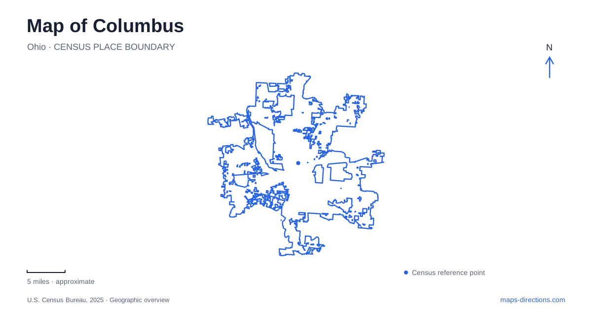
Street tiles load from OpenStreetMap when opened. The blue line shows the 2025 Census boundary.
- State
- Ohio
- Population · July 2025
- 938,396
- Land area
- 221.9 sq mi
- Water area
- 5.9 sq mi
Columbus has a useful central spine in High Street and a second, greener organizing line along the Scioto River. The visitor bureau groups several central districts under the name Five on High because they occupy a roughly five-mile stretch of the street. The riverfront adds parks, bridges and views toward Franklinton. Together, these two lines explain much of the central visitor geography: neighborhoods extend north and south, while the river introduces an important east–west relationship.
High Street connects different kinds of district
The University District, Short North, downtown, Arena District, and German Village–Brewery District area form the visitor bureau's central grouping. Their shared association with High Street is useful, but their character changes along the corridor. The University District centers on Ohio State and its cultural and sporting institutions. Short North concentrates galleries, independent shops and restaurants. Downtown introduces state-government buildings, offices and major performance venues.
A Columbus map that shows only the center can make these districts appear compressed. Following High Street outward reveals the sequence more clearly. It is a corridor of distinct areas rather than a single entertainment block. A day organized around university museums belongs to a different part of that sequence from one centered on the Statehouse or the brick streets south of downtown.
German Village supplies a southern reference
The official neighborhood guide places German Village just south of downtown and describes its nineteenth-century brick houses and brick streets. Mohawk and Kossuth form one named local intersection in the guide, demonstrating the smaller residential street scale within the district. That street texture contrasts with the larger civic and commercial landmarks in the central business area.
The neighboring Brewery District is often grouped with German Village in visitor material, but the names remain useful distinctions when locating an individual venue. The wider grouping explains the southern cluster; the street address places a stop within it. Looking at the actual streets also helps a visitor understand why a neighborhood walk can be the main activity here, rather than movement between a series of large freestanding attractions.
Downtown turns toward the Scioto
The Ohio Statehouse and Ohio Theatre provide central civic and cultural anchors, while the Scioto Mile extends the downtown experience toward the water. The parks department lists the Scioto Mile Promenade at 233 Civic Center Drive. The broader riverfront directory includes Battelle Riverfront Park, Bicentennial Park, Coleman’s Point, Genoa Park and Dorrian Green, showing that the riverfront is a collection of named spaces rather than one uniform lawn.
For Columbus geography, the relationship across the river is especially important. The visitor bureau directs people across it toward COSI and Franklinton's arts scene. A walk along the promenade and a visit across the river are connected experiences, but they occupy different sides of the water. The bridges become the organizing points between them, while the named parks give an itinerary more precision than the broad Scioto Mile label alone.
The river landscape was reshaped
The downtown development organization's account of the Scioto Riverfront describes a landscape designed around multi-use paths, lawns, overlooks and water access. Coleman’s Pointe and the Lower River Walk are identified as places from which to experience the river. This is not simply leftover space beside downtown roads: the riverfront is a deliberate public-space system with its own routes and destinations.
A map can therefore support several different outings in the same area. One might follow the upper promenade and civic frontage; another might focus on the lower river path or a park across the water. The distinction is geographic, not a claim that every route takes the same time or suits every activity. The parks' individual names make it possible to describe the intended route accurately.
Ohio State has a campus and a river corridor
The university's self-guided map identifies academic buildings, the Oval, Mirror Lake, the stadium area, medical facilities and parking within a substantial campus landscape. A campus visit can involve several of these places without leaving the university setting. The guide also notes Mirror Lake's role in the original site selection, giving the water feature historical significance beyond its appearance as a small pond on the map.
North of the main campus activity, the university's Olentangy River Wetland Research Park uses an address on West Dodridge Street. Its directions reference Olentangy River Road and West Lane Avenue, helping place this research landscape relative to the more familiar campus core. It is a useful Columbus example of how one institution can occupy multiple geographic settings: academic courtyards, medical buildings, sports venues and a river research site.
The central Columbus map becomes more informative when these relationships remain visible together. High Street explains the district sequence, the Scioto explains the downtown riverfront and Franklinton connection, and the Olentangy helps organize the university's river-side geography. Named streets and public spaces then turn those broad relationships into a plan that can be followed on the ground.
Map and statistics: U.S. Census Bureau, 2025 Gazetteer, January 2025 generalized place boundaries and Vintage 2025 population estimates. Local references: Experience Columbus; Columbus Recreation and Parks; Downtown Columbus Inc.; Ohio State University. Article prepared by Maps & Directions.