Map of College Station
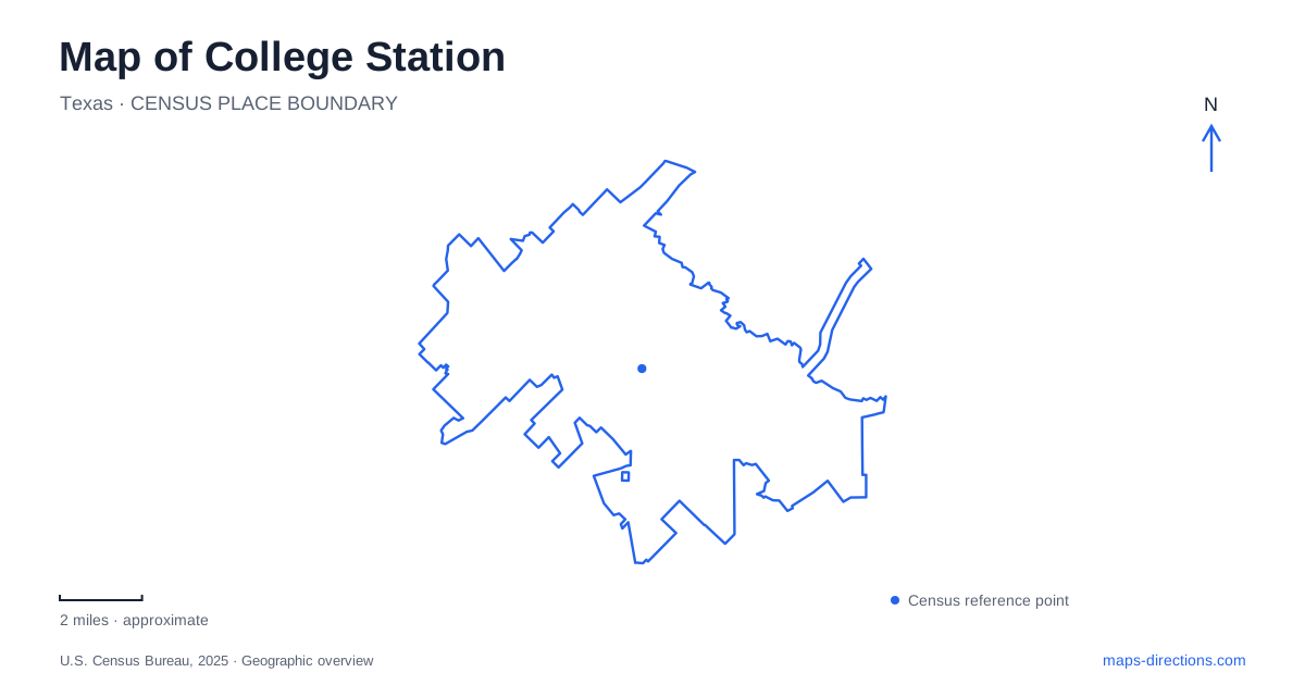
Street tiles load from OpenStreetMap when opened. The blue line shows the 2025 Census boundary.
- State
- Texas
- Population · July 2025
- 127,472
- Land area
- 51.2 sq mi
- Water area
- 0.1 sq mi
College Station has several centers of activity, and Texas A&M University is the largest organizing feature on the map. Yet a university address can refer to very different surroundings: the commercial district across from campus, the main academic area, the western campus, or the presidential library. The creek parks introduce another geography that has little to do with classroom buildings. Understanding these different anchors makes it easier to assemble a visit that combines campus landmarks with the city's public landscapes.
Campus geography and the western museum
Wellborn Road is an important reference for separating the main campus from West Campus. The university's project at Old Main Drive and Wellborn Road created a grade-separated connection for vehicles and pedestrians between those areas. That crossing helps explain the shape of the campus network: the two sides are connected, but they are still recognizable areas whose destinations should be located individually.
The George H.W. Bush Presidential Library and Museum provides a particularly clear western anchor. Its physical address is 1000 George Bush Drive West, and the museum identifies Lot 41 in front of the building as its visitor parking area. Keeping “West” in that road name is useful when reading an address. The library belongs to the university campus, but a generic university location gives much less information than this particular road and building.
For a map of College Station, the campus is therefore best understood as a collection of places joined by a road and pedestrian network. A library visit and an appointment in an academic building may both be university trips while requiring different approaches. The Bonfire Memorial adds another kind of campus destination: a place of remembrance rather than a museum or classroom. Its inclusion on a campus itinerary should reflect that purpose, not simply its appearance as another attraction marker.
Northgate as a mixed neighborhood
Northgate sits across from Texas A&M and combines restaurants, shops, entertainment venues, residences, and churches. The city describes a district of approximately 150 acres. That scale and mixture matter: the name refers to a neighborhood, not one building or a single row of bars. Its commercial core is only part of the broader district.
College Main and Church Avenue are useful street references here. The municipal parking garage is on College Main, while a city surface parking lot is on Church Avenue. These two named streets give a visitor more precise orientation than the district label alone. They also help distinguish an arrival point from whichever restaurant, residence, or other destination brought someone to the area.
Northgate gives College Station a campus-facing commercial focus, while the presidential library provides a separate museum destination elsewhere in the university landscape. Treating those as two different clusters makes the city's layout more legible. A person can choose to spend time within the mixed neighborhood or make a deliberate transfer to a campus landmark without assuming all university-related places form one small walkable group.
Wolf Pen Creek and an urban landscape plan
Wolf Pen Creek is useful for understanding how the city has integrated water, recreation, and surrounding development. The municipal master plan adopted in 1988 sought to retain creek vegetation and wildlife while introducing paths for walking and cycling. It also addressed drainage and erosion, so the corridor's open space has a practical environmental role alongside recreation.
The associated zoning district encouraged development to face the creek. This gives the landscape a different meaning from a park isolated behind surrounding buildings. The creek was intended to be an organizing feature for the adjoining area. When reading this part of the College Station map, trace the green corridor as well as the roads: the linear park structure explains why outdoor space extends through an urban setting.
Wolf Pen Creek Park includes an amphitheater and an open festival site. The city's facility listing gives 1015 Colgate Drive as its address. Those event-oriented spaces distinguish this destination from a woodland preserve. An afternoon on the paths and an amphitheater visit may use the same park name, but they emphasize different pieces of its layout.
Rock Prairie Road and the nature preserve
Lick Creek Park, at 13600 Rock Prairie Road, supplies a more wooded counterpart to Wolf Pen Creek. The city's tourism office identifies approximately five miles of marked trails and opportunities for hiking, cycling, birdwatching, and equestrian activity. The Gary Halter Nature Center is located within the park, making the center and the preserve related destinations rather than separate parks with coincidentally similar names.
The municipal Yaupon Loop guide uses blue markers for a self-guided nature walk focused on trees and plants. That is a useful change of scale from the city map: Rock Prairie Road locates the preserve, while the named loop organizes an outing inside it. A map of College Station can support both scales without confusing them. The university's campus crossings, Northgate's neighborhood streets, Wolf Pen Creek's planned green corridor, and this marked woodland loop each reveal a different way the local landscape is connected.
Map and statistics: U.S. Census Bureau, 2025 Gazetteer, January 2025 generalized place boundaries and Vintage 2025 population estimates. Local references: Texas A&M University; George H.W. Bush Presidential Library and Museum; City of College Station; Visit College Station. Article prepared by Maps & Directions.