Map of Coeur d'Alene
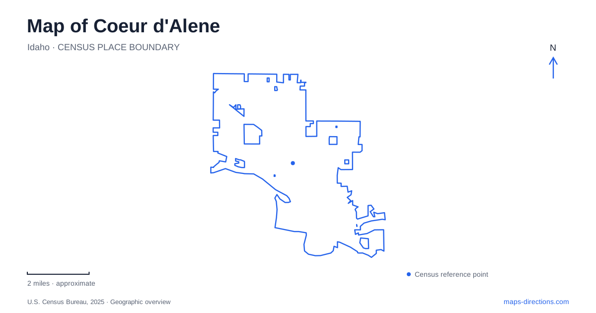
Street tiles load from OpenStreetMap when opened. The blue line shows the 2025 Census boundary.
- State
- Idaho
- Population · July 2025
- 58,179
- Land area
- 16.9 sq mi
- Water area
- 0.8 sq mi
Coeur d'Alene has several waterfront landscapes within reach of its urban streets. McEuen Park meets the wooded slopes of Tubbs Hill, City Park provides a more traditional beach-and-lawn setting, and the Spokane River frontage includes former industrial land now used for recreation. The Centennial Trail connects the local picture with a much longer regional route. Front Avenue, Fort Ground Drive, Tilford Lane, and Atlas Road help distinguish these places on the map.
McEuen Park and the hill behind it
McEuen Park is listed at 520 East Front Avenue. Its amenities include the Avista Pavilion, open lawns, playground, splash pad, sports courts, dog park, and a seawall overlook. The city also identifies access to Tubbs Hill from the park, creating a direct relationship between developed recreation grounds and natural open space.
Tubbs Hill projects into the lake, with water around its western, southern, and much of its eastern sides. That shape explains the hill's importance on a map of Coeur d'Alene: it is both a landmark above the waterfront and a piece of shoreline that interrupts the otherwise urban edge. Trails follow the natural terrain rather than simply extending the street grid.
The contrast can be experienced within a single outing. McEuen provides broad gathering and play spaces, while the hill shifts attention toward wooded slopes, rock, and changing views of the water. The west-side trailhead is reached from the southwestern corner of the park near South Third Street, giving the transition a clear street reference.
City Park and the Fort Grounds setting
City Park is listed at 415 Fort Ground Drive. The city's park inventory identifies a beach, bandshell, picnic facilities, public art, and the Fort Sherman Playground. The historic Fort Grounds neighborhood and North Idaho College lie to its west, placing the park within a broader waterfront district rather than an isolated recreation parcel.
The park's character differs from Tubbs Hill. Here, a beach and established community facilities organize the public space, with places to gather, play, and attend events. The hill instead preserves a more natural landform. Both offer lake access and views, but their physical settings encourage different kinds of use.
For visitors to Coeur d'Alene, these adjacent waterfront areas can provide variety without requiring an itinerary built entirely around driving. A broad map shows the relationship among downtown, the park grounds, and the college-side neighborhood. A closer view then reveals the particular activity spaces and paths within the park itself.
A local waterfront on a regional trail
The North Idaho Centennial Trail extends from the Washington state line to Higgins Point east of town. The city's trail description identifies paved walking, jogging, and cycling facilities, with a connection to the Spokane River Centennial Trail at the state boundary. This makes the urban waterfront part of a regional route rather than the end of a short city path.
Higgins Point lies at the eastern end of the lake-drive corridor, while the western connection leads toward Post Falls and Washington. Those endpoints give the trail a useful orientation even for someone planning only a small section. A short outing can follow a local stretch without implying a journey along the full route.
The Centennial Trail also gives Coeur d'Alene a different scale of movement from the hill paths. Tubbs Hill is a compact natural landform with routes responding to its slopes and shoreline; the Centennial corridor carries users across a much wider area. Comparing the two on a map helps match an outing to the desired distance and landscape.
Riverstone and the former Atlas Mill site
Riverstone Park is at 1805 Tilford Lane, off Beebe Avenue. Its amphitheater, picnic shelter, playground, and pedestrian and bicycle paths create a community gathering space within the Riverstone area. The city's directions approach through Lakewood Drive and Riverstone Drive, providing a separate road sequence from the downtown lakefront.
Nearby on the Spokane River, Atlas Mill Park occupies former mill property at 2411 North Atlas Road. The city describes about four thousand feet of public waterfront, with picnic space, a playground, water access, and a Centennial Trail connection. Original flywheels from the industrial site have been incorporated into the park's theme.
That reuse adds an industrial-history layer to Coeur d'Alene's outdoor map. The riverfront is not only scenic open space; it also records a change in land use from production to public recreation. Taken alongside McEuen, Tubbs Hill, and City Park, the former mill grounds show how varied the city's relationship with water can be, even among places that all appear as parks on a general map.
Map and statistics: U.S. Census Bureau, 2025 Gazetteer, January 2025 generalized place boundaries and Vintage 2025 population estimates. Local references: City of Coeur d’Alene; Visit North Idaho. Article prepared by Maps & Directions.