Map of Coachella
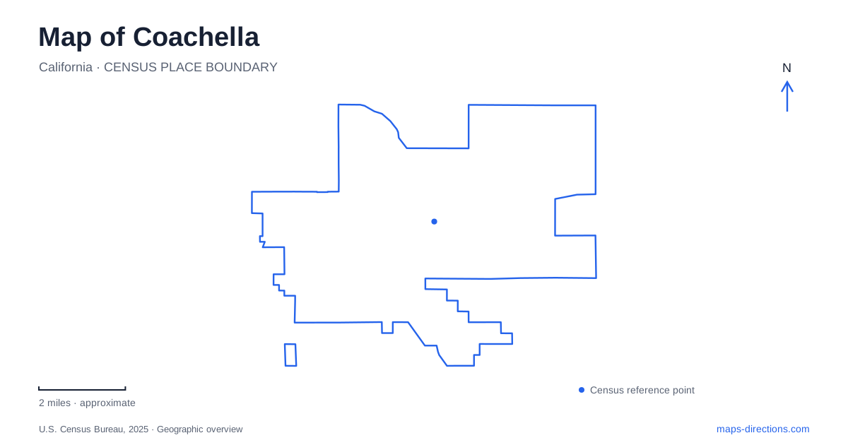
Street tiles load from OpenStreetMap when opened. The blue line shows the 2025 Census boundary.
- State
- California
- Population · July 2025
- 45,411
- Land area
- 29.9 sq mi
- Water area
- 0.0 sq mi
Coachella’s older streets connect railway history, agricultural labor, public art, and community gathering places. Pueblo Viejo, the historic downtown area, has a particularly strong relationship between buildings and the stories displayed on their walls. Sixth Street and Vine Avenue provide useful references within that setting. Farther into the neighborhoods, Bagdouma and Dateland parks serve recreation needs on a different scale, linking the city’s cultural center with the places used for everyday sports and play.
Woodspur, irrigation, and the agricultural landscape
The town’s early name, Woodspur, described its relationship with the Southern Pacific railway. A siding served shipments of mesquite wood to Los Angeles, and Jason Rector became associated with the terminal and the subsequent development of the townsite. The city’s historical account connects the next stage of growth with artesian water and the possibility of irrigating the surrounding land.
That combination of transport and water is fundamental to understanding Coachella. The railway provided a connection to outside markets, while irrigation made agricultural settlement possible in the desert setting. The streets and community institutions that followed belonged to a working agricultural town, not simply a scenic resort development.
The city’s land-use policies still treat agricultural character as significant. They discuss preserving productive land and, where feasible, retaining features such as date farms, vineyards, and citrus trees within the changing urban landscape. These are policy goals rather than a claim that every agricultural parcel is protected, but they show how farming remains part of the city’s physical identity.
Murals that make labor history visible
The public-art program places farmworker history directly onto the downtown streetscape. At 722 Vine Street, a Date Farmers mural occupies the north-facing wall beside the former workers’ center associated with Cesar Chavez’s organizing. Another work by Sego y Ovbal appears on the south-facing wall, using hands, a heart, leaves, and migratory birds within its imagery.
At Sixth and Vine, El Mac’s portrait of an anonymous farmworker extends that theme into another prominent downtown location. The Coachella Walls project is rooted in recognition of the eastern valley’s workers and communities. Its significance is therefore tied to the neighborhood and agricultural history, rather than only to the scale or color of the artwork.
Other works broaden the downtown collection. Andrew Hem’s “Breaker” is identified at 1560 Sixth Street, while Juan Ramirez’s “Motherhood” sculpture stands along Sixth between Vine and Orchard. Together, murals and sculpture make the street itself a cultural setting, with art attached to particular walls and public spaces rather than contained in a single gallery.
Sixth Street as a community address
The library at 1500 Sixth Street opened its new building to the public in 2018. Its Spanish Revival design includes arches, ceramic tile, and a tower conceived with mission bells in mind. Study, meeting, computer, and workshop spaces expanded the range of activities associated with the library beyond borrowing books.
The building gives Coachella’s Pueblo Viejo a substantial educational and civic landmark alongside its public art. Veterans Memorial Park is also associated with the Sixth Street area between Orchard and Vine. The proximity of reading spaces, commemorative grounds, and artwork creates a concentration of community uses within the older town.
This district’s character comes from that combination. A mural may address agricultural labor, a sculpture may emphasize family, and a library supports contemporary learning. Their placement within the same street network allows different aspects of community identity to appear together without requiring them to tell a single simplified story.
Sports and neighborhood art beyond Pueblo Viejo
Bagdouma Park occupies approximately 46 acres at Avenue 52 and Douma Street, near several schools. The grounds include a boxing club, swimming pool, tennis courts, playing fields, basketball, picnic facilities, and playground space. Its scale and range of activities establish it as a major recreation concentration outside the compact downtown cultural setting.
Dateland Park, on Shady Lane beside Bobby Duke Middle School, contains the city’s skateboard park. Across Shady Lane, a community mural extends along a wall in sections by different artists. This pairing gives the neighborhood both a youth recreation destination and a separate public-art presence, continuing the city’s visual storytelling beyond Sixth Street.
Coachella’s map can thus be read as a relationship between work, culture, and community life. Woodspur’s railway and irrigation origins explain the agricultural foundation; Pueblo Viejo’s art and library express local identity; and the Douma and Shady Lane recreation grounds provide places where that community continues to gather.
Map and statistics: U.S. Census Bureau, 2025 Gazetteer, January 2025 generalized place boundaries and Vintage 2025 population estimates. Local references: City of Coachella. Article prepared by Maps & Directions.