Map of Cleveland Heights
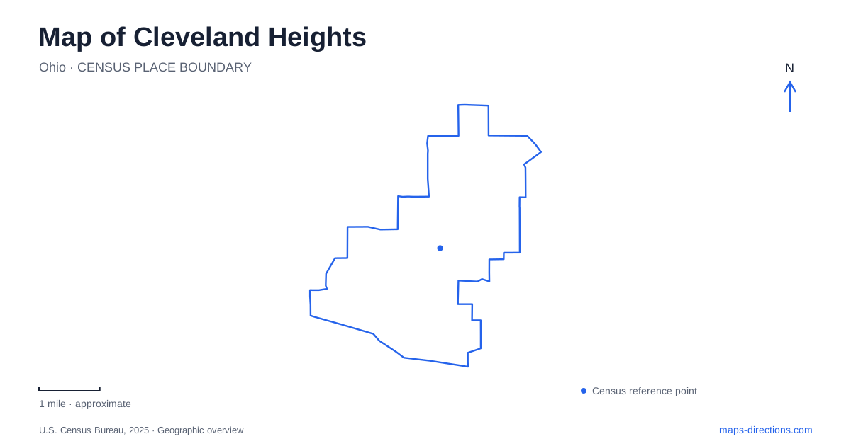
Street tiles load from OpenStreetMap when opened. The blue line shows the 2025 Census boundary.
- State
- Ohio
- Population · July 2025
- 43,750
- Land area
- 8.1 sq mi
- Water area
- 0.0 sq mi
Cleveland Heights is a city of several commercial centers rather than one dominant downtown. Cedar Fairmount, Cedar Lee, and Coventry developed around important streetcar routes and intersections, giving different neighborhoods their own shopping streets. The elevated setting, historic subdivisions, and stream ravines add further layers. A useful map therefore starts with the relationship between these centers, then examines the residential and park landscapes between them.
Shopping streets follow the streetcar city
Municipal preservation guidelines trace the major commercial areas to the intersections of Cedar and Lee, Cedar and Fairmount, and Coventry and Mayfield. Their growth in the early twentieth century accompanied expanding residential neighborhoods and streetcar service. The resulting pattern still helps explain why several different places can feel like the center of a local community.
The city's history describes streetcars as a way of overcoming the difficult approach to the Heights. Roads climbing from the lower city had previously offered challenging access. Improved transport made the upland more attractive for residential development, linking the physical slope with the eventual pattern of streets and neighborhoods.
Reading Cleveland Heights in this way gives the commercial districts a shared logic. They are not competing versions of an absent central square. They are the surviving structure of a suburb that grew around several routes and junctions, with housing filling the land around them.
Forest Hill refers to more than one place
Forest Hill is a particularly important name to interpret carefully. John D. Rockefeller's estate occupied land that later contributed to Forest Hill Park. His son donated parkland to two municipalities in 1938, so the park's history crosses the boundary with East Cleveland. The city's parks map locates its local facilities around Lee and Monticello.
Grant Deming's Forest Hill neighborhood is a separate historic residential district. The city describes it as roughly bounded by Cedar Road, Coventry Road, Lincoln Boulevard, and Lee Road. Its development began on former farmland assembled by Deming in the early twentieth century.
The distinction matters on a map of Cleveland Heights because the shared name can obscure very different destinations. One is an estate-derived public landscape near the northern part of the city; the other is a residential district associated with a different developer. Naming the relevant cross streets makes the geography clear without erasing the historical connection each place has to suburban growth.
Houses reveal more than architectural style
Deming's district includes both single-family and two-family homes, with variation between architect-designed houses and builder-designed properties. Municipal documentation identifies Craftsman, Tudor Revival, and Colonial Revival among its prominent styles. The neighborhood therefore illustrates a range of housing forms within one planned residential area.
Elsewhere, the city's account of two-family houses connects their construction with the extension of the Cedar Road streetcar line. Streets such as Renrock, Stillman, Edgewood, and Oakdale developed substantial rows of doubles. These buildings help explain how more households could live near a transport corridor without every street taking the form of an apartment district.
For a neighborhood walk, this is a useful layer to add to the map. Building type, lot pattern, and distance from a former transit route can be read together. The historic landscape contains differences in density as well as differences in decorative style.
Cain Park uses the shape of a ravine
Cain Park gives Cleveland Heights a cultural landscape fitted into distinctive terrain. The venue's history describes the ravine between Taylor and Lee Roads and the early outdoor theater project led by drama teacher Dina Rees Evans. The amphitheater was completed in 1938, and the smaller Alma Theater followed in 1944.
Those theaters occupy different parts of the park. The venue identifies the Evans Amphitheater with approaches near Goodnor and Superior, while the Alma Theater lies near the Lee Road entrance. The park's elongated shape is therefore relevant to an evening at a performance, rather than just background scenery.
Its origin also explains why performing arts and a sledding hill share the same larger place. The natural depression and slopes supported different public uses as the ravine became a designed recreation landscape.
Streams continue beneath the developed surface
Three watersheds divide Cleveland Heights: Doan Brook, Dugway Brook, and Nine Mile Creek. The city's watershed information explains that much of Dugway Brook was enclosed in pipes to make room for development, although open sections remain in Forest Hill Park and other locations beyond the city.
Nine Mile Creek likewise has extensive buried sections. A street map showing little surface water can consequently understate how drainage organizes the landscape. Parks, ravines, and isolated open channels are visible pieces of systems that continue underground.
This hidden geography complements the streetcar pattern above it. Commercial junctions explain where people gathered and traveled; stream corridors explain some of the terrain and open spaces between them. Together they produce a more complete reading of the city's neighborhoods than roads or landmarks alone.
Map and statistics: U.S. Census Bureau, 2025 Gazetteer, January 2025 generalized place boundaries and Vintage 2025 population estimates. Local references: City of Cleveland Heights; Cain Park City of Cleveland Heights. Article prepared by Maps & Directions.