Map of Cleburne
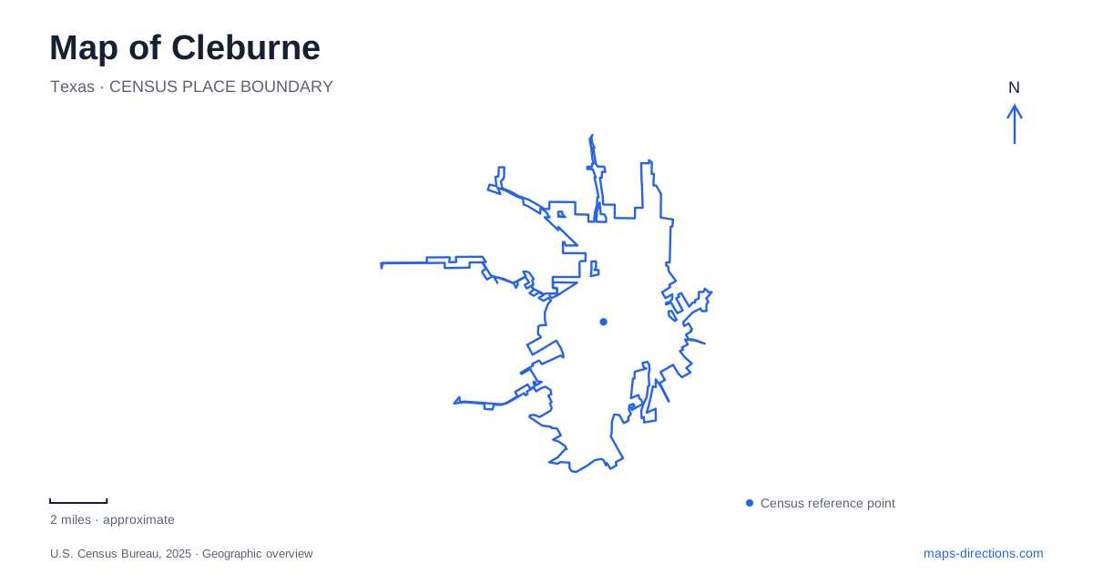
Street tiles load from OpenStreetMap when opened. The blue line shows the 2025 Census boundary.
- State
- Texas
- Population · July 2025
- 39,942
- Land area
- 33.4 sq mi
- Water area
- 2.9 sq mi
Cleburne grew at a meeting of routes and water sources before the railway gave it a larger regional role. West Buffalo Creek attracted travelers, and an early wagon road linked the forts of Graham and Belknap. Today, the city's historical places range from downtown museum buildings to a lakeside outdoor collection. Beyond them, a state park preserves a separate lake and a different era of public construction. Understanding those distinctions makes the map much more useful.
Roads and water before the railway
The city's downtown master plan traces the settlement's early importance to its crossroads position and dependable water on West Buffalo Creek. Cattlemen traveling near the Chisholm Trail were among the people drawn to this setting. The first railway arrived in 1881, adding another means of movement to an already established meeting place.
This sequence matters because the city was not created by a single transport project. A map showing only modern highways would miss the earlier creek and wagon-road geography, while a purely railway interpretation would overlook the settlement that preceded the tracks. The downtown area developed through successive connections, with each period adding a different reason for people and goods to pass through.
A library building with a second public life
The Layland Museum occupies the former Carnegie library at 201 North Caddo Street. The building opened in 1905 after a local campaign secured Carnegie funding and a matching community contribution. The museum began in 1963 with a collection donated by the heirs of William J. Layland, initially using the library's upper floor.
When the library moved in 1978, the museum gained the entire building. Its present function therefore grew in stages rather than replacing the library immediately. That history makes the structure both an exhibit space and an artifact of local public life. The move also explains why an old photograph labeled as the library can depict the same building now identified as a museum.
Railway history in several locations
The Cleburne Railroad Museum stands at 206 North Main Street, separate from the Layland building despite the institutions' shared programming. Its displays include historic objects and material connected with railway sites around town. The museum's Studio is a shared program space, so an event associated with either institution may take place in the Main Street building.
Railway heritage also appears outdoors. BNSF identifies steam engine 3417 in Hulen Park and a Santa Fe caboose at the Layland Museum as separate preserved objects. The engine, caboose and indoor railway collection should not be collapsed into one destination. Their distribution gives the city several different ways to encounter its railway past, from a full-size locomotive to smaller objects and interpretation.
Wardville and the outdoor museum
The Chisholm Trail Outdoor Museum occupies the historic Wardville townsite, which served as Johnson County's first county seat beginning in 1854. This is an earlier administrative location, distinct from the present downtown. The museum grounds interpret cattle drives and county history through features including the original courthouse, a blacksmith shop and a stagecoach station.
The setting beside the reservoir is visually striking, but the modern shoreline belongs to a much later period than the early county seat. Visitors are looking at a historic townsite within a landscape subsequently altered by water engineering. Keeping those dates apart avoids imagining the nineteenth-century settlement beside the same lake visible today.
The Nolan River reservoir
Lake Pat Cleburne lies on the Nolan River southwest of the city, near U.S. 67. The Texas Water Development Board dates dam construction to 1963–64. This reservoir is therefore a twentieth-century addition to the regional map, with a shape determined by the impounded river valley.
Lakeshore Park, formerly Kirtley Park, occupies about twenty-seven acres along part of the shoreline from the boat-launch area toward the dam. The former name may still appear in older descriptions. It refers to the same municipal park, not a second lake. The specific shoreline park and the much larger reservoir are also different geographical units: one identifies managed recreation land, while the other describes the water body.
Cedar Lake and the CCC landscape
Cleburne State Park surrounds Cedar Lake, a separate 116-acre lake created by Civilian Conservation Corps work. Its earthen dam and three-tiered spillway belong to the New Deal era, rather than the 1960s municipal reservoir project. The spillway was cut into Comanche Peak limestone, giving the park a recognizable engineered landform.
The park's trail information identifies the Camp Creek bridge and a Park Road 21 overlook as further parts of that designed landscape. A drive or walk there reveals how the CCC connected roads, views, masonry and water infrastructure. Cedar Lake's identity should remain explicit when comparing recreation options across the area.
A map of Cleburne connects crossroads history, a reused library, dispersed railway artifacts and two very different lakes. The most useful reading preserves those differences: downtown museums, the Wardville site, the Nolan River reservoir and the state park each explain a separate part of the city's wider setting.
Map and statistics: U.S. Census Bureau, 2025 Gazetteer, January 2025 generalized place boundaries and Vintage 2025 population estimates. Local references: City of Cleburne; BNSF; Texas Historical Commission; Chisholm Trail Outdoor Museum; Texas Parks and Wildlife; Texas Water Development Board. Article prepared by Maps & Directions.