Map of Cincinnati
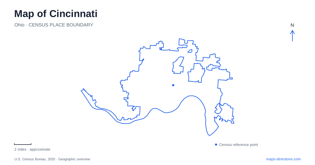
Street tiles load from OpenStreetMap when opened. The blue line shows the 2025 Census boundary.
- State
- Ohio
- Population · July 2025
- 314,367
- Land area
- 77.9 sq mi
- Water area
- 1.7 sq mi
Cincinnati's map is shaped by transportation routes from several eras: the Ohio River, an old canal corridor, railway infrastructure, and a modern streetcar loop. Its public places preserve those layers. Riverfront parks occupy the city's edge beside the water, Findlay Market anchors a historic neighborhood farther inland, and Union Terminal gives a former rail gateway a cultural role. The hills add another dimension, placing parks and institutions above the lower urban basin.
The riverfront and the crossing to Kentucky
Smale Riverfront Park connects downtown with the Ohio River and neighboring waterfront parks. Its features include gardens, water play areas, large swings, Carol Ann's Carousel, and historical monuments. The Ohio River Trail adds a linear route through this landscape, while the river itself remains an active transport corridor rather than a purely scenic background.
The John A. Roebling Suspension Bridge links the Ohio bank with Covington, Kentucky. It formally opened on January 1, 1867, with a central span of 1,057 feet that was then the world's longest. The bridge's towers and cables provide a strong orientation point, and the state boundary gives the crossing a regional significance beyond connecting two urban street grids.
For a Cincinnati map, the riverfront is both a local gathering place and the edge of a metropolitan area extending across the water. Looking toward Kentucky is therefore looking toward another part of the same regional landscape. The bridge makes that relationship visible in a way that an isolated downtown map can obscure.
A streetcar links the lower-city districts
The Connector follows a 3.6-mile loop between The Banks, the central business district, and Over-the-Rhine. Its eighteen stops include access to destinations such as Findlay Market, Washington Park, and Fountain Square. The loop gives visitors a practical way to understand how these districts follow one another inland from the river.
The system serves a defined part of the city. It is useful for movement among the riverfront and central neighborhoods, while destinations on the hills or around Union Terminal require a different connection. Reading the route as a loop, rather than assuming it follows the same street in both directions, also helps explain where the nearest return stop may be located.
Central Parkway preserves an older transportation alignment. The Miami and Erie Canal once followed this corridor before it became part of the modern roadway landscape. This historical layer adds meaning to a broad street that otherwise might seem simply an oversized division between blocks.
Findlay Market and its surrounding streets
Findlay Market stands on Elder Street between Elm and Race. The market structure was erected in 1852 but did not open until 1855 because construction problems and contractual disputes delayed the project. Its cast- and wrought-iron frame was an unusual building technology at the time, and the original pavilion had open sides.
The site survives from a system of nine municipal markets that once served Cincinnati. Its location was established through land associated with James and Jane Findlay, and the surrounding street pattern retains names connected with that early development. The market is therefore both a working food destination and a surviving piece of nineteenth-century urban infrastructure.
The operator's building-history project documents dozens of neighboring properties, emphasizing that the district extends beyond the market hall. Shops and other street-front buildings help retain the commercial setting in which the market developed. Walking the surrounding blocks reveals that relationship more clearly than treating the hall as a standalone attraction.
Union Terminal reorganized the railway city
Union Terminal opened in 1933, replacing five passenger stations. Its location east of Mill Creek reflected a city planning decision to concentrate rail facilities away from an earlier proposed downtown site. The building's Art Deco design gave this major transport project a distinctive architectural identity.
Today the Museum Center uses that monumental setting for cultural interpretation. Winold Reiss's murals emphasize local industry and the wider national story, making the building's art part of its historical message. On a map of Cincinnati, Union Terminal remains a reminder that rail connections helped organize the city at a scale larger than individual downtown blocks.
Eden Park brings terrain into the picture
Eden Park lies between Mount Adams and East Walnut Hills and contains the art museum, Playhouse in the Park, and Krohn Conservatory. Mirror Lake preserves a connection with the park's former reservoir landscape; part of the old reservoir wall remains visible south of the lake. The Twin Lakes occupy a former quarry and are joined by a footbridge.
These features show how the park incorporated earlier working landscapes into recreation and culture. Overlooks provide views of the Ohio River and Kentucky, while paths connect gardens, lakes, and institutions across the elevated ground. Including Eden Park completes a Cincinnati map in three dimensions: the lower river basin contains the central districts, while the hills offer their own public spaces and perspectives on the region.
Map and statistics: U.S. Census Bureau, 2025 Gazetteer, January 2025 generalized place boundaries and Vintage 2025 population estimates. Local references: Cincinnati Parks; Roebling Bridge Society; City of Cincinnati; Findlay Market; Cincinnati Museum Center. Article prepared by Maps & Directions.