Map of Cicero
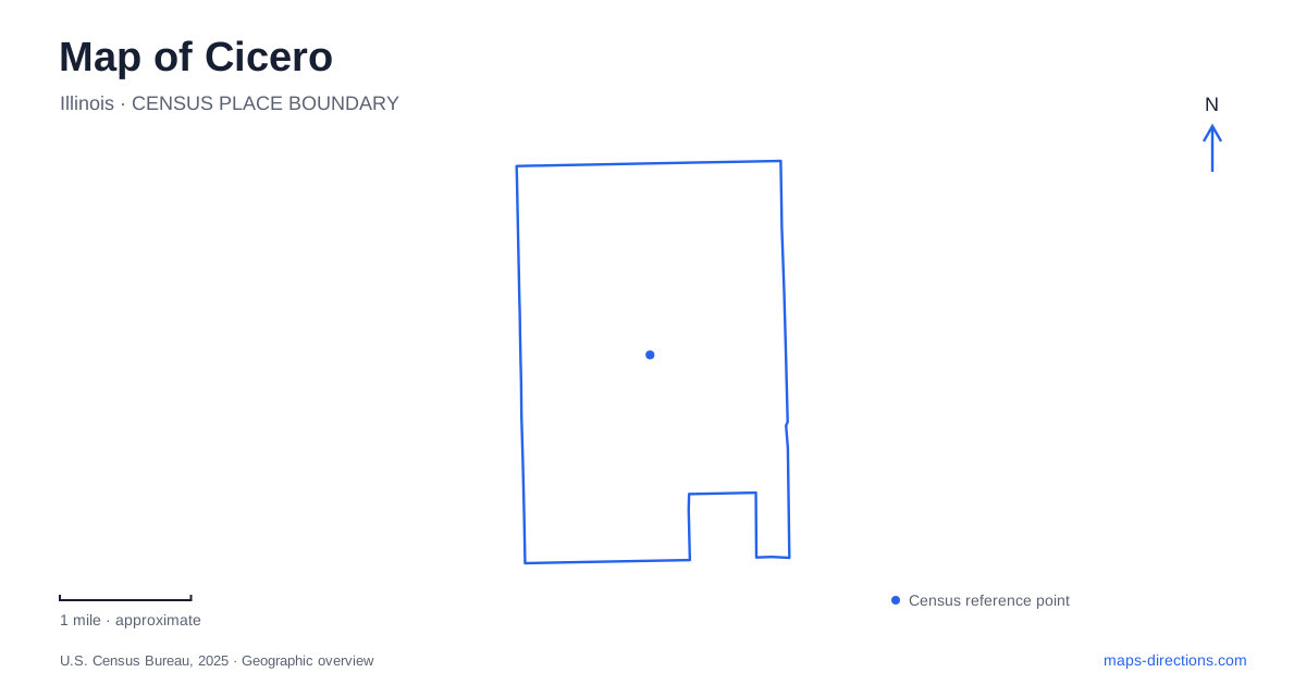
Street tiles load from OpenStreetMap when opened. The blue line shows the 2025 Census boundary.
- State
- Illinois
- Population · July 2025
- 81,858
- Land area
- 5.9 sq mi
- Water area
- 0.0 sq mi
Cicero's numbered streets and avenues provide a strong framework, but rail infrastructure gives the town a more complicated shape than a simple grid suggests. Cermak Road groups several civic destinations near rapid transit, while the broad railway landscape farther south changes how neighboring districts connect. Start with those two features and the map becomes a set of understandable corridors: public services along Cermak, regional rail around 26th Street, and educational destinations near Central Avenue.
Cermak Road as a civic reference
Town Hall's published address is 4949 West Cermak Road. The public library stands farther west at 5225 West Cermak Road. These addresses establish a useful stretch of the same corridor, while the community center uses a separate address at 2250 South 49th Avenue. The road names explain the arrangement better than grouping every municipal destination under a single town-center label.
A trip involving town business and the library can therefore be organized around Cermak Road, with 49th Avenue identifying the community center's approach. The town's Collector's Office is located at Town Hall, so that office does not require a search for a separate administrative campus. The library, however, has its own building and address rather than occupying the same complex.
For a map of Cicero, this civic corridor supplies a practical starting scale. Keep individual blocks visible enough to distinguish a Cermak frontage from an avenue address. Numbered roads are helpful here precisely because they convey position; replacing them with a broad neighborhood label removes information that is useful for reaching a particular building.
A terminal spanning more than one avenue
The CTA's 54th/Cermak station lies just north of Cermak Road between 54th Avenue and Laramie Avenue. The transit agency identifies 54th Avenue as the 5400 west line and Laramie as the 5200 west line. Its published station address is 2134 South 54th Avenue, but that single address does not describe the full extent of the facility.
CTA lists farecard entrances at both ends and an accessible entrance with vending machines in the center. That arrangement gives the terminal a broader relationship to the surrounding streets than its abbreviated name might suggest. Someone arriving from Laramie approaches a different end from someone arriving at 54th Avenue, though both are using the same station.
The terminal serves the Pink Line. Older official material describes it as part of the Blue Line's Cermak branch, because the Pink Line began operating in 2006. This historical naming explains conflicting labels in archived pages without requiring a traveler to treat them as two different present-day terminals. Use the current line designation when locating the station, and reserve the older name for understanding transit history.
The railway landscape south of the civic corridor
The regional comprehensive plan identifies a major BNSF intermodal facility between 26th Street and Ogden Avenue. This is a large operational railway landscape, not simply a thin rail line crossing an otherwise uninterrupted street grid. Its extent helps explain the change in map texture south of the civic and rapid-transit corridor.
Cicero's transit-area plan also places the Metra station around 26th Street and the town's namesake avenue. The Metra facility and the 54th/Cermak terminal belong to different rail systems and different locations. Their presence in the same town should not be interpreted as a single shared station complex.
When looking across the railway area, follow the actual roads shown around and through it. A sequence of numbered blocks on either side does not make the intervening land an ordinary continuation of residential streets. The rail yard is a substantial part of the town's geography, and recognizing its footprint gives the surrounding neighborhoods a clearer relationship to one another.
College and racecourse addresses
Morton College is at 3801 South Central Avenue. Its academic catalog describes a campus of approximately 37 acres with five educational buildings. This establishes a southern institutional destination with a campus layout of its own, distinct from the civic buildings along Cermak Road.
Nearby regional searches can also return Hawthorne Race Course. The operator gives its address as 3501 South Laramie in Stickney. That municipal label matters: a familiar attraction associated with the broader Cicero area can use a neighboring community in its official address. Preserve the operator's street and municipality when identifying the racecourse rather than assuming every nearby landmark belongs within the same boundary.
Cicero is easiest to understand through these concrete relationships: a civic road with several separate buildings, a rapid-transit terminal extending between avenues, a broad intermodal railway district, and a college campus farther south. They turn the numbered grid into a geographic picture of how public services, transportation, and institutions occupy the town.
Map and statistics: U.S. Census Bureau, 2025 Gazetteer, January 2025 generalized place boundaries and Vintage 2025 population estimates. Local references: Town of Cicero; Cicero Public Library; Chicago Transit Authority; Chicago Metropolitan Agency for Planning; Morton College; Hawthorne Race Course. Article prepared by Maps & Directions.