Map of Cibolo
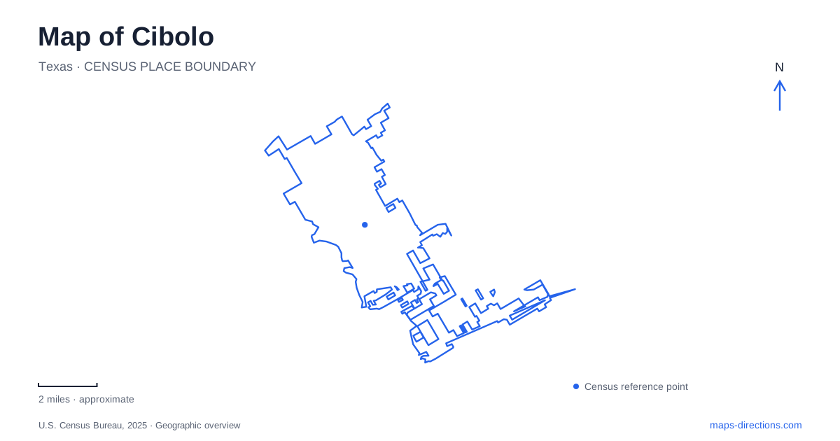
Street tiles load from OpenStreetMap when opened. The blue line shows the 2025 Census boundary.
- State
- Texas
- Population · July 2025
- 39,019
- Land area
- 21.1 sq mi
- Water area
- 0.0 sq mi
Cibolo lies in western Guadalupe County within the group of communities northeast of San Antonio known as the Metrocom. FM 78 and FM 1103 are more useful local reference lines than a broad regional label: they connect the older settlement, civic destinations and expanding residential areas. The railroad remains an important part of that geography. Its historic role in creating a trading town is still visible in the modern questions of how roads cross the tracks and connect different parts of the community.
A farming settlement shaped by rail
The Texas Historical Commission's town history describes a general store operated by George Schlather and Ernst Jenull during the 1870s. Charles Fromme later purchased it, and the settlement was also known as Fromme's Store. This detail gives the older center a human scale: a business serving a farming district could become a geographic reference for the whole community.
Local histories agree on the importance of the railway's arrival in the 1870s, even though accounts use different precise years. Cotton became a major crop, alongside grain cultivation. Formal incorporation came much later, in 1965. Cibolo's urban history consequently includes a long period when a recognizable community existed without the municipal structure that manages it today. Its old commercial and agricultural connections should not be confused with the much newer suburban growth surrounding them.
Main Street remains a civic reference
City Hall's address is 200 South Main Street. The municipal downtown study places public buildings, older commercial properties, homes, churches and the railway within the same small district. That mixture is important: the historic core is a lived-in area with several uses, rather than a self-contained attraction separated from ordinary neighborhood life.
A present-day map can therefore show government functions and older settlement patterns close together. Main Street offers an anchor for understanding that overlap, while FM 78 provides a larger transport line nearby. The city's downtown planning material discusses opportunities for redevelopment, but its drawings are proposals and analysis, not a guarantee that every pictured building or public space has been completed. Existing addresses remain a firmer starting point than a concept illustration.
Recreation along the FM 78 corridor
Niemietz Park, at 618 FM 78, is identified in the city's resident guide as its oldest park. A federal environmental assessment records its 1977 dedication as a land-and-water conservation project supported by local, state and federal agencies. The same assessment describes playing fields, walking paths and facilities for meetings and events. Its history links municipal recreation to a broader public investment in outdoor space.
The nearby YMCA and Cibolo Sports Complex use 176 FM 78, a separate address from Niemietz. Similar sporting purposes do not make them alternative names for the same park. The municipal facility directory also places the Miracle League Field on South Main Street. These separate entries show why a tournament, class or organized activity needs its exact venue identified: the recreation network extends across several sites in the older southern part of the city.
Schlather and smaller neighborhood spaces
Schlather Park is listed at 174 Wiedner Road. The city's guide describes its walking trail, playground and disc-golf use, giving it a different combination of activities from the FM 78 facilities. Al Rich Park, at 228 Deer Meadow, is smaller and sits between a school and a residential neighborhood. Its gazebo, baseball diamond and musical play equipment reflect that more local setting.
Veterans Memorial Park adds memorial and gathering functions, with covered picnic areas and recreation facilities. Read together, these parks provide several kinds of public space: sports-oriented grounds, a trail-and-play destination, a compact neighborhood park and a place of commemoration. The variety is more informative than simply counting the green polygons on a map. Each site relates to a different street approach and surrounding pattern of development.
A similarly named nature center is elsewhere
The Cibolo Nature Center is in Boerne, at 140 City Park Road. It is a separate Hill Country destination, not a municipal park within this Guadalupe County city. Its conservation organization manages trails, prairie, woodland and marsh habitat there. The shared name can easily obscure that geographic separation in a search result, especially when both places are described in the wider San Antonio region.
Locally, the railway has also shaped proposals for movement across the city. The North-South Connector plans identify a grade-separated crossing at FM 78 and Country Lane, illustrating the challenge of crossing the rail corridor. Funding selection and construction drawings are planning evidence rather than directions for an open road. Cibolo's map thus brings together an established rail-and-farm center, distinct recreation sites and proposals for additional connections. Keeping those categories clear makes the city's geography easier to follow.
Map and statistics: U.S. Census Bureau, 2025 Gazetteer, January 2025 generalized place boundaries and Vintage 2025 population estimates. Local references: City of Cibolo; Texas Historical Commission; Federal Aviation Administration; Cibolo Center for Conservation. Article prepared by Maps & Directions.