Map of Chula Vista
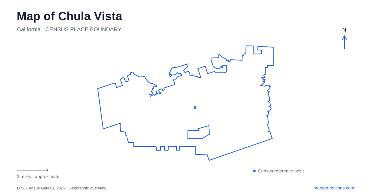
Street tiles load from OpenStreetMap when opened. The blue line shows the 2025 Census boundary.
- State
- California
- Population · July 2025
- 275,533
- Land area
- 49.8 sq mi
- Water area
- 2.3 sq mi
Chula Vista stretches across landscapes that are easy to underestimate from a single downtown map. San Diego Bay forms the western setting, while the Otay River Valley leads inland toward the Otay Lakes. Between them, Third Avenue records the growth of an agricultural community into an urban center. The bayfront's public parks and protected marshes add another layer, where recreation is shaped by the needs of wildlife habitat. These distinct settings are useful anchors for understanding the city as a whole.
Third Avenue and the earlier commercial center
During the period from 1911 to 1939, Third Avenue developed as a center of commercial and civic services within an agricultural community. Hotels and a fire station were among the additions. Paved streets and other improvements followed the early settlement pattern, while architectural styles reflected broader trends in Southern California, including Spanish Colonial Revival houses during the 1920s and 1930s.
This history explains why the avenue has a different role from a modern shopping center assembled around a large parking field. It inherited a sequence of businesses, public functions and neighboring homes. Later streetscape work strengthened the connection between Third Avenue and Memorial Park through a plaza intended for civic activity. Wider pedestrian spaces, decorative paving and outdoor dining areas reinforced the older center's role as a place to gather. In Chula Vista, that relationship between a commercial street and public park is an important part of the urban geography, distinct from the open bayfront.
Sweetwater Park opens a new waterfront landscape
Sweetwater Park opened in April 2025 as part of the bayfront redevelopment. Its 39 acres sit beside the Sweetwater Marsh refuge and were designed around lower-impact recreation and appreciation of habitat. The park includes dunes, meadows, native planting, nature play areas and overlooks, with a total of about two and a half miles of pedestrian and bicycle paths.
Its listed address is 845 E Street. The park's position and design make it a useful introduction to the bayfront, where built recreation spaces meet sensitive habitat. Wildlife blinds allow observation with less disturbance, while native planting helps buffer the adjacent refuge. Roberto Salas's sculpture Rigors of Flight takes the form of a large wishbone, connecting public art with the birds that use the area. This is a different kind of waterfront destination from a sports complex: its defining features encourage looking, walking and learning about the surrounding environment.
Reaching the Living Coast and Sweetwater Marsh
The Living Coast Discovery Center occupies a site within the San Diego Bay National Wildlife Refuge at Gunpowder Point. Access is organized through an outer parking area west of the intersection of Bay Boulevard and E Street, followed by a complimentary shuttle. That arrangement is a significant practical detail because the facility's postal address alone does not describe the normal visitor arrival.
Sweetwater Marsh provides opportunities to observe the plants and animals of the refuge, with walking routes associated with the center's programs. The protected setting is part of the experience, not simply land surrounding a building. For a visit to Chula Vista, the center and Sweetwater Park offer complementary perspectives on the same broader coastal landscape. One combines exhibits and organized interpretation with refuge access; the other provides a larger public park next to the habitat. Their proximity does not erase the different ways each site manages visitors.
Otay Valley connects bay and inland water
Otay Valley Regional Park extends roughly eleven miles inland from the southeastern salt-pond area at the mouth of the Otay River toward Upper and Lower Otay Lakes. It is a cooperative effort involving the two cities and county, reflecting the fact that a river corridor does not follow one municipality's boundaries. Its purposes include recreation and protection of wildlife, open space, historic and agricultural resources.
The corridor is useful for reading the southern landscape of Chula Vista. Rather than a compact park surrounded on all sides by city blocks, it follows a valley connecting coastal and inland settings. Hiking, cycling and equestrian opportunities form part of that regional framework, alongside areas for other recreation. The broad park boundary should not be mistaken for one uninterrupted, uniformly developed trail. Individual access points and trail segments serve different portions of the valley.
The northern valley completes the picture
The Sweetwater Valley forms another important connection, running from Sweetwater Reservoir toward San Diego Bay. Its river and associated open spaces create a separate geographic system from the Otay corridor. Rohr Park and the municipal golf course occupy part of that valley landscape, linking everyday recreation with the broader river setting.
Together, these features give Chula Vista a clear spatial structure: an older commercial avenue, a western bayfront with protected marshland, and river valleys extending toward inland water. The city's parks are not interchangeable green areas. Each reflects a particular relationship among streets, water, habitat and public access, and those relationships are the most useful guide to understanding the map.
Map and statistics: U.S. Census Bureau, 2025 Gazetteer, January 2025 generalized place boundaries and Vintage 2025 population estimates. Local references: City of Chula Vista; Port of San Diego; Living Coast Discovery Center. Article prepared by Maps & Directions.