Map of Chino
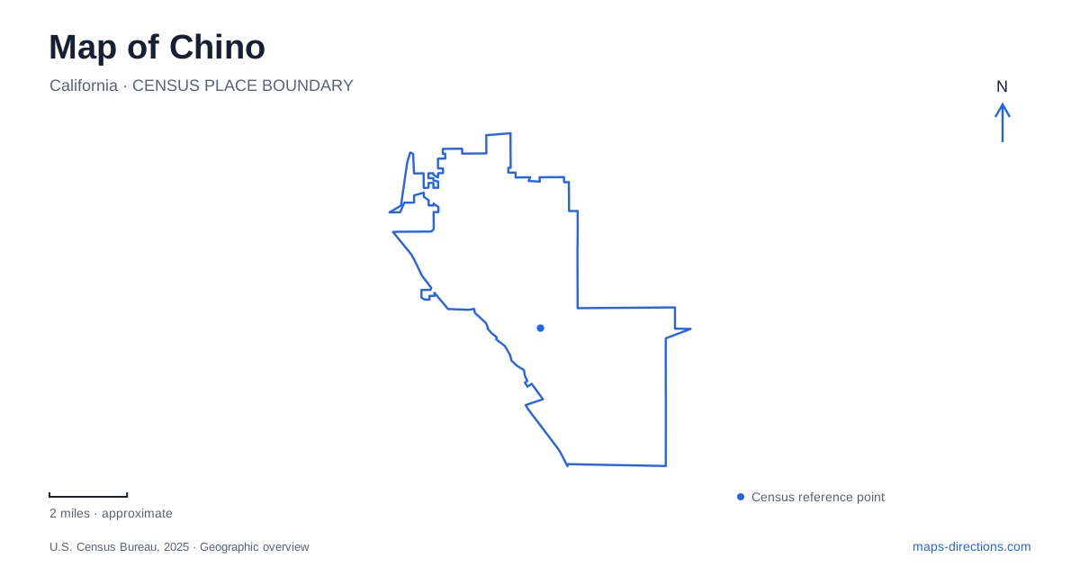
Street tiles load from OpenStreetMap when opened. The blue line shows the 2025 Census boundary.
- State
- California
- Population · July 2025
- 96,957
- Land area
- 30.0 sq mi
- Water area
- 0.1 sq mi
Chino has three particularly useful geographic anchors: the historic civic area around Central Avenue and D Street, the airport and its aviation museums, and Prado Regional Park farther along the Euclid Avenue corridor. Each reflects a different part of local development. The civic blocks preserve an older urban center, the airfield carries a wartime training legacy, and Prado combines recreation with a landscape shaped by regional flood control.
The older center is organized around D Street
Central Avenue and D Street mark the area where the first City Hall stood. The city's current Civic Center Master Plan treats this historic core as a long-term revitalization district. Its proposals include civic buildings and outdoor spaces, but a twenty-year plan should be read as a framework for future change rather than a catalog of completed construction.
The Chino Youth Museum provides a more immediate historic landmark at 13191 Sixth Street. It occupies the former First National Bank building, built in 1912, and opened as a museum in 1999. Banking, dairy, and commerce are among the themes used to introduce children to community history. The building therefore preserves both an architectural presence on the street and a connection to the activities that supported the town.
D Street, Sixth Street, Seventh Street, and Central Avenue form a small-scale grid around the civic area. Aguiar Square and the nearby transit center help explain how public spaces and daily services fit among those blocks. This is a different street pattern from the larger airport and regional-park properties, where individual buildings occupy much broader grounds.
The airport explains a major chapter of local history
Chino Airport began as Cal-Aero Field, associated with a civilian academy that trained military pilots during the early 1940s. The academy closed in October 1944 after preparing thousands of pilots for wartime service. Later, surplus military aircraft arrived at the field, and restoration and preservation became important parts of its identity.
The present airport remains a general-aviation facility, not simply a museum campus. Flight training, maintenance, and other aviation businesses share the wider property with public attractions. This continuing activity helps explain why historic aircraft preservation is especially visible here: the collections occupy a working aviation environment with the skills and facilities needed to care for aircraft.
For a visitor interested in Chino's development, the airfield supplies a distinct historical layer between the earlier civic core and later suburban growth. Its Cal-Aero name survives in local addresses, preserving a reference to the training era within the modern road network.
Two museums have separate street addresses
Planes of Fame Air Museum is at 14998 Cal Aero Drive. Its collection spans early aviation, the world wars, and later conflicts, with many aircraft restored to flying condition. Its visitor entrance leads through the gift shop attached to the east end of the Maloney Hangar. That gives a museum visitor a specific destination within the much larger airfield setting.
Yanks Air Museum is a separate institution at 15121 Stearman Drive, on the airport's western side. Its grounds include indoor aircraft displays, restoration facilities, and an outdoor area containing future projects and large aircraft. The museum identifies Merrill Avenue as the road approach to its parking area.
The two collections can support an aviation-focused itinerary, but their separate entrances, operating arrangements, and collections remain important. Cal Aero Drive and Stearman Drive are the useful final street references. An airport label alone is too broad to describe either museum's visitor experience.
Prado's recreation grounds grew from flood-control land
Prado Regional Park stands at 16700 South Euclid Avenue. The county's history traces the wider landscape to major Santa Ana River floods in 1937 and 1938 and the construction of Prado Dam, completed in 1941. The regional park itself opened in July 1976, decades after the dam began capturing floodwaters.
Today, the park offers camping, fishing, picnic areas, trails, and disc golf. Its official map separates the campground, equestrian center, sports fields, shelters, and lake-related facilities. These are several activity areas within a regional property, rather than amenities arranged around one small neighborhood lawn.
The dog-training and recreation concession uses its own entrance farther south on Euclid Avenue, separate from the main park entrance. That detail matters for anyone arriving with a specific program or facility in mind. The park lake also carries changing water-quality notices, so its mapped presence does not establish suitable conditions for every water activity.
A map of Chino becomes easier to use when these different scales are retained: compact civic blocks around D Street, museum addresses within an active airport, and a regional recreation landscape along South Euclid Avenue. Their histories explain why the destinations are distributed as they are.
Map and statistics: U.S. Census Bureau, 2025 Gazetteer, January 2025 generalized place boundaries and Vintage 2025 population estimates. Local references: City of Chino; San Bernardino County Airports; Planes of Fame Air Museum; Yanks Air Museum; San Bernardino County; San Bernardino County Parks. Article prepared by Maps & Directions.