Map of Chico
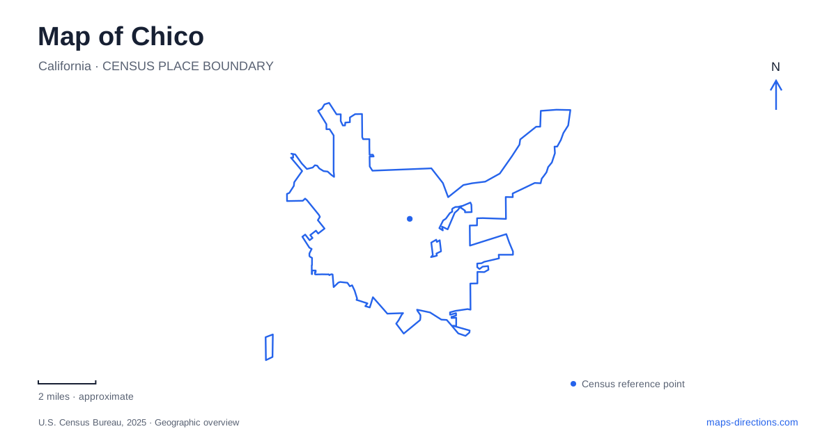
Street tiles load from OpenStreetMap when opened. The blue line shows the 2025 Census boundary.
- State
- California
- Population · July 2025
- 105,081
- Land area
- 34.6 sq mi
- Water area
- 0.2 sq mi
Chico's most useful geographic thread is the creek running from the foothills through parkland and the university. Along that thread, the map changes from trails and recreation areas to footbridges and downtown blocks. Bidwell Park is a large, varied landscape rather than a single neighborhood green. The university is closely connected to downtown, while the City Plaza supplies a compact civic gathering place. Understanding those relationships makes it easier to choose between a central walking outing, a family recreation stop, and a longer excursion into the park.
The plaza within the downtown blocks
City Plaza sits between Broadway and Main Street, with Fourth and Fifth streets forming its other sides. Those four boundaries make it a clear reference point within the commercial grid. The plaza contains a performance area, water feature, landscaping, a veterans memorial, and a large Blue Atlas cedar.
Its role differs from the long creekside park. Here the public space is defined by surrounding blocks and storefront streets, with events taking place in an established urban setting. Broadway and Main provide the longitudinal references, while the numbered streets make movement between nearby blocks easy to describe.
A map of Chico benefits from showing the plaza as a complete block, rather than just placing an event symbol in the middle of downtown. Its edges explain how people approach from several directions, and its internal features give the open space a recognizable structure. The distinction between this civic plaza and the much larger Bidwell landscape is fundamental to understanding the city's different outdoor places.
A campus divided and connected by water
Chico State adjoins downtown, and Big Chico Creek passes through its grounds. Footbridges connect the two sides, turning the waterway into both a landscape feature and an organizing line for campus movement. The university's arboretum extends across the campus, with planted collections and a creekside route that includes native-plant restoration.
This means a campus walk can be read as a sequence of buildings, bridges, and vegetation rather than a trip along ordinary city streets. The creek's bends and crossings matter as much as the street addresses at the university's perimeter.
For bicycle travel, the university identifies designated routes near the creek for east–west movement and Warner Street for north–south access. The distinction between those routes and pedestrian areas is important within the campus itself. The surrounding city grid may suggest several approaches, but movement among academic buildings follows a more specific internal network.
One-Mile, Five-Mile, and the larger park
Annie Bidwell donated approximately 2,500 acres to establish Bidwell Park in 1905. The present landscape contains several recreation settings whose names should remain separate on a detailed map. One-Mile Recreation Area is in Lower Park, extending east from Pine Street toward the eastern edge of Caper Acres Playground. It includes Sycamore Pool and the campfire council ring.
Five-Mile Recreation Area belongs to Middle Park. The municipal definition places it around the diversion structure and adjacent creekside areas, including the north gravel parking area off Five Mile Way. The familiar mileage names therefore identify particular recreation areas, not interchangeable labels for all park facilities.
Upper Park adds more extensive trail terrain. The community observatory stands near Horseshoe Lake, while Peregrine Point is the upper-park disc-golf location. Sherwood Forest is the separate disc-golf area in Middle Park. These individual landmarks help break a very large green shape into destinations with different activities and surroundings.
The city manages Bidwell as a day-use park. Its rules close upper trails to bicycles and horses during wet conditions because of erosion concerns. That policy reflects the difference between developed recreation areas and vulnerable trail surfaces, rather than a uniform set of conditions across the entire park.
The mansion site after the fire
Bidwell Mansion's visitor experience changed substantially after the December 11, 2024 fire severely damaged the historic building. Distinguish the mansion itself from the visitor center's exhibit hall and shop. California State Parks provides the appropriate guidance for their separate visiting arrangements, so an older interior-tour description should not be used as proof of access to the damaged structure.
This distinction is essential for interpreting older photographs and guide descriptions. A map may continue to identify the state historic park, but that does not mean the former mansion-tour experience is available. The visitor center and the damaged historic building now represent different parts of the site with different access conditions.
Taken together, these places show Chico at several scales: a downtown plaza bounded by four streets, a university linked by footbridges, named recreation areas within a long park, and a historic site shaped by preservation and fire damage. Keeping those scales visible produces a more accurate picture than treating every creekside landmark as part of one continuous attraction.
Map and statistics: U.S. Census Bureau, 2025 Gazetteer, January 2025 generalized place boundaries and Vintage 2025 population estimates. Local references: Downtown Chico Business Association; California State University Chico; City of Chico; City of Chico Municipal Code; California State Parks. Article prepared by Maps & Directions.