Map of Cheyenne
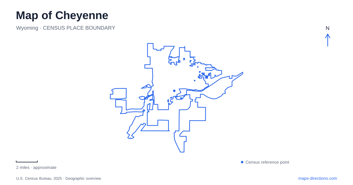
Street tiles load from OpenStreetMap when opened. The blue line shows the 2025 Census boundary.
- State
- Wyoming
- Population · July 2025
- 66,507
- Land area
- 39.8 sq mi
- Water area
- 0.1 sq mi
Cheyenne has an unusually clear downtown relationship: the Wyoming State Capitol and the former Union Pacific depot anchor opposite ends of Capitol Avenue. Government and rail transport are therefore visible in the basic arrangement of the streets, not just in museum exhibits. Beyond that central axis, parkland around Sloan's Lake, railroad displays, and paths following creek corridors broaden the picture. These features make a useful framework for understanding the capital without treating its famous rodeo grounds as the entire city.
Capitol Avenue's two ends
The State Capitol stands at 200 West 24th Street. Its grounds lie between Central and Carey avenues, with 24th and 25th streets defining the southern and northern edges. The depot stands farther south at 121 West 15th Street. Their relationship across the downtown grid gives Capitol Avenue both a visual identity and an organizing role for nearby streets.
The depot contains a railroad museum within the historic Union Pacific building. Immediately associated with this southern downtown anchor is Depot Plaza, at Capitol Avenue and Lincolnway, used for public gatherings. That arrangement allows the railway building to remain part of civic life even for people who are not entering the museum. On a map of Cheyenne, the plaza and the Capitol grounds frame a central corridor rather than two isolated attractions.
State history within the downtown grid
The Wyoming State Museum is at 2301 Central Avenue, close to the Capitol. The Historic Governors' Mansion sits at 300 East 21st Street. These addresses reveal a small cluster of state-history destinations, but also show why they should be located individually: the museum, legislative building, and former residence occupy different blocks and represent different functions.
For a visit centered on state history, this cluster offers a coherent geographic starting point. Central Avenue and the numbered cross streets provide a way to understand where the buildings sit relative to the Capitol Avenue axis. The former residence draws attention away from the monumental government building toward domestic life, while the museum supplies a broader interpretive setting. Together they give downtown more depth than its two most prominent landmarks alone.
Finding the right Big Boy
Holliday Park contains Union Pacific Big Boy locomotive No. 4004, displayed in the park's southeast corner. The parking approach identified by the visitors bureau is at East 17th Street and Morrie Avenue. This is the outdoor display location for the retired locomotive, a substantial piece of railway history placed within a public neighborhood park.
The distinction matters in Cheyenne because the railroad also maintains a working steam program. Union Pacific explicitly states that its steam shop lies within an active railroad facility and does not accept walk-in public visits. Occasionally arranged shop tours are a different experience from seeing No. 4004 in Holliday Park. A search for a Big Boy engine can therefore refer to a permanent public display or to operating equipment and specialized events; the locomotive number and setting resolve that ambiguity.
Sloan's Lake and the northern parks
Lions Park surrounds Sloan's Lake and combines water recreation with fields, playgrounds, picnic areas, and Greenway connections. The lake gives this park a different shape from the downtown street grid: paths and activity areas gather around the water rather than a single central square. The aquatic center and Kiwanis Community House add indoor recreation and gathering spaces to the larger landscape.
The botanic gardens' Grand Conservatory is at 710 South Lions Park Drive. Its planted interiors, orangerie, and observation deck create another kind of destination within the park area. Nearby, the Old West Museum at 4610 Carey Avenue sits beside Frontier Park and Lions Park. Its collections interpret the western heritage associated with the annual rodeo celebration. These neighboring sites let a northern Cheyenne outing focus on gardens, lake paths, or cultural history, with each experience occupying a specific part of the broader recreation district.
Reading the Greenway through its creeks
The municipal Greenway is a concrete path network for walking and cycling across the city and into parts of the county. Its origins lie in the Crow Creek Greenway Committee formed in 1990. Existing segments follow Crow Creek, Dry Creek, and Allison Draw, showing how drainage corridors also provide space for movement through developed neighborhoods.
This network deserves its own layer when reading the map of Cheyenne. A street route describes vehicle connections; the Greenway reveals another pattern organized partly around watercourses and open space. Lions Park connects into that larger system, while downtown retains its strong Capitol-to-depot axis. Holding both patterns in view explains the city's geography more completely: formal civic streets establish the historic center, and creek-based paths connect a wider everyday landscape.
Map and statistics: U.S. Census Bureau, 2025 Gazetteer, January 2025 generalized place boundaries and Vintage 2025 population estimates. Local references: Wyoming Administration and Information; National Park Service; Cheyenne Depot Museum; City recreation department; Visit Cheyenne; Union Pacific; Old West Museum; City of Cheyenne. Article prepared by Maps & Directions.