Map of Chesapeake
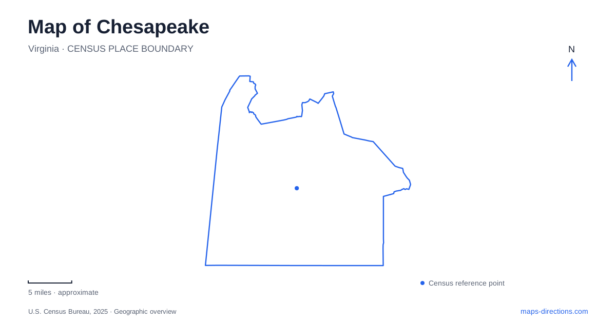
Street tiles load from OpenStreetMap when opened. The blue line shows the 2025 Census boundary.
- State
- Virginia
- Population · July 2025
- 255,332
- Land area
- 338.5 sq mi
- Water area
- 12.5 sq mi
Chesapeake is a city where water shapes both the visible landscape and the routes through it. The Southern Branch of the Elizabeth River, a working canal corridor, forested wetlands and the Northwest River create several different settings within the same municipal area. Great Bridge provides a particularly useful starting point: here, transportation history, a Revolutionary War battlefield and modern boating activity meet. Farther south and west, the map becomes less about compact street blocks and more about waterways, long access roads and protected land.
Great Bridge at the river and canal junction
Great Bridge Lock Park occupies a small peninsula at the meeting of the Southern Branch of the Elizabeth River and the Albemarle and Chesapeake Canal. Its 19 acres are bounded by river on one side and canal on the other. The lock manages the transition between the river's salt water and the canal's fresh water, making this an operating piece of water infrastructure as well as a public recreation site.
The park is at 100 Locks Road, just off Battlefield Boulevard. A raised viewing area and interpretive signs explain the lock system, while a boat ramp and kayak launch support access to the water. Watching vessels here gives the map's thin canal line a more tangible scale: the junction accommodates boats moving through the Intracoastal Waterway, not merely local park traffic.
The canal was completed in 1859. Its route belongs to a nineteenth-century effort to connect regional waters for navigation, whereas the battle commemorated nearby occurred in the previous century. Keeping those dates separate avoids compressing several distinct histories into one apparently timeless waterfront scene.
A crossing contested in 1775
The Battle of Great Bridge took place on December 9, 1775. The local museum and battlefield foundation interpret the Patriot victory and the strategic importance of the crossing. Battlefield Park, opened in 2011, includes a quarter-mile interpretive route and a recreation of the 1775 causeway. That reconstructed feature makes the relationship between firm ground, marsh and a constrained approach easier to understand.
The museum address is 1775 Historic Way. A separate nature route reaches the Marsh Overlook Trail by a footbridge and leads toward a viewing tower. These outdoor spaces connect historical interpretation with the surrounding wetland topography. In this part of Chesapeake, the marsh is essential context for the battle: the shape of the ground helps explain why a bridge and causeway could become such consequential places.
The southeastern river park
Northwest River Park lies in the southeastern part of the city despite the directional word in its name. The park takes that name from the river, so looking for it in the northwest corner of a city map would be misleading. Its entrance is at 1733 Indian Creek Road, and the property covers 763 acres on the river's banks.
The park map distinguishes Lake Lesa, the campground, equestrian areas and several trails. The quarter-mile Molly Mitchell Accessible Trail uses crushed stone, while the longer Indian Creek, Molly Mitchell and Otter Point hiking routes have compacted surfaces that can include roots, rocks or mud. The Shuttle Trail supplies another alignment through the grounds. These details show a varied recreation landscape rather than one lakeside loop with interchangeable paths.
For an approach from the north, the city's directions use Route 168 to Hillcrest Parkway East, then Battlefield Boulevard and Indian Creek Road. From North Carolina, the published approach uses Gallbush Road and Indian Creek Road. Those alternatives reflect the park's southern position within Chesapeake and its relationship to the regional north-south corridor.
Different approaches to the Great Dismal Swamp
The Great Dismal Swamp National Wildlife Refuge extends across southeastern Virginia and northeastern North Carolina. Lake Drummond occupies its interior, surrounded by forested wetlands and a network of ditches and associated routes. The protected landscape crosses local boundaries, so the nearest visible edge on a map does not necessarily provide the desired kind of access.
On the Chesapeake side, the Portsmouth Ditch entrance is associated with Martin Johnson Road, and the refuge identifies Black Bear Trail as a rustic three-mile walking route there. The Feeder Ditch provides a water connection from the Dismal Swamp Canal toward Lake Drummond. These approaches serve different activities and should be distinguished from the vehicle route to the lake.
The designated Wildlife Drive begins at 3120 Desert Road in neighboring Suffolk. It follows six miles of gravel road one way toward the lake, with boardwalk stops along the route. The refuge's access information places the driving entrance there rather than on the canal's eastern side. For an outing from the city, this is a useful example of why regional geography matters: the destination may be visible within the broader swamp landscape while its practical road approach lies across a city boundary.
Map and statistics: U.S. Census Bureau, 2025 Gazetteer, January 2025 generalized place boundaries and Vintage 2025 population estimates. Local references: City of Chesapeake; Great Bridge Battlefield & Waterways History Foundation; U.S. Fish & Wildlife Service. Article prepared by Maps & Directions.