Map of Charleston
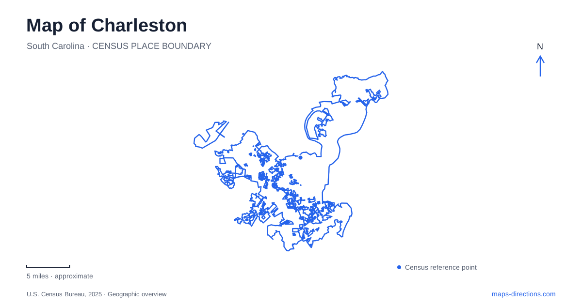
Street tiles load from OpenStreetMap when opened. The blue line shows the 2025 Census boundary.
- State
- South Carolina
- Population · July 2025
- 159,423
- Land area
- 115.3 sq mi
- Water area
- 20.9 sq mi
Charleston is best understood as a city arranged around water rather than as a single continuous downtown. The Ashley and Cooper rivers frame the peninsula, while the harbor separates places that can appear close together on a small map. West Ashley adds another substantial urban landscape across the river, including an earlier colonial settlement site and a former railway corridor adapted for walking and cycling. These relationships explain why a short straight-line distance may involve a bridge, a ferry, or an entirely different district.
The peninsula’s southern edge was engineered
The Battery and White Point Garden occupy the prominent southern end of the peninsula, but their present outline is not an untouched natural shoreline. Seawall construction and land filling created the waterfront edge over successive periods. The High Battery seawall was completed in 1818, and the first public garden opened on newly enclosed and filled land in 1838. Subsequent work extended the garden westward toward King Street.
This makes the southern waterfront both a public landscape and a record of engineering. Looking inland from the promenade shows streets and buildings behind a boundary constructed to separate urban land from tidal water. White Point Garden provides the planted space within that setting, while the seawall promenade gives a more exposed view toward the harbor.
Charleston’s Lower Battery history includes further land reclamation in the early twentieth century. Between 1909 and 1911, a new wall extended from the foot of King Street toward the western end of Tradd Street. Material dredged from the Ashley filled land behind it. The broad waterfront shape visible today therefore reflects multiple building campaigns, not one original defensive line preserved without change.
The harbor requires two different kinds of journey
Fort Sumter stands on an artificial island in the harbor. Its visitor route is by authorized ferry, with departures from the National Park Service visitor center at Liberty Square and from Patriots Point in Mount Pleasant. The Liberty Square address is 340 Concord Street. Selecting a departure location is part of planning the visit because the two terminals sit on different sides of the Cooper River.
Fort Moultrie has a different geographical relationship to the mainland. It is on Sullivan's Island, rather than on Fort Sumter's isolated harbor island. Both belong to the same national historical park, but they are separate sites with different approaches. A map label for the combined park can conceal that practical distinction.
For Charleston visitors, the water crossing also makes the history easier to visualize. The harbor defenses were positioned around a navigable entrance and its approaches, not gathered in one museum precinct. Seeing their separation helps explain why the locations mattered militarily and why a harbor view from the Battery is not the same experience as reaching the island fort.
An earlier settlement across the Ashley
Charles Towne Landing State Historic Site preserves the setting where English settlers arrived in 1670. It occupies a marshy point off the Ashley River, outside the familiar lower-peninsula streets. This is an important correction to an easy assumption: the best-known historic downtown is not the precise location of that first colonial settlement.
The park combines a self-guided history trail with gardens and interpretation of early trade. Its replica seventeenth-century vessel, Adventure, is associated with Old Towne Creek and illustrates the maritime connections supporting the settlement. The surrounding marsh and river make those connections visible in the landscape instead of leaving them as abstract dates.
An eighty-acre garden area, live-oak avenue, and the Legare Waring House add later layers to the property. Charleston’s history here consequently spans more than the initial landing. The site presents a place that continued to change, with colonial interpretation, later estate features, and natural habitat sharing the same broader setting. Seasonal maintenance can affect access to the vessel, so it should not be treated as an attraction available without interruption.
A railway alignment through West Ashley
The West Ashley Greenway follows a former railroad bed between Albemarle Road and Main Road. The city describes an approximately eight-mile linear park passing through neighborhoods, woods, fields, creeks, and marshes. This succession of environments gives it a different character from the waterfront promenade: it crosses everyday residential and ecological landscapes rather than remaining beside the historic harbor frontage.
The former railway alignment supplies continuity, but intersections and access points remain part of the route. Municipal planning treats the greenway and the separate West Ashley Bikeway as components of a broader walking and cycling network, with improvements directed at crossings and missing connections. A proposed network line and an existing trail are therefore different kinds of map information.
Together, these places give Charleston several useful geographical anchors. The engineered Battery defines the peninsula's southern edge, ferry terminals organize access to the island fort, the marshy landing site locates an earlier colonial center, and the greenway shows another way through West Ashley. Reading those relationships first makes the wider city more coherent than treating every historic or outdoor destination as part of one downtown walk.
Map and statistics: U.S. Census Bureau, 2025 Gazetteer, January 2025 generalized place boundaries and Vintage 2025 population estimates. Local references: City of Charleston; Charleston County Public Library; National Park Service; South Carolina State Parks. Article prepared by Maps & Directions.