Map of Chandler
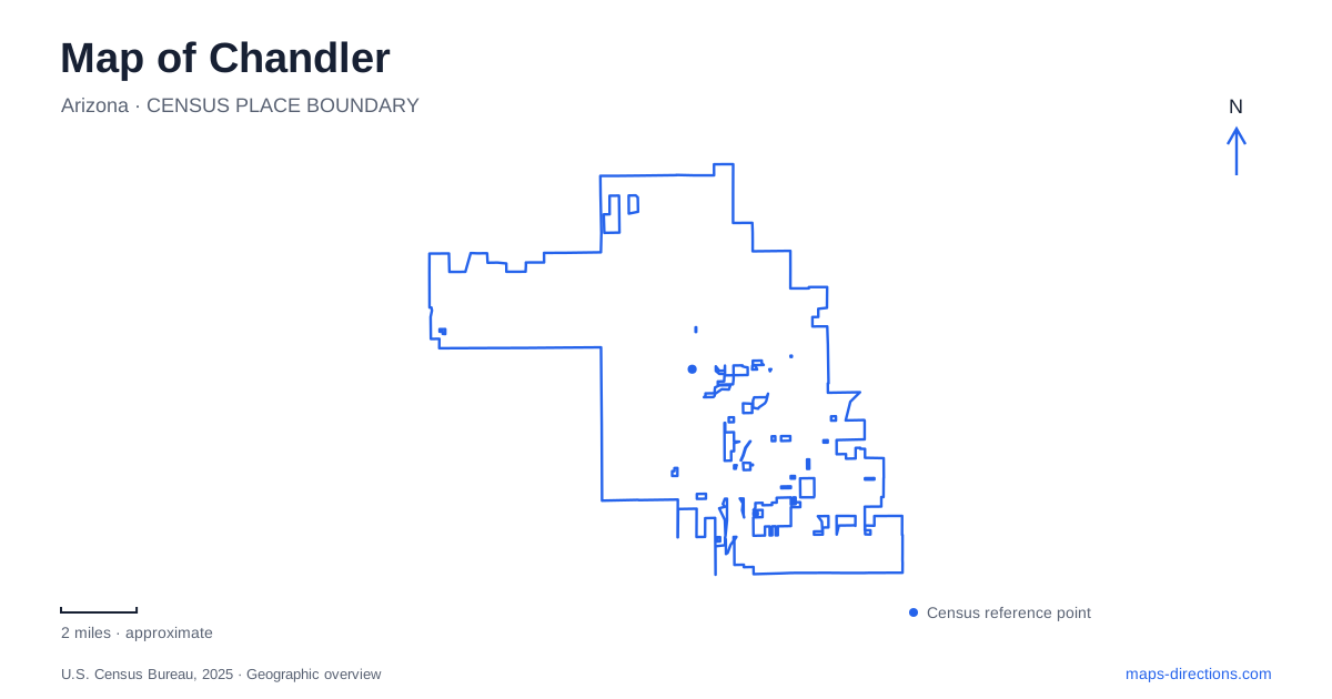
Street tiles load from OpenStreetMap when opened. The blue line shows the 2025 Census boundary.
- State
- Arizona
- Population · July 2025
- 278,748
- Land area
- 65.7 sq mi
- Water area
- 0.1 sq mi
Chandler's map reflects several transformations of the same desert landscape: irrigated ranch land became a planned town, agricultural buildings became museum resources, and engineered water basins became wildlife habitat and recreation space. The original downtown remains centered on Arizona Avenue, but many places that explain the city's development lie outside that core. Looking at the town square, Tumbleweed Park, Veterans Oasis and the McCullough-Price House together reveals how growth has reused land and buildings with very different beginnings.
A planned square changed by a highway
The community was founded in 1912 around a deliberately planned commercial center. Its founder envisioned a landscaped park surrounded by businesses, with covered walkways supported by colonnades. The San Marcos hotel was part of that early vision. The arrangement placed shared public space at the center of the town rather than treating a park as a later addition among existing streets.
Arizona Avenue subsequently altered that design. In 1940, the state proposed carrying Route 87 through the center, dividing the park to accommodate a highway alignment. That change explains an important feature of downtown Chandler: the original square and the modern transport corridor occupy the same central space. The surviving relationship among the park, shops and historic resort still conveys the early plan, even though traffic and later redevelopment changed its form. Current park renovation is another stage in that continuing adaptation, rather than the creation of an entirely new civic center.
Tumbleweed Park's present and agricultural past
Tumbleweed Park, at 2250 South McQueen Road, covers about 200 acres. Sports facilities, pavilions, play areas and a paved walking circuit make it a large community recreation destination. Its recreation center and tennis facilities add indoor activity and organized sport to the open park landscape.
Within the grounds, Tumbleweed Ranch interprets the East Valley's agricultural history. The preserved area began in 1999 and now covers 19 acres. Its collection includes historic houses, an early twentieth-century grocery store, the Red Shed Theater, demonstration fields and farm equipment. The range of features is significant: rural life involved homes, supplies, production and community activity, not just fields outside a town.
The McCroskey House was built in 1917 and represents the practical bungalow housing used by farming families. The Edwards House originated as an Aladdin catalog design, the Maples model, built in 1913. Both illustrate the use of economical, repeatable house designs in a growing agricultural community. These preserved structures give Chandler's park landscape a historical layer beneath its present sports and recreation uses. Building interiors are not generally available simply because the outdoor ranch grounds are accessible.
Water management made visible at Veterans Oasis
Veterans Oasis Park occupies 113 acres in the southeastern part of the city, with its address on East Brooks Farm Road near Lindsay Road. Its lake, trails, observation point and memorial share space with an important piece of water infrastructure. Five recharge basins occupy about 32 acres of the park.
The basins receive reclaimed water and allow it to infiltrate through sand and gravel toward the water table. Their purpose is therefore different from that of a decorative pond. At the same time, the basins create riparian habitat and support nature trails, so engineering and recreation occupy the same landscape. This makes Veterans Oasis particularly useful for understanding Chandler's relationship with water. The green space is not separate from the work of managing a desert water supply; some of its defining features exist because of that work.
The park's layout can be read through those functions. Open turf and shaded gathering areas serve everyday recreation, while the basin landscape makes water storage and habitat visible. Recognizing the difference helps explain why the site has several water areas rather than one conventional central lake.
A winter home amid former fields
The McCullough-Price House was built in 1938 as a Pueblo Revival residence designed by Lescher and Mahoney. William McCullough, a Detroit resident who had spent winters at the San Marcos hotel, commissioned it amid hundreds of acres of alfalfa and cotton fields. The family history and architectural form connect the house with both agricultural land and winter residence in the desert.
The property was donated to the city in 2001 and later adapted for museum-related use, including archival research and administrative functions. Its surroundings changed substantially as former rural land developed. The house therefore preserves a different aspect of Chandler's past from the farm bungalows at Tumbleweed Ranch. Together, the planned square, modest agricultural homes, winter residence and recharge park show how civic ambition, farming, seasonal living and water management have all helped shape the city that appears on today's map.
Map and statistics: U.S. Census Bureau, 2025 Gazetteer, January 2025 generalized place boundaries and Vintage 2025 population estimates. Local references: City of Chandler; Chandler Museum. Article prepared by Maps & Directions.