Map of Cerritos
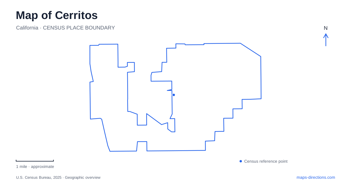
Street tiles load from OpenStreetMap when opened. The blue line shows the 2025 Census boundary.
- State
- California
- Population · July 2025
- 46,367
- Land area
- 8.7 sq mi
- Water area
- 0.1 sq mi
Cerritos is easier to understand when its cultural buildings and parks are grouped by street and setting. Bloomfield Avenue links several civic and recreation references, while the performing arts venue has its own Park Plaza Drive address. Farther west, Liberty Park occupies land between Studebaker Road and the San Gabriel River. These relationships reveal a city with several purposeful public destinations rather than one traditional sightseeing center.
Bloomfield Avenue and 183rd Street
The civic center is identified by the intersection of Bloomfield Avenue and 183rd Street. The municipal library's local history traces the site back to strawberry fields, with the original library becoming the first civic center building in 1973. That agricultural background gives the intersection a meaning beyond its present institutional uses.
Today the library, public art, and landscaped civic spaces provide several reasons to explore this area. A map can show them as separate markers, but their relationship matters: they form a cultural cluster where the setting between buildings contributes to the visit. The Amaryllis fountain sculpture, for example, stands west of the library and combines plant and animal forms around a pool.
The Cerritos Sculpture Garden adds another kind of art experience. Dedicated in 2006 for the city's fiftieth anniversary, it contains spaces designed for viewing a growing collection of outdoor works. Locating the garden within the civic area helps distinguish a sculpture outing from a visit focused on the library's interior collections and programs.
A performance destination has its own address
The Cerritos Center for the Performing Arts is listed at 18000 Park Plaza Drive. Its presence in the Towne Center story is different from the library's role at the civic center. Both are cultural destinations, but their shared municipal identity does not mean they occupy the same building group.
This distinction is useful when arranging an afternoon and evening in the city. Someone interested in public sculpture can organize time around the civic grounds, while a ticketed performance is anchored to the venue on Park Plaza Drive. The two activities can belong to one itinerary without being treated as a single stop.
The library's history describes how the theater project helped inspire a broader interest in public art. That is a cultural relationship, rather than a statement that every artwork is inside or immediately beside the theater. The wider collection appears in civic, retail, and office settings, giving art a role across the city rather than confining it to one institution.
Heritage Park has a deliberately imagined landscape
Heritage Park, at 18600 Bloomfield Avenue, uses an American Revolutionary-era theme. Its play island includes a covered bridge, a ship, passages, and slides, while a Paul Revere sculpture reinforces the historical imagery. This is a designed play environment inspired by Old Boston, not a preserved colonial settlement in Southern California.
That distinction makes the map label more informative. The word heritage describes the park's chosen theme, whereas the former strawberry fields at the civic site belong to local land-use history. Both can interest a visitor, but they tell different kinds of stories.
The park also contains a community center, sports facilities, and picnic areas. A family interested in the play island may have a different focus from a group using a room or an athletic area. Bloomfield Avenue places the destination within the city; the internal arrangement determines which part of the park fits the outing.
A regional park with shared responsibilities
At 19800 Bloomfield Avenue, Don Knabe Community Regional Park introduces a larger recreation setting. County-operated facilities include a lake, aquatic center, tennis courts, picnic space, and other open areas. The city's sports fields occupy the southern portion, and the skate park also falls under municipal operation.
This division matters because the name on a map represents a landscape with more than one responsible organization. Someone asking about a field reservation is dealing with a different facility from someone seeking information about the county aquatic center. The geography is shared, but the destination within it determines the appropriate information.
For a map of Cerritos, the sequence of civic grounds, Heritage Park, and the regional park offers a useful Bloomfield Avenue framework. It is not necessary to treat all three as one continuous pedestrian attraction to recognize their relationship along the same named corridor.
Liberty Park and the river side of the city
Liberty Park occupies a different setting, between Studebaker Road and the San Gabriel River, south of South Street. The city's library history describes its substantial late-1980s expansion, including gathering spaces and recreation facilities. Its river-side location gives it a geographic identity distinct from the Bloomfield Avenue cluster.
A useful map of Cerritos therefore preserves several scales at once: individual works of art around the civic buildings, themed play within Heritage Park, different facilities inside a regional park, and the broader river relationship at Liberty Park. Choosing among them becomes easier when the map explains what each place is for and how it fits into the surrounding streets.
Map and statistics: U.S. Census Bureau, 2025 Gazetteer, January 2025 generalized place boundaries and Vintage 2025 population estimates. Local references: Cerritos Library; City of Cerritos. Article prepared by Maps & Directions.