Map of Ceres
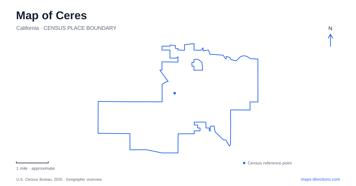
Street tiles load from OpenStreetMap when opened. The blue line shows the 2025 Census boundary.
- State
- California
- Population · July 2025
- 48,982
- Land area
- 9.5 sq mi
- Water area
- 0.0 sq mi
Ceres occupies part of the central San Joaquin Valley, where agricultural land, railway history, and later highway development have shaped the town. The Tuolumne River forms part of its northern boundary, while numbered downtown streets give the historic center a compact framework. Whitmore Avenue, Hatch Road, and the public spaces around Fifth Street provide useful reference lines. A local map becomes more informative when those street names are connected with the people and land uses behind them.
An agricultural name and a later charter
The municipal centennial history credits Elma J. Carter with choosing the name in 1871 for her father’s granary and warehouses near the railway depot. Its association with the Roman goddess of agriculture was appropriate for a settlement whose economy depended on the surrounding fields. That naming history connects the town’s identity with both farming and the movement of harvested goods.
Incorporation came much later, on February 25, 1918. The difference between settlement, naming, and municipal government matters when interpreting historic dates on local buildings. A nineteenth-century house can predate the city charter without belonging to a different community. The surviving historical places document several stages of growth rather than one founding moment.
Two Whitmore residences on Fifth Street
Daniel C. Whitmore’s home stands at 2928 Fifth Street. The city dates it to 1870 and records its restoration with the local historical society. This comparatively early residence is a physical link to the family associated with the settlement’s development.
The Whitmore Mansion is a separate property at 2732 Fifth Street, built by Daniel’s son Clinton in 1903. The shared family name can make the two buildings easy to confuse in search results, but they represent different generations and addresses. A map of Ceres should preserve that distinction instead of reducing both to a single historical-house marker.
The municipal downtown plan identifies Fifth Street as a historic corridor, with the old water tower nearby on Sixth Street. It describes Second and Third Streets as a civic concentration and Fourth Street as the intended commercial heart. These planning categories offer a useful way to read the center, although proposed landscaping or redevelopment in a plan should not be assumed to exist simply because it appears in a drawing.
From large holdings to smaller farms
The agricultural landscape changed as irrigation and rail transport supported more intensive cultivation. The city’s environmental history describes the division of the Whitmore Ranch into smaller tracts, including Smyrna Park in 1903 and several subsequent colonies. Lots that had once belonged to extensive holdings became smaller agricultural properties supporting orchards and other crops.
The Smyrna name has a specific farming association: the tract was promoted for cultivation of Smyrna, or Calimyrna, figs. This gives a familiar park name a deeper local meaning. It also helps explain why the present street and neighborhood map retains traces of agricultural subdivisions beneath later residential development.
The same historical account identifies the 1968 modernization of State Route 99 as a major disruption to the old business district. That highway change helps explain why modern commercial activity cannot be interpreted solely through the original town center. The urban map records both gradual subdivision and a substantial transport intervention.
Public gathering places with separate addresses
The community and event center at 2701 Fourth Street contains assembly, conference, and meeting rooms as well as an outdoor courtyard. It provides a contemporary civic destination within the numbered-street area. The American Legion Memorial Building is another event venue at 2609 Lawrence Street, with an assembly room and additional gathering spaces.
The booking office for the latter is at the community center, which creates a practical address distinction. An event guest and someone arranging the rental may need different buildings. Within Ceres, these venues are close enough in the civic landscape to be related, but their street addresses should remain separate in a meeting plan.
Recreation on neighborhood ground and river terraces
Smyrna Park lies at Moffett and Fowler roads. Its recreation features include the Costa fields, a skate park, volleyball facilities, a rose garden, and walking space. The mix supports ordinary neighborhood recreation in a setting whose name reaches back to the agricultural tract.
River Bluff Regional Park, reached from Hatch Road, presents a different landform. Its seventy-six acres include sports fields and an observation deck overlooking the lower terrace. The city identifies that lower ground as floodplain, an important distinction from the upper recreation area. The view reveals how river processes remain relevant beside developed neighborhoods.
These two park settings, the numbered downtown streets, and the distinct Whitmore residences give Ceres several scales of interpretation. Following those local relationships reveals more than a route through the highway corridor: a map of Ceres also records agricultural subdivision, civic gathering, family history, and the edge of the river landscape.
Map and statistics: U.S. Census Bureau, 2025 Gazetteer, January 2025 generalized place boundaries and Vintage 2025 population estimates. Local references: City of Ceres. Article prepared by Maps & Directions.