Map of Centennial
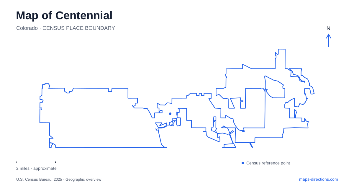
Street tiles load from OpenStreetMap when opened. The blue line shows the 2025 Census boundary.
- State
- Colorado
- Population · July 2025
- 108,658
- Land area
- 30.2 sq mi
- Water area
- 0.1 sq mi
Centennial is a relatively young municipality layered over established suburban neighborhoods and employment districts. It became a city in February 2001, so its map does not revolve around a single nineteenth-century town square. Arapahoe Road supplies an important east-west reference, while Interstate 25 and Parker Road distinguish broad portions of the community. Municipal planning, recreation districts, and regional transportation each describe the area somewhat differently. Reading them together helps explain why civic buildings, shopping districts, rail access, and neighborhood parks are spread across several recognizable centers.
Arapahoe Road as the organizing line
The city's comprehensive-plan background describes a broad three-part pattern: predominantly residential areas west of Interstate 25 and east of South Parker Road, with a concentration of business and entertainment uses between them. It identifies Arapahoe Road as the route extending across the city's long east-west span. This is a useful first reading of Centennial because it relates land use to two major north-south corridors rather than assuming every destination sits close to the municipal offices.
The pattern is a planning description, not a rule that every block follows. Individual neighborhoods and commercial pockets require a closer street view. Still, Arapahoe Road provides a consistent reference when comparing places on opposite sides of Interstate 25. Names such as University Boulevard, Peoria Street, Jordan Road, and Parker Road become more informative when understood as crossings or connections within that larger corridor.
A civic center and a deliberately designed park
The Civic Center stands at 13133 East Arapahoe Road, in a building the city purchased in 2008. The adjacent park opened in 2012, creating a public gathering place beside the administrative offices. Centennial Center Park now occupies approximately 15 acres and uses a separate visitor address at 13050 East Peakview Avenue. These two addresses describe neighboring parts of a civic cluster, with the park approached through the surrounding street network.
The park's design incorporates local and regional interpretation. Its main plaza includes information about the Cherry Creek Basin and a watershed map, while a Statehood Walk presents Colorado history. An amphitheater, lawns, shelters, and playground spaces support different kinds of gatherings within the grounds. The result is a civic landscape built to give an established suburban area a shared public place.
Access is also affected by a specific road project. The city reports restrictions on left turns and north-south through movements at Revere Parkway during construction of the Lone Tree Creek Trail underpass at Arapahoe Road. Peoria, Vaughn, and Potomac streets are identified as alternative approaches to the road's north side. That project concerns a particular crossing near the park, rather than a closure of the entire east-west corridor.
The rail corridor and a future mixed-use center
Midtown planning covers an area from Yosemite Street to Havana Street and from Arapahoe Road to County Line Road. Dry Creek Light Rail Station, Interstate 25, and the nearby airport are major reference points in this planning geography. The city describes the district as historically dominated by office parks and commercial spaces, with a long-term aim of creating a more walkable mixture of uses.
For a map of Centennial, the distinction between the existing district and the future vision matters. A planning-area label does not mean a finished, continuous downtown already occupies every block. The District, formerly called the Jones District, is one identifiable component west of Interstate 25 between IKEA and Dry Creek station. That location provides a concrete anchor within the larger Midtown area. Streets, station access, and existing buildings remain the most useful references while redevelopment proceeds over time.
Western recreation and service boundaries
South Suburban Park and Recreation District serves the portion of the city west of Interstate 25 along with several neighboring communities. Its facilities therefore belong to a regional system whose boundary differs from the municipal boundary. Goodson Recreation Center at 6315 South University Boulevard provides a specific western recreation anchor. The district also lists Heritage Village Park at 5000 East Fair Drive and Holly Park Tennis Center at 6652 South Krameria Way, revealing several distinct neighborhood destinations.
The South Suburban Sports Complex uses 4810 East County Line Road and contains ice sheets, indoor turf fields, and gymnasiums. It is a specialized regional sports facility rather than another full-service recreation center like Goodson. This distinction helps interpret similar organizational names on a map. Arapahoe Road, the civic cluster, the Dry Creek planning area, and the western recreation network together explain Centennial as a connected municipality with multiple centers and overlapping service geographies.
Map and statistics: U.S. Census Bureau, 2025 Gazetteer, January 2025 generalized place boundaries and Vintage 2025 population estimates. Local references: City of Centennial; South Suburban Park and Recreation District. Article prepared by Maps & Directions.