Map of Celina
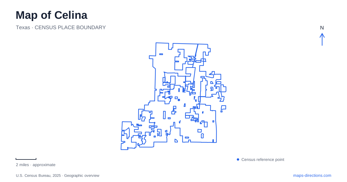
Street tiles load from OpenStreetMap when opened. The blue line shows the 2025 Census boundary.
- State
- Texas
- Population · July 2025
- 64,427
- Land area
- 49.1 sq mi
- Water area
- 0.5 sq mi
Celina is often discussed in terms of new neighborhoods, but its most distinctive map feature is the older downtown square. Its form reflects a farming and railroad economy that predates the current expansion of the Dallas region. The historic center, nearby small parks and larger recreation sites serve different purposes. Understanding how the town moved, where its businesses gathered and which park projects remain under development produces a more useful picture than treating every labeled destination as part of one continuous downtown.
A town that moved toward the tracks
The railway did not simply arrive in the middle of the original settlement. Residents moved their town toward the St. Louis, San Francisco and Texas Railway, changing its geographic focus. The Texas Historical Commission's account of the Nelson Hotel dates that relocation to 1902. Municipal incorporation followed in 1907. These are separate milestones: moving buildings and activity toward the transport corridor came before formal city government.
The downtown square took shape in 1911 under J. Fred Smith, associated with the local mill and elevator company. The city's arts and culture history describes a three-sided square and the graveling of its streets. Wheat handling and other agricultural businesses helped support the surrounding commercial district. Celina's older center is therefore better understood as a place organized around trade and transportation than as a conventional courthouse square. Its particular shape is part of that story, rather than an irregularity to ignore on a street map.
The hotel building tells a layered story
The Nelson Hotel marker at 222 West Walnut Street identifies a building whose original use was different from its later name. Richard Tinsley Peterman constructed it in 1914, with a grocery business downstairs and rental space above. Charlie Spergon Nelson bought the property in 1922; his family occupied the lower floor while railroad travelers stayed upstairs. The hotel continued under family ownership until 1976.
That sequence makes the building a useful record of changing downtown needs. A single structure accommodated retail, housing and lodging at different stages. In Celina, the railroad-era story is not limited to rails or grain facilities: it also appears in the everyday buildings that served people passing through. The marker explains historic use; it should not be interpreted as a promise that a working hotel still occupies the property.
Local memory on West Pecan Street
The area heritage association's visitor center and museum occupies 211 West Pecan Street. Its collections and presentations provide a more personal scale than the broad municipal history, including the community's attachment to Bobcat football. This is a local-history destination within the established commercial area, not a large regional museum campus outside town.
The city's trail-planning history also records the former Black school east of the square. It describes the school's closure in 1965 following integration and the preservation of its location through a marker and surviving approach walkway. That place adds an essential dimension to the downtown story: the commercial center and its celebrated institutions existed alongside segregated education. Reading historic sites together can reveal those differences rather than presenting development as a single uncomplicated timeline.
Two established parks with different roles
Founders Station Park is one block east of the square, at 135 North Louisiana Drive. Its compact setting includes courts, a small playground and a gazebo. The relationship to downtown is its main geographic advantage: it belongs to the same close street pattern as the older shops and public gathering places.
Old Celina Park, at 12670 FM 428, has a different role. Its playing fields, multipurpose areas, fishing pond and walking trails accommodate organized recreation on a broader site. The parks department gives scheduled municipal leagues priority over general use of the open playing areas. An apparent empty field on a map is therefore not necessarily available for an unscheduled game. Likewise, the department's administrative offices on West Maple Street are separate from the sports venue; an office address is not the correct destination for a field assignment.
Reading construction plans as plans
Wilson Creek Park's development plans distinguish a roughly 30-acre first phase from an eventual park of nearly 100 acres near Sunset Boulevard and Roseland Parkway. The city marked its groundbreaking in September 2025. That milestone belongs to the site's history, while the phase boundaries help explain project maps. Consult the city's park information for available entrances and facilities rather than using the ultimate planned acreage as the size of an accessible recreation area.
Those dates describe progress and expectations, not proof that every proposed amenity is open. Celina's map combines surviving historic places with a fast-changing network of streets, public buildings and parks. The square and its documented buildings supply stable reference points; new project names require more attention to phase and status. Keeping that distinction clear allows the town's older identity and its current growth to be understood together.
Map and statistics: U.S. Census Bureau, 2025 Gazetteer, January 2025 generalized place boundaries and Vintage 2025 population estimates. Local references: City of Celina; Texas Historical Commission; Celina Area Heritage Association. Article prepared by Maps & Directions.