Map of Cedar Hill
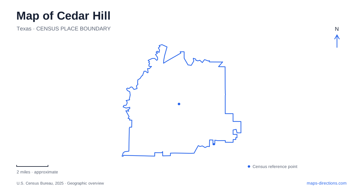
Street tiles load from OpenStreetMap when opened. The blue line shows the 2025 Census boundary.
- State
- Texas
- Population · July 2025
- 49,801
- Land area
- 35.8 sq mi
- Water area
- 0.1 sq mi
Cedar Hill combines an old town center with a notably varied landscape of limestone hills, woodland, prairie remnants, and reservoir shoreline. The historic square gives one starting point, while FM 1382 links several major outdoor destinations. Joe Pool Lake occupies a different scale again, with access managed by more than one jurisdiction. A useful map should show these relationships clearly: downtown is a compact historical district, the escarpment supports several preserves, and the lake has separate parks around its shores.
The square and the older street pattern
The city traces its settlement to 1846 and the donation of land for the town square to 1847. The formal plat followed in 1871. Those stages explain why the square has a history predating the recorded layout: community activity and land division did not happen in one instant. The surrounding streets have long accommodated government, business, and gatherings.
The city's historic-preservation description gives practical boundaries for the old center. West Belt Line Road is on the north, Highway 67 on the east, and the southern extent runs near Cooper and Broad. The district also extends west beyond the railway tracks toward the lake. These limits are useful when interpreting references to Old Town, Historic Downtown, or simply Downtown; all describe the same general area rather than different centers within Cedar Hill.
FM 1382 links several outdoor landscapes
The Balcones Trail runs for about three miles along FM 1382 from New Clark Road to the city limits. Dedicated in 2022, it connects the state park, Cedar Mountain Preserve, and Dogwood Canyon Audubon Center. Its role is to connect destinations along the road corridor, while the trails inside each destination offer different terrain and experiences.
This distinction helps make sense of the green area on a map. The named preserves are adjacent or connected, but their internal paths do not all lead to the same places. A paved corridor beside FM 1382 serves a different purpose from a soft-surface hill loop or a route descending into a canyon. Choosing between them begins with the landscape one wants to explore, not simply the nearest patch of green.
Cedar Mountain and Dogwood Canyon
Cedar Mountain Preserve occupies 123 acres, with parking shared with the Audubon center at 1206 FM 1382. Dallas County describes both a short paved loop and a longer soft-surface loop crossing a hill. The county attributes the area's unusual elevation changes to the White Rock Escarpment and its Austin Chalk geology. That is a useful explanation for terrain that differs from the flatter image many visitors have of the Dallas area.
Dogwood Canyon is named for its flowering dogwood grove. Its trails can provide views of Joe Pool Lake, but Audubon explicitly states that none reaches the lake itself. This is a concrete geographical distinction for a visit to Cedar Hill: a viewpoint over the reservoir is not a shoreline access route. The preserve's trails operate with the center's opening schedule, while the adjoining Balcones corridor has a separate function as a connecting multi-use path.
The state park faces the reservoir
Cedar Hill State Park occupies the eastern side of Joe Pool Lake, with its entrance at 1570 West FM 1382. The state acquired the park land in 1982 and opened the park in 1991. Across the reservoir, Grand Prairie operates other parks, so a general search for lake recreation can produce destinations on very different shores.
The state park's trail information describes a meeting of tallgrass prairie and rugged limestone terrain. It includes the short Penn Farm route, a shoreline route, and longer DORBA loops used by hikers and cyclists. Check access for the named trail you intend to use: DORBA, Talala, Plum Valley, Duck Pond, Penn Farm and Shoreline occupy different parts of the park and may have different maintenance or ground conditions. That distinction is relevant when selecting a particular outing rather than assuming every mapped trail is available.
Penn Farm preserves a working landscape
Penn Farm Agricultural History Center contains historic and reconstructed buildings spanning the nineteenth and twentieth centuries. The Penn family worked this land for more than a century, and the interpretation examines changes in farming as machinery replaced older methods. The buildings therefore represent an evolving farm rather than one moment recreated uniformly across the site.
This agricultural history completes the geographical picture of Cedar Hill. The square recalls settlement and commerce, the escarpment explains the hill and canyon habitats, and the reservoir reshaped the broader water landscape. Penn Farm keeps the intervening story of cultivation visible within the state park. Reading these places together gives a visitor several ways to explore the city while understanding why each destination occupies its particular setting.
Map and statistics: U.S. Census Bureau, 2025 Gazetteer, January 2025 generalized place boundaries and Vintage 2025 population estimates. Local references: City of Cedar Hill; Dallas County; Audubon; Texas Parks and Wildlife. Article prepared by Maps & Directions.