Map of Cedar Falls
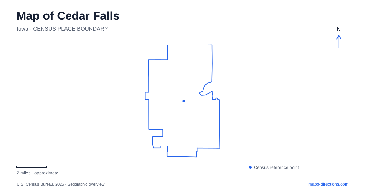
Street tiles load from OpenStreetMap when opened. The blue line shows the 2025 Census boundary.
- State
- Iowa
- Population · July 2025
- 41,240
- Land area
- 29.5 sq mi
- Water area
- 0.8 sq mi
Cedar Falls has two important organizing landscapes: the older town beside the Cedar River and the university area farther south. Public parks help explain the first, while the history of the University of Northern Iowa explains the second. Between and beyond them, trails connect neighborhoods with a wider recreation network shared with Waterloo. Reading those relationships gives the map more depth than treating downtown, campus, and nearby lakes as one continuous destination.
The courthouse square that became a park
Overman Park occupies a full block at Third and Clay streets, near downtown in the Vintage Home District. The city identifies it as its earliest documented park, acquired in 1853. John Overman donated the property for a Black Hawk County courthouse, and it was initially known as Court House Square.
That intended use helps explain its central position and block-sized shape. The county seat moved to Waterloo after an 1855 referendum, but the donated square remained an important local space. Its present facilities include the municipal bandshell, a shelter, benches, and a pioneer cabin replica. Civic history is therefore embedded in the layout even though the planned county-government role did not endure.
The streets around the park also make it a useful starting point for understanding Cedar Falls at a neighborhood scale. The city offers historical walking and cycling material for the Overman area as well as North Cedar, Cedar Heights, Lawn City, and Seerley Park. Those separate studies show that the community's built history extends beyond the commercial blocks of Main Street.
Riverfront recreation on Center Street
Island Park provides a much larger public landscape along the Cedar River. The city acquired it in 1922, and its park guide describes it, together with Tourist Park, as part of the northern approach to downtown. Earlier attractions included animals, a carousel, and a small train, showing how the riverfront has long been used for leisure even as the facilities changed.
The current park inventory includes boat ramps, picnic shelters, a playground, a nine-hole disc golf course, and access to the Cedar Valley Lakes trail system. The Beach House is a separate gathering facility within the park, with its address listed as 218 Center Street. The broader park guide also uses a Center Street location farther along the road, which reflects the extent of the grounds rather than a wholly different park.
This setting illustrates a recurring feature of the riverfront: several activities occupy a large shared landscape. The trail connection, boat access, and gathering building are individual destinations within it. A map focused on the river and Center Street makes their relationship easier to understand than a view centered only on the park's name.
A campus with a different beginning
The University of Northern Iowa adds a separate historical center to Cedar Falls. University archives explain that its original campus was the site of the Iowa Soldiers' Orphans' Home, established for children of Civil War soldiers and sailors. Local residents donated the original forty-acre property for that purpose.
The archives describe its approximate boundaries as Twenty-third Street to the north, College Street to the east, the former course of Twenty-seventh Street to the south, and a line through the area of the present Campanile to the west. Those reference points give a concrete sense of how much smaller the original institutional grounds were than the university landscape visible today.
In 1876, the state consolidated the orphans' home operation in Davenport and transferred the local campus to the new Iowa State Normal School. The modern university therefore grew from both a change in institutional purpose and an established site. Its history is distinct from the courthouse-square and riverfront stories downtown.
Four lakes in the neighboring state park
George Wyth State Park sits between Cedar Falls and Waterloo, with its official entrance address on Wyth Road in Waterloo. It connects with the regional trail network and contains both paved routes and soft-surface trails. That makes it part of the broader outdoor geography while retaining its own park boundaries and approach.
Its four lakes have different identities. Fisher Lake is a natural oxbow of the Cedar River. George Wyth Lake has the swimming beach and accessible fishing facilities, while Brinker Lake and Alice Wyth Lake are separately named waters within the same park. Locating the intended lake matters because the recreational features are distributed rather than concentrated at one shoreline.
A wider map of Cedar Falls can therefore be read as several related but distinct settings: the old civic square, the riverfront recreation grounds, the university campus, and a neighboring state park connected by trails. Each grew from different circumstances, and those origins help explain the arrangement of destinations that visitors encounter today.
Map and statistics: U.S. Census Bureau, 2025 Gazetteer, January 2025 generalized place boundaries and Vintage 2025 population estimates. Local references: City of Cedar Falls; University of Northern Iowa; Iowa Department of Natural Resources. Article prepared by Maps & Directions.