Map of Castle Rock
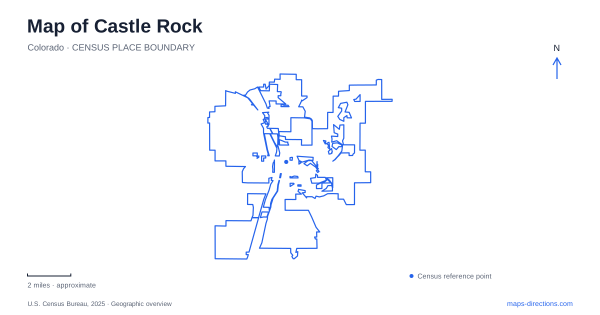
Street tiles load from OpenStreetMap when opened. The blue line shows the 2025 Census boundary.
- State
- Colorado
- Population · July 2025
- 83,815
- Land area
- 34.7 sq mi
- Water area
- 0.0 sq mi
Castle Rock takes its name from a landmark that also helps explain the town's geography. The rock stands north of the historic downtown, while Interstate 25, railway lines, creek corridors and rolling open spaces create other strong organizing features. A map of the town is most useful when these different systems are visible together. The small downtown street grid, the climb at Rock Park and the extensive trails west of the center each require a different sense of scale.
Downtown sits between major linear boundaries
The town's downtown parking map generally covers the area between Interstate 25 on the west, the railroad tracks on the east, Eighth Street on the north and Phelps Street on the south. These boundaries provide a compact frame for understanding the central district. Wilcox and Perry streets are useful local references within it, with numbered cross streets helping to locate individual blocks.
For a Castle Rock visit centered on downtown, begin with this bounded area rather than the town's much wider developed footprint. The highway and railroad are not just background lines; they help explain why the historic center has a recognizable shape. A destination on one of the central blocks can be understood in relation to its cross street and its position between those larger corridors.
Festival Park adds a creek-side public space to this street pattern. The town describes it as an activity center with a lawn and picnic opportunities beside the creek. Its parking guidance identifies the Wilcox Street bridge over Sellars Gulch just west of the park. That combination of bridge, watercourse and gathering space gives the southern part of downtown a different character from a continuous row of commercial blocks.
Rock Park locates the namesake landform
Rock Park is listed at 1710 Front Street. The town's parks guide describes its trails as native-surface single track and classifies the outing as difficult. The landmark's location north of downtown makes it an obvious orientation feature, but its visibility should not be confused with effortless access to its higher ground.
A Castle Rock street map tells you how to reach Front Street; a trail map explains the climb beyond the arrival area. The distinction is geographical rather than merely recreational. A prominent rock can dominate views from a district while remaining a separate terrain-based destination. When pairing downtown exploration with a visit to the landmark, treat the walk on commercial streets and the trail outing as two different kinds of movement.
Philip S. Miller Park spreads across hills and facilities
Philip S. Miller Park is at 1375 West Plum Creek Parkway. Its grounds include the Miller Activity Complex, Millhouse, amphitheater, playground, trails and Challenge Hill staircase. The town identifies Challenge Hill as a 200-step climb rising 178 feet. This is a useful example of why a large park symbol hides substantial internal variation.
Within this part of Castle Rock, an event at the amphitheater and a climb on Challenge Hill share a park name without being the same destination. Use the facility names to understand the grounds. The activity complex and event buildings organize one kind of visit; the native-surface loops organize another. The park's map shows a landscape of connected recreation areas, not a single uninterrupted lawn.
The terrain also gives distance a different meaning here than downtown. A short line between two hillside points can involve climbing, while a longer paved route may follow a gentler alignment. Select the mapped facility or trail loop that fits the outing instead of judging solely by its apparent distance from the park's main label.
The western trail connection uses a specific overpass
The official park trail map identifies a connection to Ridgeline Open Space and the Stewart Trail network using the Wolfensberger Road pedestrian overpass. It also places the Ridgeline trailhead parking lot on Coachline Road. These details turn two neighboring open-space labels into an understandable route relationship.
The overpass is especially useful as a map reference because it explains how the trail systems cross the road between them. Coachline Road describes another way to approach the western network. Someone starting at Philip S. Miller Park and someone arriving at the Ridgeline trailhead can explore connected terrain while beginning from different sides of that system.
A planned creek connection is not an existing shortcut
The town's Industrial Tributary Trail plans describe a connection from the western park area toward East Plum Creek Trail and downtown. The proposed alignment passes under Prairie Hawk Drive and the BNSF railroad, illustrating an alternative to the Plum Creek Parkway and Interstate 25 interchange. Consult the town's trail guidance for available sections rather than treating the entire line in a development drawing as an open route.
This proposal illustrates a real gap in the travel network. It should be read as an explanation of intended connectivity, not assumed to be an available route. A useful Castle Rock map distinguishes completed overpasses and trails from planned links. Together, the downtown boundaries, Front Street landmark access, hillside park facilities and named trail crossings provide a concrete framework for understanding the town.
Map and statistics: U.S. Census Bureau, 2025 Gazetteer, January 2025 generalized place boundaries and Vintage 2025 population estimates. Local references: Town of Castle Rock. Article prepared by Maps & Directions.