Map of Casper
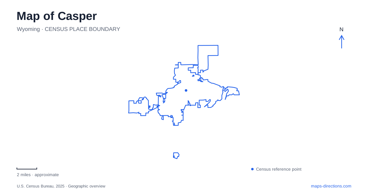
Street tiles load from OpenStreetMap when opened. The blue line shows the 2025 Census boundary.
- State
- Wyoming
- Population · July 2025
- 58,771
- Land area
- 26.8 sq mi
- Water area
- 0.3 sq mi
Casper's geography begins with the North Platte River, a corridor that shaped both historic travel and present-day recreation. The river's bends link a modern trail system with places interpreting emigrant routes and military history. South of the city, rising ground introduces another landscape at Garden Creek Falls and Rotary Park. A useful map shows these environments together while preserving their different histories, surfaces, and changes in elevation.
Following the river through the community
The Platte River Trail is a paved route following the North Platte through the urban area. The local visitor bureau describes approximately eleven miles of river-following trail, with interpretive signs, mile markers, wildlife information, and public art. Those features give the path a role beyond exercise: it also helps visitors read the landscape through which they are moving.
The river's meandering shape means that progress along the trail is not equivalent to following a straight city street. Views change as the path follows the water, and the relationship between the riverbank and nearby development shifts along the way. This is one of the most revealing ways to experience Casper at a slower pace, particularly for someone who first encountered the city from an interstate exit.
The trail organization identifies the Tate Pumphouse and the Caspar underpass among its local reference points. Such names help break a long corridor into recognizable stretches. They also reflect the mixture of infrastructure, history, and recreation along the river, rather than presenting the path as an isolated strip of scenery.
A crossing explains the fort's location
Fort Caspar occupies a major historic river-crossing site. The spelling differs from the city's name, and it is worth preserving when identifying the museum. The crossing was part of the Oregon, Mormon Pioneer, California, Pony Express, and transcontinental telegraph corridor, placing the site within several overlapping systems of movement and communication.
The reconstructed buildings date from a 1936 project undertaken by the Works Progress Administration and the city. They were rebuilt near their original locations using a plan drawn by Lieutenant Caspar Collins. The museum explains that the reconstruction represents Platte Bridge Station rather than the later expanded fort.
A replica Mormon ferry and a reconstructed section of the Guinard bridge make the practical problem of crossing the North Platte visible. The first commercial ferry operation here began in 1847, while Louis Guinard established his toll bridge and trading post in 1859–60. For a history-focused visit to Casper, these structures turn an abstract trail line on a map into a concrete question: how did travelers, animals, and equipment get across the water?
North Poplar Street and the larger trail story
The National Historic Trails Interpretive Center is at 1501 North Poplar Street. The Bureau of Land Management's directions approach it from Interstate 25 exit 189, continuing north on Poplar. This puts the center on a readily identifiable road approach rather than requiring visitors to trace an old emigrant route to reach a modern museum.
Its exhibits address the Oregon, California, Mormon Pioneer, and Pony Express trails. The interpretation includes emigrant experiences and the consequences of westward expansion for Indigenous peoples whose homelands the routes crossed. That broader framing complements the specific crossing infrastructure at Fort Caspar.
The two institutions therefore answer different questions. At the fort, geography concentrates attention on a river crossing and the buildings associated with it. At the interpretive center, the story expands to long journeys and the people affected by them. Seeing both gives a map of Casper historical depth without reducing the region's past to a single migration story.
Garden Creek rises into mountain terrain
Rotary Park and Garden Creek Falls are reached from Garden Creek Road at the mountain's base south of the city. Picnic sites, viewing platforms, and trail connections follow a setting that is substantially steeper than the river corridor. A waterfall visit can remain focused on the lower park, while longer routes continue upward through the surrounding terrain.
The county's 2025 trail map distinguishes the Waterfall Loop, West Loop, East-West Connector, and Geology Viewing Trail. A geology interpretation project installed that year adds signs on the climb from Rotary Bridge toward the highest waterfall viewing platform. These labels help distinguish a short look at the falls from a longer hill walk.
Around Casper, the change from the North Platte to Garden Creek is thus more than a change of destination. One landscape follows a broad historic travel corridor; the other draws attention to a confined creek, exposed rock, and elevation. Reading both on the map explains why a paved river outing and a mountain-base hike require different expectations, even when they form parts of the same day.
Map and statistics: U.S. Census Bureau, 2025 Gazetteer, January 2025 generalized place boundaries and Vintage 2025 population estimates. Local references: Visit Casper; Platte River Trails Trust; City of Casper; Bureau of Land Management; Natrona County. Article prepared by Maps & Directions.