Map of Casa Grande
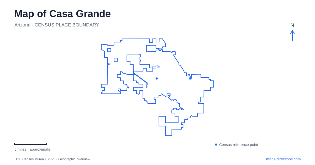
Street tiles load from OpenStreetMap when opened. The blue line shows the 2025 Census boundary.
- State
- Arizona
- Population · July 2025
- 69,753
- Land area
- 114.2 sq mi
- Water area
- 0.0 sq mi
Casa Grande has a downtown history of preserved buildings and commercial signs, a mountain trail landscape, and a name shared with a much older archaeological site elsewhere. Those three subjects are easily mixed together in a search result. On a map, however, they describe distinct destinations and different periods of human activity in the Sonoran Desert. Understanding the distinction is a useful starting point for exploring the city and its surrounding region.
The famous ruins are in Coolidge
Casa Grande Ruins National Monument is located in Coolidge, with its visitor address on West Ruins Drive. It preserves an Ancestral Sonoran Desert farming community and the Great House, built around 1350. The National Park Service connects the site to a wider network of irrigation canals and trading communities. The surviving structure's precise purpose remains uncertain, so confident claims that it was exclusively a palace, fortress, or observatory go beyond what the park establishes.
This geographical clarification changes an itinerary immediately. The monument is a regional archaeological excursion, while the downtown museum and sign park belong to the modern city's historical center. A search for the ruins should therefore retain “Coolidge” in the destination details. The shared name links the regional story, but it does not place an ancient compound among the downtown commercial blocks.
Florence Boulevard and the historical museum
The Museum of Casa Grande stands at 110 West Florence Boulevard. Its collections cover mining, agriculture, railroads, settlement, and technological change, allowing the valley's development to be considered through several connected industries. Photographs and archival materials complement the historic properties on the grounds. This is an appropriate starting point for someone interested in how a working desert community developed, rather than only in its most photogenic surviving landmarks.
One of those properties is the former Stone Church, a 1927 building designed by Robert Orr and built by stonemason Michael Sullivan. Congregation members gathered the fieldstone used in its walls. The city's history walk records later use as a mortuary before acquisition by the historical society in 1977 and the museum's opening in 1978. That sequence makes the building an example of changing civic use, with material continuity beneath several different institutional identities.
A relocated classroom with a local story
The Rebecca Dallis Schoolhouse adds a different history to the museum grounds. The wooden one-room building dates to 1934 and originally served a segregated school on South Florence Street. Rebecca Dallis began teaching there in 1939, continuing until a larger segregated school opened in 1952. The building reached its present museum location in 1983.
Its relocation is important when interpreting a historical map. The current museum address shows where the classroom is preserved, while South Florence Street identifies the community setting in which it originally functioned. Preserving both locations in the story avoids turning an educational landmark into a detached architectural curiosity. It also makes clear that local agricultural growth and the arrival of African American workers and families shaped institutions as well as fields and businesses.
Commercial memory on Sacaton Street
The Neon Sign Park at 408 North Sacaton Street offers another way to read downtown. Operated by the local Main Street nonprofit, it collects restored commercial signs in a dedicated public setting. This puts objects once associated with individual businesses into a common interpretive landscape. A displayed sign can consequently document a business without identifying that business's original building immediately behind it.
Casa Grande's downtown attractions reward this distinction between preserved objects and original sites. The museum campus brings historical structures and collections together; the sign park concentrates visual fragments of commercial life. Both help explain the city, but each assembles its evidence differently. Florence Boulevard and Sacaton Street provide useful address anchors for these two forms of preservation.
Trails beyond the downtown blocks
The mountain trail system developed through public planning and volunteer work. The city obtained National Park Service assistance for a trails master plan in 2004, and the first volunteer-built trail followed in April 2010. Municipal information now describes more than 17 miles of established, marked routes. Hiking, mountain biking, and equestrian use belong to this landscape; motor vehicles do not belong on the trail system.
The Arica Road approach leaves Interstate 10 at Sunland Gin Road, then heads west along Arica beyond Lamb Road and the end of the pavement. That change from highway to local road to unpaved approach is a concrete feature of access, not merely a change in map color. Downtown heritage and mountain recreation therefore require different kinds of preparation. Seen together, they give Casa Grande a map story that extends from reused civic buildings and relocated artifacts to an actively developed desert trail network.
Map and statistics: U.S. Census Bureau, 2025 Gazetteer, January 2025 generalized place boundaries and Vintage 2025 population estimates. Local references: National Park Service; Casa Grande Valley Historical Society; City of Casa Grande; Casa Grande Main Street. Article prepared by Maps & Directions.