Map of Cary
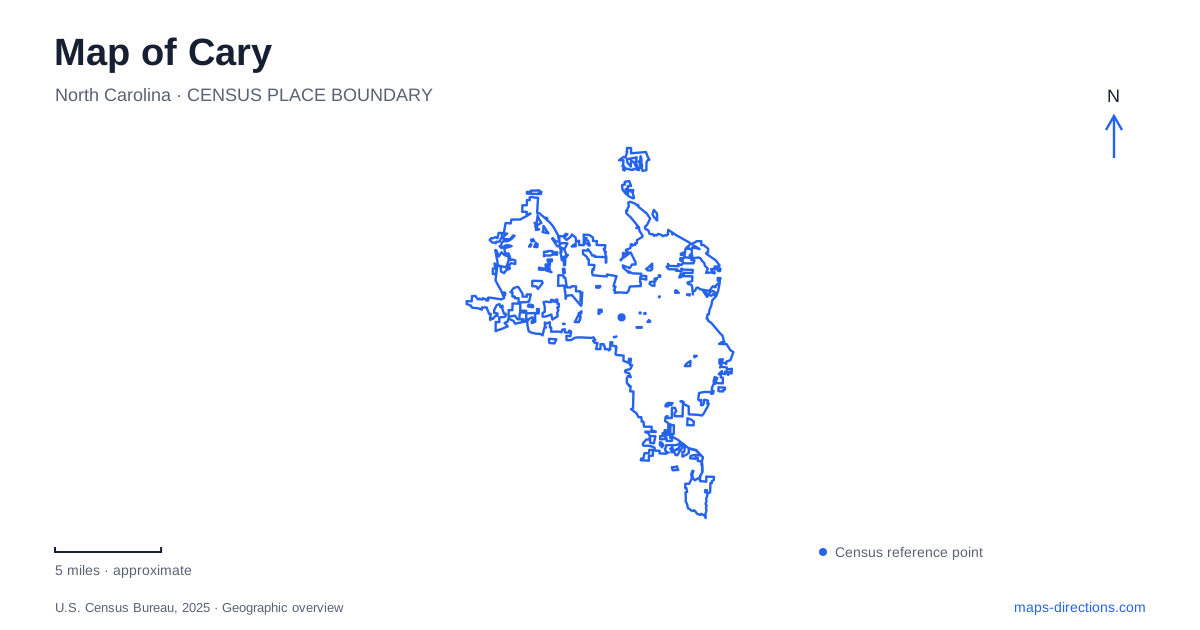
Street tiles load from OpenStreetMap when opened. The blue line shows the 2025 Census boundary.
- State
- North Carolina
- Population · July 2025
- 183,582
- Land area
- 61.1 sq mi
- Water area
- 1.1 sq mi
Cary is easier to understand through the relationship between its railway heritage and its streamside open spaces than through a single suburban label. The historic center contains a former railroad hotel and a public urban park, while larger recreation areas follow lakes, creeks, and wooded slopes. These places tell different stories about the town's growth. A useful map keeps the compact downtown streets visible while also showing the longer greenway connections beyond them. That combination explains how a former rail stop became a place with both an active civic center and extensive outdoor destinations.
The railway hotel and the civic campus
The Page-Walker Hotel at 119 Ambassador Loop provides a concrete starting point for the older landscape. Frank Page built it in 1868 to accommodate railroad passengers; the railway itself had arrived in 1854. Its Second Empire architecture belongs to the period when rail travel shaped local commerce and settlement. Page sold the property to the Walker family in 1884, giving the building the paired name it retains today.
The building subsequently served as a boarding house, apartments, and a private home before restoration in the 1990s established its current cultural role. Today the Page-Walker Arts and History Center sits within the Town Hall campus. Galleries, classrooms, and the heritage museum occupy a structure originally designed for overnight travelers. The neighboring Page Smokehouse and Anne B. Kratzer Educational Garden extend the historical interpretation beyond the hotel walls.
For a map of Cary, this is more than an isolated museum symbol. It connects the railway-era economy with the modern civic campus, giving downtown an identifiable historical anchor. The building's survival also lets visitors compare a nineteenth-century passenger-oriented landmark with the public spaces created much later around the center.
Seven acres within four streets
Downtown Park occupies seven acres bounded by Academy, Walker, Park, and Walnut streets. Those four boundaries make its extent unusually easy to read on a street map: it is an urban landscape embedded in the downtown blocks rather than an outlying recreation tract. The initial approximately one-acre phase opened in 2017, followed by the larger completed park in 2023.
Its design distributes activities among several named areas. The Skywalk, the Nest play space, the Great Lawn Pavilion, Gathering House, and Park Street Courts serve different purposes within the same compact footprint. Gardens and gathering spaces make the park useful for more than scheduled performances or children's play. Its street edges also explain how it can be incorporated into a downtown walk without treating the entire visit as a separate excursion.
This newer public landscape gives Cary a second downtown reference point alongside the older hotel campus. The contrast is useful: one preserves a building associated with railroad travel, while the other reorganizes several acres around everyday public activity. Keeping both visible produces a fuller picture of the center than either landmark alone.
Bond Park and the connected landscape
Fred G. Bond Metro Park operates at a markedly different scale. Its 310 acres make it one of Wake County's largest municipal parks. The lake and surrounding land were proposed for county recreation in 1970, and municipal responsibility followed in 1974. That history helps explain why the park feels like a substantial landscape within the developed town rather than simply a neighborhood recreation lot.
Bond Park also matters because paths extend its influence beyond its own boundary. White Oak Creek Greenway connects the park with Davis Drive Park, Ed Yerha Park, and the American Tobacco Trail. Black Creek Greenway is another listed connection. A map that displays only roads misses this recreational framework, which links separate parks along corridors that do not necessarily follow the driving network.
The town's greenway planning describes wooded stream corridors and floodplains as important settings for these routes. It also identifies gaps in overall connectivity. Consequently, the existence of several connected destinations does not establish an uninterrupted path between every park or downtown street. For a longer outing through Cary, the useful distinction is between an established greenway segment and a proposed connection shown on a planning map.
A woodland shaped by unusual conditions
Hemlock Bluffs introduces a third kind of public landscape. Along Swift Creek, north-facing bluffs rise as much as 80 feet within a preserve of roughly 140 acres. The protected community includes eastern hemlocks and other plants more commonly associated with mountain environments. Its significance rests in this unusual combination of landform and vegetation, not in a large lawn or a concentration of athletic facilities.
Approximately three miles of mulched nature trails and scenic overlooks provide access to the woodland. The Stevens Nature Center adds educational exhibits about nature and the Piedmont's history. State and municipal cooperation underlies the preserve's management, reflecting its conservation and educational purposes.
These distinct settings give Cary a legible local geography: the railway hotel explains an earlier center, the seven-acre downtown park represents a contemporary civic investment, Bond Park anchors wider recreation connections, and the bluffs protect an exceptional natural community. Reading those places together reveals why the town's outdoor spaces vary so much in scale, surface, and purpose.
Map and statistics: U.S. Census Bureau, 2025 Gazetteer, January 2025 generalized place boundaries and Vintage 2025 population estimates. Local references: Town of Cary; North Carolina Office of Environmental Education. Article prepared by Maps & Directions.