Map of Carmel
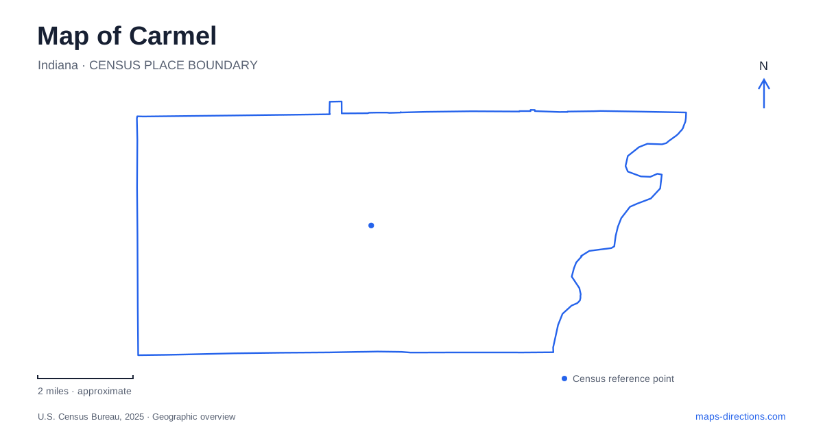
Street tiles load from OpenStreetMap when opened. The blue line shows the 2025 Census boundary.
- State
- Indiana
- Population · July 2025
- 105,634
- Land area
- 49.1 sq mi
- Water area
- 1.1 sq mi
Carmel has a particularly useful organizing line for a visitor's map: the Monon Greenway. The former railway corridor passes through several distinct urban settings before reaching larger recreation grounds. Main Street, Midtown, City Center Drive, and Central Park each relate to that line in a different way. Range Line Road provides another important reference through the central districts. Reading the greenway alongside these streets reveals how galleries, public plazas, theaters, and park trails form a connected geography without turning every destination into the same kind of downtown experience.
The old center at Main and Range Line
The Arts & Design District is anchored around Main Street and Range Line Road. It occupies the historic Old Town area, with galleries, shops, dining, and design businesses. Its present identity developed through deliberate revitalization beginning in the early 2000s, rather than through the preservation of an entirely unchanged commercial center.
Life-size bronze figures by Seward Johnson are among the district's recognizable public-art features. They give the sidewalks a series of individual points of interest, useful when exploring the area at walking pace. The Indiana Design Center, at 200 South Range Line Road, adds a larger showroom destination south of Main.
This part of Carmel is therefore best understood at two scales. Main and Range Line identify the district's broad location; the individual galleries, sculptures, and showroom addresses explain how a visit unfolds within it. The Monon runs through the district as a separate north–south route, allowing the older commercial streets to connect with newer public spaces farther along the corridor.
Midtown as the intervening district
Midtown Plaza, at 365 Monon Boulevard, occupies a former industrial area between the Arts & Design District and City Center. Its position is central to understanding the arrangement of these districts. Midtown is an intervening urban space with its own businesses and residences, rather than simply another name for the Main Street area.
The plaza includes shared seating, shaded areas, public entertainment space, and places for informal games. That combination gives the Monon corridor a place to stop as well as a route to follow. It also reflects the change from a working industrial strip to a public-facing district organized around recreation, homes, and commerce.
For Carmel, the old rail alignment is consequently more than a recreational conversion. It helps join successive episodes of urban development. The parks department describes the local greenway as running between 96th and 146th streets, with connections into the longer regional trail. Those numbered streets establish its wider extent, while Main, Midtown, and City Center give the central portion recognizable destinations.
Carter Green's separate performance buildings
Near City Center Drive, Carter Green organizes the performing-arts campus. The Palladium uses the address 1 Carter Green. Across the green, the James Building contains the Tarkington and Studio Theater at 4 Carter Green. The open space therefore sits between performance buildings with separate identities and entrances.
The Palladium itself has several approaches. Its west lobby faces 3rd Avenue SW and contains the box office; the east lobby has an entrance from the Monon Greenway. The south lobby is nearest the center's parking garage across Carter Green. These relationships explain the campus more clearly than a single theater symbol on a map.
Carmel's concert and theater geography is especially suited to a pedestrian-scale view. Carter Green, the Monon, and the different lobbies form a small network within the larger City Center district. Someone arriving along the trail encounters a different side of the Palladium from someone approaching the west box office, even though both are entering the same building.
Recreation farther south
Central Park occupies 159 acres between 116th Street, 111th Street, College Avenue, and Westfield Boulevard. The Monon runs through its center. The park combines the Monon Community Center and Waterpark with trails through prairie, wetlands, and woods, making it a substantial landscape beyond the central plazas.
Westermeier Commons occupies the western portion, where Dillon Woods connects with the greenway. On the east side, trails follow the creek. This internal geography matters: the community facilities and the quieter landscape routes occupy different parts of the same park, with the through-trail providing a common reference.
Another designed landscape sits by City Hall: the Kawachinagano Japanese Garden, reflecting the sister-city relationship with Japan. The garden's redesign reopened in spring 2026; expansion plans toward the southern retention pond form a separate part of its development history. In Carmel, this garden adds a cultural landscape to the sequence of civic and recreation spaces. Its evolving grounds, Central Park's ecosystems, and Midtown's public plaza demonstrate three very different uses of open space along the city's central area.
Map and statistics: U.S. Census Bureau, 2025 Gazetteer, January 2025 generalized place boundaries and Vintage 2025 population estimates. Local references: City of Carmel; Carmel Clay Parks and Recreation; Allied Solutions Center for the Performing Arts. Article prepared by Maps & Directions.