Map of Carlsbad
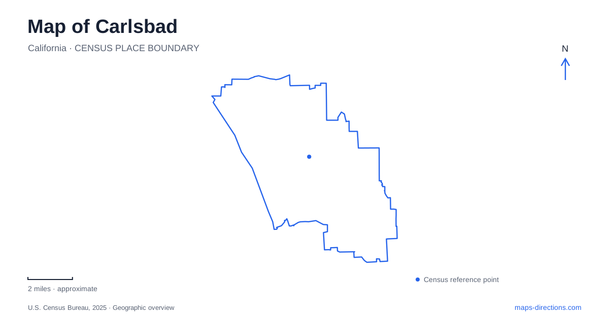
Street tiles load from OpenStreetMap when opened. The blue line shows the 2025 Census boundary.
- State
- California
- Population · July 2025
- 112,260
- Land area
- 37.8 sq mi
- Water area
- 1.3 sq mi
Carlsbad stretches from an oceanfront village and coastal rail corridor to inland neighborhoods and a preserved ranch landscape. Three lagoons interrupt the coastal pattern, creating habitats, recreation areas, and distinct approaches to the water. The result is more varied than a simple strip of beach beside Interstate 5. A useful map shows the two rail stations, the separate beach areas, the lagoon access points, and the inland ranch as destinations with different geographical relationships.
Village and Poinsettia rail arrivals
The Village station is at 2775 State Street, while Poinsettia station uses 6511 Avenida Encinas. Both appear in the North County Transit District's COASTER station directory, but they serve different parts of the city. The Village station sits within the village setting, approximately a quarter mile from the ocean. Poinsettia provides another coastal arrival farther south.
These addresses give a rail-based visit two different starting points. State Street places a visitor within the older village's street network, while Avenida Encinas points toward the southern coastal area. Comparing the destination with the station address is more useful than choosing solely by the city name displayed on the rail map. A trip combining the village and southern beaches may involve two distinct parts of the coastal corridor.
Tamarack and the southern state beach
Carlsbad State Beach is associated with the Tamarack Avenue approach and the beach below the coastal bluffs. The state identifies its location on Carlsbad Boulevard at Tamarack. The boulevard, bluff, and beach form three different levels or spaces to recognize on a close map: the road above, the access routes, and the sand below.
Parking access can change with coastal conditions. At Tamarack, distinguish the day-use vehicle lot from pedestrian and bicycle approaches to the beach. Check the state park's access notice before selecting that lot as a driving destination, especially after erosion or storm damage. The beach's place on the map remains stable even when a particular arrival point is restricted.
South Carlsbad State Beach is a separate unit farther along the coast, with campground and day-use areas. The state's coastal guide describes an approach from Interstate 5 via Palomar Airport Road, continuing south along the coastal highway. Its Ponto day-use area lies south of the campground. The different park names and access areas matter when choosing between a beach outing and an overnight camping destination.
Three lagoons with different visitor settings
Buena Vista, Agua Hedionda, and Batiquitos form the city's principal lagoon landscapes. Agua Hedionda has three connected basins divided by Interstate 5 and the railway bridge. Those crossings visibly shape the water on a map. The city permits certain boating and paddle activities there, subject to its permit arrangements, making it a different kind of lagoon destination from a purely land-based wildlife walk.
Batiquitos has shoreline, marsh, and riparian forest habitats. The state ecological reserve's published trail approach uses Gabbiano Lane, south of Batiquitos Drive. From Interstate 5, its directions follow Poinsettia Lane east, then Batiquitos Drive south to Gabbiano Lane. The trail access is at the end of that residential street. This gives a lagoon walk a definite landward approach rather than an arbitrary point along the water's edge.
Buena Vista's nature center belongs to the neighboring Oceanside side of the lagoon, at 2202 South Coast Highway. Operated by Buena Vista Audubon, it includes wildlife displays, a viewing deck, and a short nature trail. The lagoon may be part of a city-focused outing, but the center's Oceanside address is correct. It is a useful example of a natural landscape extending across the municipal geography used by street searches.
An inland ranch preserved from a much larger property
Leo Carrillo Ranch Historic Park is at 6200 Flying Leo Carrillo Lane. Actor Leo Carrillo built its adobe and wood structures between 1937 and 1940 as a retreat and working ranch. The original property covered 2,538 acres; the present historic park preserves a much smaller 27-acre setting. That difference helps explain why the buildings feel like the center of a larger rural landscape even within today's developed city.
The visitor center occupies the barn and provides exhibits, a film, and orientation. Earthen paths, paved surfaces, stairs, and uneven terrain are all part of the grounds. This is a different walking environment from the village streets or the coastal promenade.
A map of Carlsbad becomes more informative when these environments remain distinct: rail arrivals in the coastal corridor, bluff-top beach approaches, lagoon trails reached from specific streets, and the inland ranch compound. Together they show how transport, wetlands, and earlier land uses shape movement through the city.
Map and statistics: U.S. Census Bureau, 2025 Gazetteer, January 2025 generalized place boundaries and Vintage 2025 population estimates. Local references: North County Transit District; California State Parks; City of Carlsbad; California Department of Fish and Wildlife; Buena Vista Audubon; California Office of Historic Preservation. Article prepared by Maps & Directions.