Map of Cape Coral
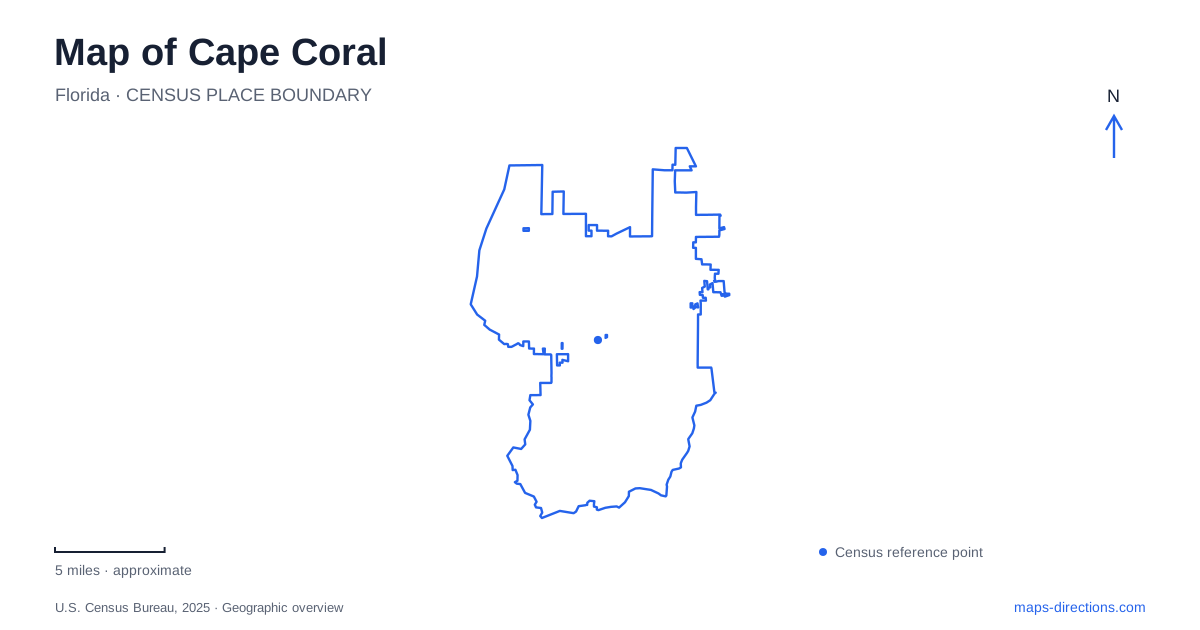
Street tiles load from OpenStreetMap when opened. The blue line shows the 2025 Census boundary.
- State
- Florida
- Population · July 2025
- 236,264
- Land area
- 106.3 sq mi
- Water area
- 13.4 sq mi
A map of Cape Coral reveals two interwoven networks: streets serving residential blocks and canals cutting long fingers of water through them. The broad Caloosahatchee River gives the eastern side a different shape from the narrower waterways toward Matlacha. Between those edges, the repeated blocks reflect a deliberately constructed community rather than a town that simply expanded outward from an old courthouse square. Reading the water alongside the roads explains both the unusual subdivision pattern and the importance of the river bridges.
How the canal landscape was made
The city's waterfront living guide traces the modern development to Jack and Leonard Rosen, who founded their enterprise here in 1957. Construction began the following year. Dredges excavated canals, and the removed material raised the adjoining building land. More than 160 miles of canals had been completed by 1963. The resulting pattern therefore records an enormous earthmoving project: the land and water portions of a neighborhood were shaped together.
Today, Cape Coral has more than 400 miles of waterways. These are not solely decorative backyards or recreational routes. The Public Works Department describes their role in carrying stormwater, managing water levels and protecting nearby estuaries. Freshwater canals also store irrigation water, with weirs and other structures controlling the system. A continuous-looking blue line on a small map consequently does not establish an uninterrupted boat passage. Freshwater storage and tidal boating water have different functions within the same urban landscape.
Crossing the Caloosahatchee
The first Cape Coral Bridge opened in 1964, materially changing the relationship between the developing peninsula and Fort Myers across the river. Its position toward the southern end remains a useful historical reference: the canal community was already being built before this direct connection existed. Aerial imagery makes the distinction between the broad river crossing and the many small neighborhood canals particularly clear.
Farther north, the Midpoint Memorial Bridge opened in October 1997. Lee County identifies it as a 1.25-mile shore-to-shore crossing linking Veterans Parkway on the west with Colonial Boulevard on the east. It carries two traffic lanes in each direction. These roads form a cross-river corridor, while the bridge's location beside Four Mile Cove places a substantial wetland preserve close to a major transportation approach. On a regional map, the two bridges provide separate reference lines through the southern and middle portions of the developed area.
Four Mile Cove's brackish edge
Four Mile Cove Ecological Preserve occupies 365 acres just north of Veterans Parkway. Its municipal address is 2589 SE 24th Street. Brackish wetlands distinguish this area from the excavated freshwater canals farther inland: this is a landscape shaped by the meeting of fresh and salt water, with a walking route and observation points intended to bring visitors into that environment.
The city describes a 6,600-foot trail system and two observation piers, along with a visitor center and a veterans memorial near the southern parking area. These features give the preserve several purposes within one site, combining habitat observation with a place of remembrance. Boardwalks and riverfront facilities are exposed to hurricane damage, so check the preserve's access guidance for the particular trail or pier you intend to use. The preserve's geography remains especially useful for understanding where the urban blocks give way to the river margin.
Rotary Park and Glover Bight
In southern Cape Coral, Rotary Park presents another meeting of developed land and coastal habitat. The environmental center's grounds include native and butterfly gardens, ponds and nature trails. Its rugged trail passes through upland areas and salt marsh; the city notes that sections can be underwater periodically. That changing ground condition is part of the site's character, rather than evidence that every trail shown on a map offers an identical walking surface.
Glover Bight has a separate, roughly three-tenths-mile accessible boardwalk at 5720 Rose Garden Road. It provides a different way to approach the wetland setting from the rugged nature trail. The city's notices identify both observation towers as closed pending repairs, a distinction that matters when choosing which parts of the park to explore. Gardens, marsh trails and a boardwalk belong to the same wider environmental destination but reveal different aspects of the coast.
The western paddling perspective
Sirenia Vista adds a western reference point to a map of Cape Coral. The eight-acre park is associated with manatee viewing, fishing, walking and a kayak launch. Its paddling connection leads toward Matlacha and the Great Calusa Blueway, shifting attention away from the Caloosahatchee bridge corridors to the waters on the opposite side of the peninsula.
Taken together, these places reveal more than a uniform canal grid. The excavated residential waterways, large river crossings, brackish preserve and western paddling access each belong to a different scale of the landscape. Keeping those scales visible makes the city's unusual shape easier to understand.
Map and statistics: U.S. Census Bureau, 2025 Gazetteer, January 2025 generalized place boundaries and Vintage 2025 population estimates. Local references: City of Cape Coral; Lee County. Article prepared by Maps & Directions.