Map of Campbell
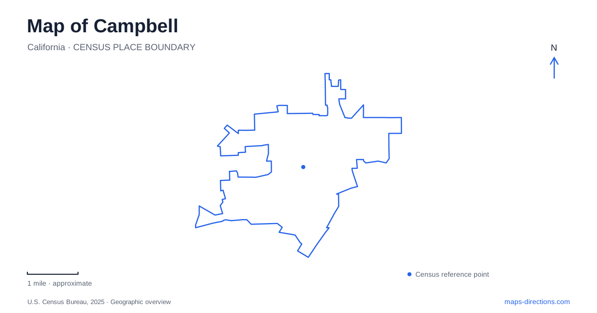
Street tiles load from OpenStreetMap when opened. The blue line shows the 2025 Census boundary.
- State
- California
- Population · July 2025
- 42,490
- Land area
- 6.1 sq mi
- Water area
- 0.0 sq mi
Campbell preserves the outline of an agricultural shipping town inside the much larger developed landscape of the Santa Clara Valley. Its downtown, water tower and historic houses make more sense when read together with the former railway economy. The Los Gatos Creek Trail adds a second line through the city, following water rather than the commercial street pattern. These two organizing features give a map useful depth: one explains where the town grew, while the other connects its open spaces to neighboring communities.
Orchards behind the downtown street pattern
The city's founding land purchase covered 160 acres in 1851, initially planted with hay and grain. That property later became the historic downtown core. An acre was sold to the railroad in 1878, and by 1887 a subdivision had been recorded west of the tracks, extending toward the location of today's Water Tower Plaza. Fruit shipping subsequently made the railway an important economic focus.
Drying grounds and canneries required space for processing as well as transport. The local fruit growers' cooperative had a 17-acre drying yard, while Ainsley, Hyde and Payne operated major canneries. This history explains why Orchard City Drive is a particularly apt local street name. The agricultural city was more than surrounding farmland: production, packing, storage and shipment were part of the urban landscape itself. Looking at downtown through that sequence brings industrial activity into a streetscape now more readily associated with shops and dining.
The tower and small reminders underfoot
At Orchard City Drive and South First Street, Hyde Park occupies the original water-company site. Its historical markers identify a 1928 elevated steel tank and a 1927 pump station. The park was dedicated in 1995 as a gift from San Jose Water Company. The tower's prominent outline consequently refers to an actual utility landscape, rather than being a decorative structure added to create a historic atmosphere.
Agricultural heritage plaques provide another way to read central Campbell. Installed during the 1992 downtown streetscape project, they depict fruits and blossoms associated with the orchard economy. Examples represent cherries, almonds, pears, prunes and apricots. These small markers shift attention from a broad identity such as “orchard town” to the variety of crops that sustained it. The combination of a visible water tower and pavement-level fruit imagery lets large infrastructure and everyday details tell parts of the same story.
A house that changed its position
The Ainsley House and Carriage House now belong to the civic landscape at Orchard City Green, but they did not originate there. Their earlier site was at the northeast corner of Hamilton and Bascom avenues. The buildings were donated by the owner's granddaughters, Geraldine Hicks and Georgene Bowen, and moved in November 1990. Their dedication at the new location followed in September 1994.
This relocation matters when comparing old and modern maps of Campbell. The present house location shows a preservation decision, not the original arrangement of the family's property. Its relationship to the civic center was created through that move. A visitor can appreciate the preserved architecture while also recognizing that the surrounding urban setting has changed. The building is evidence of local history, but its current position tells a second story about how that history was brought into public view.
School grounds become community grounds
The Heritage Theatre occupies a former high school auditorium built in 1938 with federal Works Progress Administration support. Architect William H. Weeks used Spanish Colonial Revival forms, including arched windows and decorative tile. The school closed in 1980, and the city acquired the campus in 1985 for community use. The theatre's restoration adapted the auditorium for public performance while adding the spaces needed by a modern venue.
The surrounding community center illustrates the same reuse at a larger scale. Former educational grounds now support recreation classes and facility rentals. This creates a substantial civic destination within Campbell that has a different origin from the downtown commercial blocks. Reading it as a former campus explains its collection of buildings and outdoor facilities more effectively than imagining it as a single-purpose recreation building.
Following the creek beyond the center
The Los Gatos Creek Trail extends from San Jose south through this city and onward through Los Gatos. Management is divided among several agencies. Locally, the city maintains the stretch from the Bascom Avenue undercrossing to Los Gatos Creek County Park. Its section includes about three miles of paved walkway and a two-mile fitness-course loop.
The creek route supplies continuity across municipal lines while the historical downtown concentrates attention on a smaller area. Together they make Campbell legible at two scales: a recognizable former fruit-processing town and one part of a larger valley corridor. Comparing the civic center, tower, relocated house and creek trail reveals how surviving structures, reused land and natural drainage continue to organize a place whose original agricultural economy has largely disappeared.
Map and statistics: U.S. Census Bureau, 2025 Gazetteer, January 2025 generalized place boundaries and Vintage 2025 population estimates. Local references: City of Campbell; Heritage Theatre / City of Campbell; Campbell Museums. Article prepared by Maps & Directions.