Map of Camden
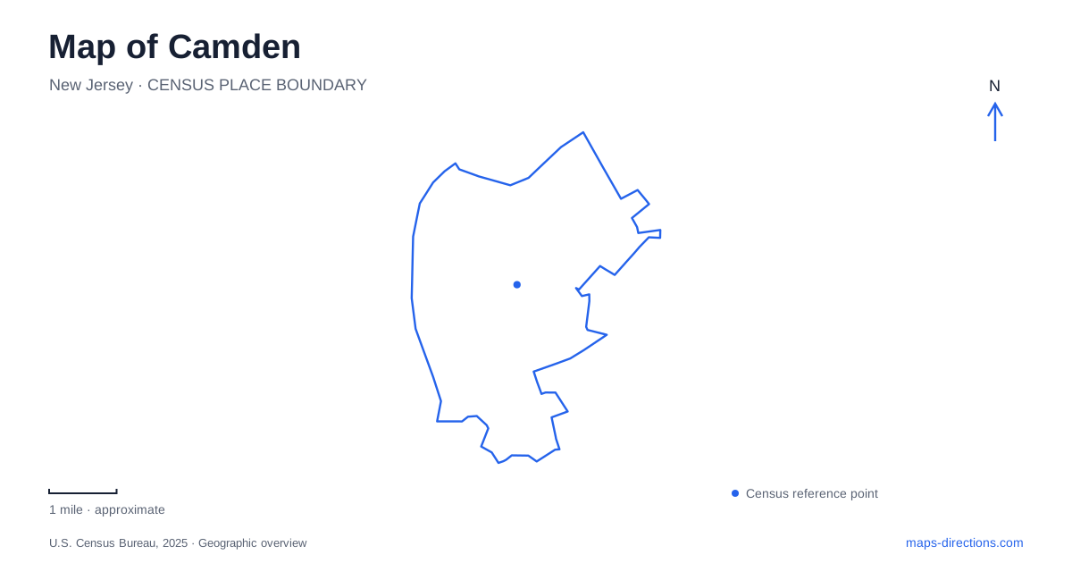
Street tiles load from OpenStreetMap when opened. The blue line shows the 2025 Census boundary.
- State
- New Jersey
- Population · July 2025
- 71,430
- Land area
- 8.9 sq mi
- Water area
- 1.5 sq mi
Camden faces Philadelphia across the Delaware River, and that relationship runs through its transportation history and present visitor landscape. Ferry landings once organized movement between the two shores. Today, a bridge, rail connections, waterfront attractions, and a marina give the same river edge several different roles. A useful map should keep the Delaware visible while also showing the streets behind it, where literary history and older crossing routes add depth to an outing focused on the waterfront.
Ferry streets and the mouth of the Cooper River
William Cooper established his Pyne Point estate where the Cooper River enters the Delaware. His family's ferry operations became an important part of the settlement's relationship with Philadelphia. The city's historical interpretation places an early ferry at the foot of present-day Cooper Street, making that street more than a convenient route toward the water.
The historical record also gives the ferry landscape a difficult dimension. Markers at former landings acknowledge sales of enslaved people at the Cooper Street Ferry, Federal Street Ferry, and Cooper's Point Ferry. Their locations include Cooper and Front Streets, Federal Street and Jersey Joe Walcott Boulevard, and Cooper's Poynt Park. Reading these sites together reveals how commercial movement across the river included both ordinary travel and the exploitation of people.
For a Camden history walk, the landing sites provide a geographically coherent set of references. They connect street names to activities once concentrated at the shore, while preventing the river's past from being reduced to a picturesque story of boats and crossings.
Wiggins Park between major waterfront destinations
Wiggins Waterfront Park sits at Riverside Drive and Martin Luther King Boulevard. Its promenade and Riverstage place walking and performance beside the Delaware. The marina lies across from Philadelphia's Penn's Landing, south of Adventure Aquarium and north of the waterfront amphitheater. These relationships make the park a useful organizing space between larger attractions.
The marina adds a working boating function to an area many visitors encounter on foot. The county identifies fifty slips and seasonal operation, with both longer stays and transient dockage available. A map of Camden's waterfront therefore shows more than a row of museums and entertainment venues: it includes a place where boats arrive, people gather outdoors, and routes along the river connect individual destinations.
Using Wiggins Park as a geographic reference also makes the opposite shore easier to interpret. Penn's Landing is visually and historically related to this riverfront, but the water between them remains a substantial part of any actual journey across the region.
A battleship with a specific land approach
Battleship New Jersey gives its site address as 62 Battleship Place, but its visitor directions use 100 Clinton Street for the ship and parking approach. A separate garage is listed at 10 Delaware Avenue. This distinction is especially useful because the vessel itself sits on the water while the arrival sequence begins on land.
The operator's route from the Benjamin Franklin Bridge uses Sixth Street, Cooper Street, Delaware Avenue, and Clinton Street. Approaches from Interstate 676 use Martin Luther King Boulevard. These streets provide a practical framework for locating the museum within the wider waterfront, rather than following the ship's outline as though it were an ordinary building surrounded by city blocks. A Camden driving plan focused on the battleship should use the operator's arrival address to connect the regional road network with the final approach.
Rail along the Delaware corridor
The River LINE links the city with Trenton along a thirty-four-mile corridor. NJ TRANSIT identifies it as a route to the aquarium, battleship, amphitheater, and children's garden. Aquarium station is listed at 2 Delaware Avenue, giving a clear street reference within the waterfront district.
The line also connects at Pennsauken Transit Center with the Atlantic City Rail Line. That relationship can broaden a visit beyond a simple drive to the riverfront, especially for travelers arriving through another rail corridor. The local waterfront stops and the regional connections serve different purposes on the map: one helps distribute visitors among nearby places, while the other links the district to a much larger journey.
Whitman's house and the scale of ordinary life
The Walt Whitman House offers a quieter counterpart to the large waterfront attractions. Whitman purchased the modest six-room home in 1884 and lived there until his death in 1892. During his years in Camden, he continued revising Leaves of Grass and working on other manuscripts.
The state's visitor listing places the house at 328 Mickle Boulevard and describes guided visits. Its collection includes writings, photographs, and memorabilia. The small domestic setting adds something a regional overview cannot show: the scale of everyday rooms associated with a writer of national significance. Including the house alongside the ferry history and waterfront landscape produces a richer reading of the city, with personal life, transportation, and public space all represented.
Map and statistics: U.S. Census Bureau, 2025 Gazetteer, January 2025 generalized place boundaries and Vintage 2025 population estimates. Local references: City of Camden; Camden County; Battleship New Jersey; NJ TRANSIT; New Jersey Historic Trust; New Jersey Division of Travel and Tourism. Article prepared by Maps & Directions.