Map of Camarillo
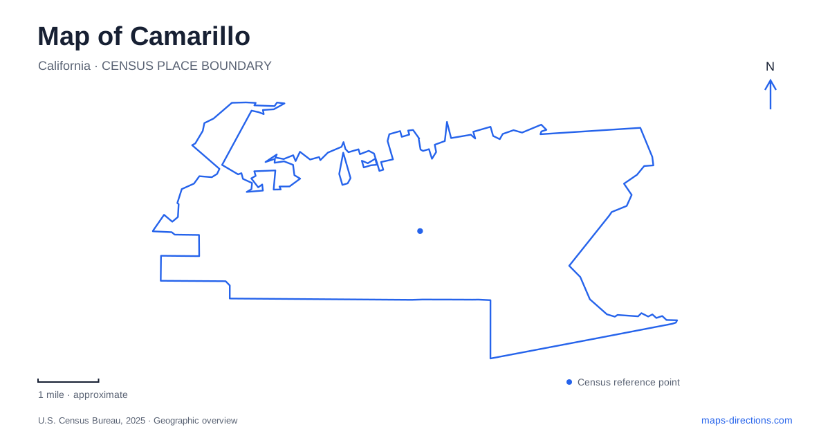
Street tiles load from OpenStreetMap when opened. The blue line shows the 2025 Census boundary.
- State
- California
- Population · July 2025
- 68,652
- Land area
- 19.7 sq mi
- Water area
- 0.0 sq mi
Camarillo is easier to understand as a series of different landscapes than as one long shopping district beside US 101. Old Town follows Ventura Boulevard, the historic ranch recalls a much larger agricultural estate, and the airport preserves another chapter of regional history. At the foothill edge, a park and nature center introduce terrain and habitats that contrast with the valley's commercial streets. These settings provide a practical framework for reading the local map.
Ventura Boulevard and the Old Town streetscape
The local visitor bureau identifies Ventura Boulevard as the spine of Old Town, with shops, restaurants, arts activities, and professional services along it. The district offers a street-oriented experience: its interest comes from the sequence of storefronts and public-facing businesses rather than from a single enclosed attraction. A walk can be organized around the boulevard itself, with particular addresses supplying the individual stops.
That is useful in a city where shopping can also refer to larger commercial complexes. “Old Town” describes this specific local district, not every older-looking building or retail destination along the freeway. Its combination of everyday services and visitor-oriented businesses also means it remains a working part of the community. On a detailed map, the continuous street frontage is the organizing feature to notice.
The ranch links the city to agricultural land
Adolfo Camarillo transformed the family ranch from a primarily cattle-based operation into a diversified agricultural enterprise. The foundation's history lists lima beans, walnuts, barley, citrus, and avocados among its products. It also identifies the former dairy, operated with Joseph Lewis, with the site of present-day Leisure Village. That connection gives a modern residential place-name a specific relationship to the earlier agricultural landscape.
The surviving 1892 Queen Anne Victorian house stands at 201 Camarillo Ranch Road. Its architecture differs markedly from the Spanish or Mediterranean forms often associated with Southern California history. The house and grounds preserve only a focused historical site within what was once a much larger working property. Seeing the ranch as the remnant of an extensive enterprise, rather than an isolated decorative mansion, gives its position among modern development greater meaning.
A former military airfield and an aviation museum
The airport site previously served as Oxnard Air Force Base. The Army Corps of Engineers records that the base became surplus to government needs in 1970 and that Ventura County later obtained the airstrip and surrounding property. The older military name can therefore appear in historical material about this location, even though a contemporary map identifies a civilian airport.
The Commemorative Air Force Southern California Wing museum provides a specific visitor destination at 455 Aviation Drive. Its displays occupy hangars and ramp space, with historic aircraft interpreted by docents. The institution preserves aviation history within an active aviation setting rather than in a detached downtown gallery. For an outing focused on aircraft, that street address is more useful than selecting a general airport marker, which represents a property with many different operational areas and tenants.
The foothill park offers two trail experiences
Camarillo Grove Park contains the park district's nature center. Its address on Camarillo Springs Road places it near the US 101 approach to the foothills. The district's trail description distinguishes a gently sloping lower loop from a more demanding upper route. Oak trees, sage, and volcanic rock formations contribute to the setting, while viewpoints and interpretive signs give the paths an educational purpose as well as an exercise function.
That difference between loops matters more than a single distance label. A short nature-oriented outing can focus on the lower landscape, while the upper trail introduces more elevation change. The park's mapped contours help explain why two routes within the same small property can offer noticeably different experiences. It is a place to read terrain, not just count the number of paths shown.
Outdoor interpretation and scheduled indoor learning
The nature center includes native gardens with Braille signs, a teaching deck, an interactive water table, and nature-based play equipment. These outdoor features support a visit organized around local habitats. The separate Nature Education Building, completed in 2024, holds teaching materials such as fossils, animal specimens, and footprint casts. The district specifies that this building opens during its outdoor programs and scheduled field trips, rather than functioning as a continuously open walk-in museum.
Together, the boulevard, ranch, airport museum, and foothill park give the city several distinct historical and geographical reference points. Agriculture explains the earlier estate, aviation explains the airfield's large footprint, and terrain explains the nature trails. A local map becomes most useful when those differences remain visible within the shared valley setting.
Map and statistics: U.S. Census Bureau, 2025 Gazetteer, January 2025 generalized place boundaries and Vintage 2025 population estimates. Local references: Visit Camarillo; Camarillo Ranch Foundation; US Army Corps of Engineers; Commemorative Air Force Southern California Wing; Pleasant Valley Recreation and Park District. Article prepared by Maps & Directions.