Map of Calexico
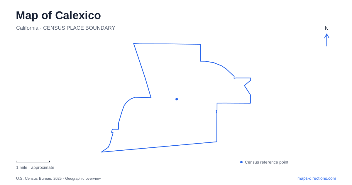
Street tiles load from OpenStreetMap when opened. The blue line shows the 2025 Census boundary.
- State
- California
- Population · July 2025
- 38,623
- Land area
- 8.5 sq mi
- Water area
- 0.0 sq mi
Calexico's map places a compact civic and commercial community beside an international boundary, a major inspection complex and a river whose watershed crosses that boundary. These are related systems, but each has its own geography. A street leading toward Mexico is not an ordinary continuation of the local road network, and a river crossing the border follows physical terrain rather than the arrangement of city blocks. The community began as a surveyors' camp in 1900 during the development of a canal carrying Colorado River water into the Imperial Valley. GSA's historical account links that origin with the first United States customs office in 1902 and the counterpart established across the boundary in Mexicali in 1904. Irrigation, settlement and cross-border administration grew together.
The old customs house at First and Heffernan
The historic customs building stands at East First Street and Heffernan Avenue. Construction began in late 1932, and the building opened in November 1933. Its restrained Spanish Colonial Revival design reflects the federal building program of the Depression era and the use of regional architectural forms.
The building served its original customs function until a nearby replacement opened in 1974. This makes it an important historic reference without making it the correct destination for every present-day inspection activity. The older structure and the modern port belong to different phases of the same border district.
For Calexico, that distinction is visible evidence of changing scale. A preserved civic building represents an earlier way of handling movement; the surrounding inspection infrastructure responds to much larger flows of people and vehicles. Both can appear under a border-station label, but they should not be read as one unchanged facility.
A port rebuilt in phases
GSA's West Land Port of Entry project has replaced and expanded facilities through several phases. The first phase, substantially completed in 2018, included vehicle-inspection lanes, an operations building and a southbound bridge over the New River. Phase 2A reached substantial completion in spring 2024.
The modernization program divides work into separate phases. Phase 2B planning includes pedestrian processing and restoration of the historic customs house, which serve different purposes from vehicle lanes. A completed vehicle crossing therefore does not by itself establish the arrangement of pedestrian facilities or access to the historic building. Use the port authority's traveler information for the specific crossing you intend to make.
This matters when comparing an older aerial image with a project rendering. One shows a recorded arrangement of roads and buildings; the other may include facilities still under construction or planned. For an actual border trip, the named port and current approach instructions are more useful than a generic city-center destination. Pedestrian and vehicle movements need to be treated separately.
A university block within the civic center
SDSU Imperial Valley's local campus is at 720 Heber Avenue, between Sherman and Seventh streets. The university describes an eight-acre city block whose buildings surround the Rollie Carrillo Quad. The library, Rodney Auditorium and John Steppling Art Gallery give the campus academic and cultural functions beyond classroom space.
Calexico's university presence began in 1959 on the site of the first local high school. This reuse connects education across different periods rather than placing the institution on an entirely new suburban campus. The combination of older and newer structures around a central lawn is part of its current physical character.
The specific Heber Avenue address is important because SDSU has several locations. A university name by itself can return directions to San Diego or to another Imperial Valley facility. Here, the destination is a compact urban campus close to the border, embedded in the local street grid.
The New River flows through a shared watershed
The regional water board explains that the New River's present channel developed during the Colorado River floods of 1905–07. The river crosses from the Mexicali Valley into the United States and continues through Imperial County to the Salton Sea. It belongs to a transboundary watershed that includes agricultural and urban land on both sides.
For Calexico, the river is therefore a connection to a much larger drainage system. It is not a decorative channel whose condition can be understood solely from the nearby blocks. The water board documents urban, industrial and agricultural contributions and a long history of water-quality work.
The Department of Water Resources announced completion of the local New River Improvement Project in 2025. Its design separates polluted flow from a city reach through diversion and bypass infrastructure, with treated water returned through a pump-back system. That is a specific engineering intervention, not proof that every reach of the entire river has been restored or opened for recreation.
Reading boundaries and infrastructure together
The most revealing map of Calexico keeps the civic block, historic customs house, modern port and river corridor distinct. Their proximity explains the city's character, while their different functions explain why an apparently simple short journey may require a carefully chosen entrance or approach.
The sequence of development also matters here. A 1933 landmark, a 1959 educational institution and a river project completed in 2025 represent different layers of the city. Border-modernization plans add another kind of map evidence: a proposed arrangement rather than a historical building. Reading those sources together gives the map substance without confusing heritage, established facilities and construction drawings.
Map and statistics: U.S. Census Bureau, 2025 Gazetteer, January 2025 generalized place boundaries and Vintage 2025 population estimates. Local references: U.S. General Services Administration; San Diego State University; Colorado River Basin Regional Water Quality Control Board; California Department of Water Resources; California Salton Sea Management Program. Article prepared by Maps & Directions.