Map of Caldwell
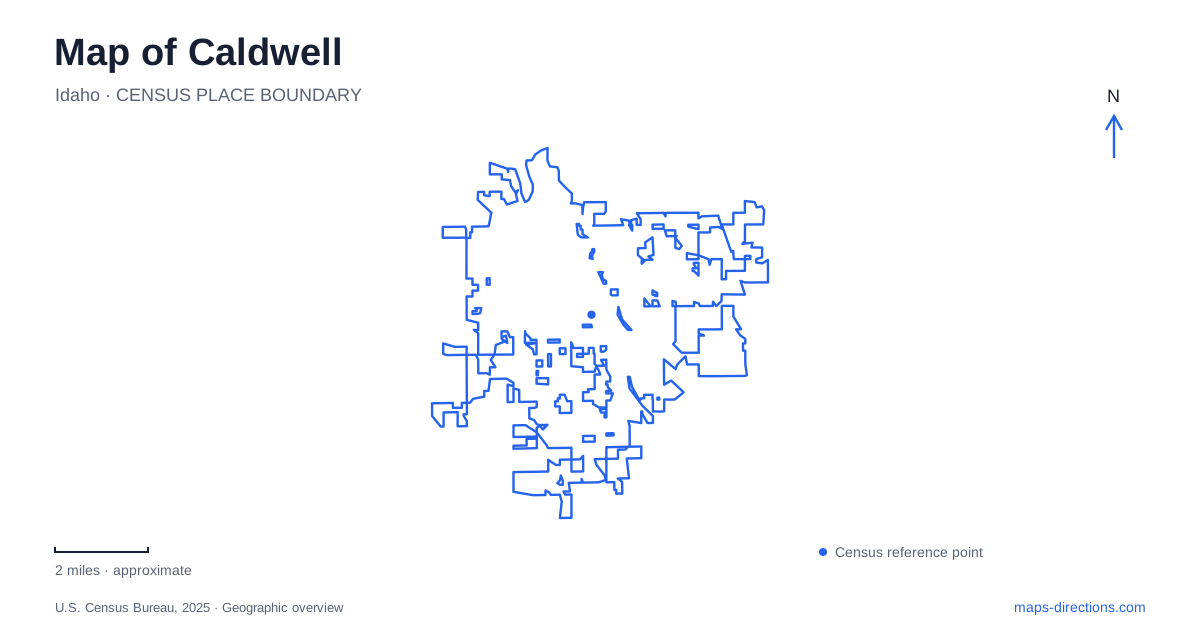
Street tiles load from OpenStreetMap when opened. The blue line shows the 2025 Census boundary.
- State
- Idaho
- Population · July 2025
- 76,629
- Land area
- 25.4 sq mi
- Water area
- 0.1 sq mi
Caldwell developed as a railroad town and agricultural trading center, but its present map also reflects a college campus and a network of waterways. Main Street's depot preserves the transportation story, Indian Creek shapes the downtown public realm, and Chicago Street leads toward parks with fishing and greenbelt access. The College of Idaho introduces another destination cluster along Cleveland Boulevard. These features provide a useful framework for understanding the city beyond a list of individual businesses or attractions.
Main Street and the railroad beginning
The town was founded and platted in 1883 in connection with construction of the Oregon Short Line Railroad. Robert E. Strahorn's development enterprise helped establish the settlement, which later became the Canyon County seat. Irrigation canals and waterways supported the agricultural economy that grew around it. Rail transport and farming were therefore linked parts of the city's development: one moved products and people, while the other made sustained cultivation possible.
The depot at 701 Main Street is a surviving landmark from this broader history. Built in 1906, it later passed to the city and underwent restoration. Its current use includes rented gatherings and special occasions. That change in function preserves a recognizable piece of the railroad landscape while giving the building a role in contemporary downtown life.
For a map of Caldwell, the depot is a useful anchor because its Main Street location connects an older transportation function with the present commercial center. It also offers a way to distinguish historical rail infrastructure from facilities intended for current passenger travel. The building's identity as a depot describes its heritage; today's municipal information presents it as an event venue.
Indian Creek and the downtown plaza
Indian Creek Plaza is at 120 South Kimball Avenue. The city owns the plaza, and Destination Caldwell manages its operations and programming. The open gathering space accommodates events across the year, with ice skating among its established seasonal activities. Its role is different from that of the depot: the plaza organizes outdoor public life, while the depot offers an enclosed historic venue nearby in the downtown street network.
The creek itself has a longer and more complicated relationship with development. Municipal planning records describe how sections were piped and covered in the twentieth century, followed by efforts to reopen the stream and restore its place within the center. This history helps explain why the waterway is significant to downtown planning. It represents a natural corridor that urban development once concealed and later began to treat as an asset.
Future promenade proposals extend that idea toward additional destinations, but proposals should be distinguished from the public spaces already in use. The established plaza and the creek's visible downtown presence can be understood on their own, without treating every line in a redevelopment plan as a completed walking route.
Boone Hall and the college setting
The College of Idaho was founded in 1891 and uses 2112 Cleveland Boulevard as its main address. Within the campus, the Whittenberger Planetarium occupies Boone Hall on the south side of Morrison Quadrangle. The college identifies the parking entrance at Twentieth Avenue and Fillmore Street as the nearest approach. These details locate a particular educational destination within the larger institution.
The planetarium has provided public outreach since 1970 beneath a twenty-four-foot dome. Its live programs interpret the night sky and astronomy rather than simply displaying static exhibits. The Orma J. Smith Museum of Natural History also occupies Boone Hall, in the basement, with collections connected to the wider Intermountain region. Confirm museum visiting arrangements with the college; a collection's presence in an academic building does not establish walk-in access. This college cluster gives Caldwell an educational identity alongside its agricultural and transportation history.
Chicago Street and the river parks
Whittenberger Park occupies 420 West Chicago Street, with a playground, open play space, shelter, and part of the Boise River greenbelt system. Rotary Pond Park lies farther west along Chicago Street at 21235 Chicago Street. Fishing docks and picnic opportunities make the pond a different kind of destination from the campus quadrangle or downtown plaza. An archery area is located slightly west of the pond.
Curtis Park, at 14285 Channel Road, adds another river-oriented setting. The city describes it as a nature retreat along the Boise River with wildlife habitat, footpaths, and a natural spring. Its vehicle gate and reservation arrangements differ from pedestrian access, which the city identifies as available without using the drive-through gate. Taken together, these parks show how Caldwell's outdoor geography extends beyond downtown's creek: the river edge, pond grounds, and neighborhood recreation spaces each offer a distinct way to encounter the local landscape.
Map and statistics: U.S. Census Bureau, 2025 Gazetteer, January 2025 generalized place boundaries and Vintage 2025 population estimates. Local references: City of Caldwell; Idaho Heritage Trust; Indian Creek Plaza / Destination Caldwell; Indian Creek Plaza; College of Idaho; COMPASS regional planning agency. Article prepared by Maps & Directions.