Map of Burien
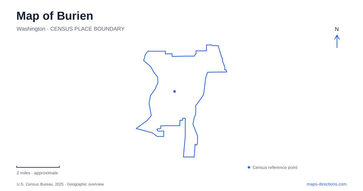
Street tiles load from OpenStreetMap when opened. The blue line shows the 2025 Census boundary.
- State
- Washington
- Population · July 2025
- 51,859
- Land area
- 10.0 sq mi
- Water area
- 1.2 sq mi
Burien combines a compact downtown with wooded slopes descending toward Puget Sound. Its most useful geographical contrast is between the inland street network and the saltwater shoreline. Numbered streets help organize the center, but the western parks follow the shape of ravines, bluffs, and beaches. A map that includes terrain explains why two places near the water may offer very different experiences and why a coastal viewpoint does not always provide a route to the beach below.
The downtown numbered streets
Southwest 152nd Street is a familiar downtown reference, with Town Square Park at 480 Southwest 152nd Street. The street also appears in descriptions of the Olde Burien commercial area. Keeping this east–west corridor visible gives a useful framework for exploring the center's public spaces and nearby businesses. It provides a street-level reference that is more precise than a broad downtown label.
The transit center is at 209 Southwest 148th Street, several numbered blocks north of the Town Square address. King County's boarding map separates its bus bays by service and direction. The relationship between these two streets is useful for someone arriving without a car: the transit center and the public square belong to the same central street network, but they are distinct destinations. The boarding area is a transport interchange, while the square is a place to pause or attend a community event.
Seahurst's forest and saltwater beach
Seahurst Park, also called Ed Munro Park, is reached at 1600 Southwest Seahurst Park Road. It combines a Puget Sound beach with forest, streams, wetlands, picnic areas, and trails. The park's setting changes as one moves between the wooded approach and the open shore. Views toward the Olympic Mountains give the waterfront a regional scale quite different from the enclosed paths above it.
The park was established in 1975, and its shoreline has since undergone substantial restoration. Removing seawall structures and reshaping the beach helped recover habitat important to forage fish and salmon. The larger north-shore project was completed in 2014, with renewed public facilities as well as environmental improvements. The present beach is therefore both a recreation space and the result of deliberate work to restore natural shoreline processes.
This history helps explain why logs, gravel, vegetation, and the beach slope matter to the park's character. They are elements of a living shore rather than obstacles to a formally engineered promenade. A map can show the broad relationship among beach, lower parking, and forest trails, while a visit reveals how water and sediment continue to shape the edge of the land.
Eagle Landing is a bluff destination
Eagle Landing Park offers a contrasting shoreline experience. Its former stairs once connected the wooded hillside with the beach, but erosion damaged the structure and eventually led to its removal. The removal project was completed in January 2024, and the park reopened with trails and viewpoints. There is no longer beach access through this stairway.
That is a consequential distinction for a map of Burien. A coastal park symbol does not necessarily indicate a public descent to the water. At this site, the bluff itself is the landscape to experience, and the maintained route remains above the shoreline. Choosing Seahurst for a beach outing and Eagle Landing for its trail and views reflects the actual geography and infrastructure of the two parks.
A neighborhood park with a school name
Lake Burien School Memorial Park, at 1620 Southwest 149th Street, supplies a different kind of outdoor setting. Its improvements completed in early 2022 included a renewed loop pathway, playground, landscaping, and drainage work. Here, the circulation pattern is a neighborhood park circuit rather than a descent through forest to saltwater. The name preserves a school association, while the present facilities support walking and play.
Comparing the memorial park with the two coastal properties helps clarify the range of local outings. A playground visit and a circuit of the field have different requirements from walking a bluff trail or exploring a tidal beach. The map becomes more useful when those differences guide the choice, instead of treating all green spaces as interchangeable destinations.
From the central streets to the Sound
For a first look around the community, Southwest 152nd Street provides the downtown reference and Seahurst supplies a clear introduction to the waterfront. The transit center establishes a separate arrival point on Southwest 148th Street, while the neighborhood and bluff parks offer alternatives for another outing. Reading streets, elevation, and water together gives Burien a coherent shape: a civic and commercial center connected to a varied landscape of wooded slopes and Puget Sound shore.
Map and statistics: U.S. Census Bureau, 2025 Gazetteer, January 2025 generalized place boundaries and Vintage 2025 population estimates. Local references: City of Burien; King County Metro. Article prepared by Maps & Directions.