Map of Buffalo Grove
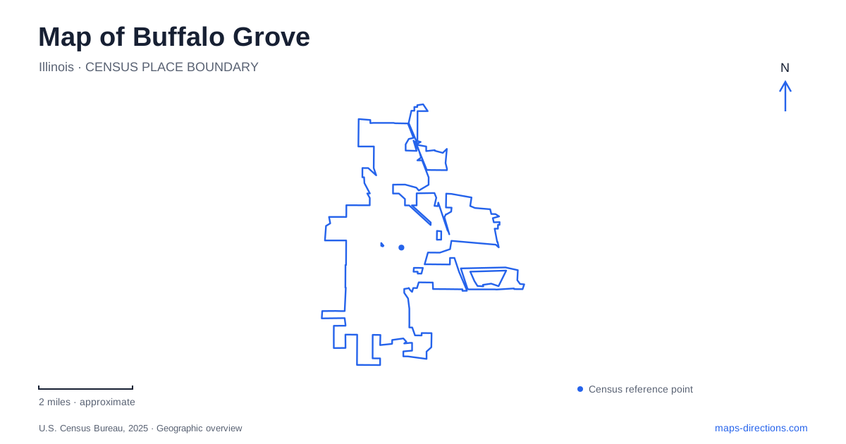
Street tiles load from OpenStreetMap when opened. The blue line shows the 2025 Census boundary.
- State
- Illinois
- Population · July 2025
- 42,812
- Land area
- 9.6 sq mi
- Water area
- 0.0 sq mi
Buffalo Grove sits across Cook and Lake counties, with a suburban street network that developed over an older agricultural landscape. Lake Cook Road, McHenry Road, Arlington Heights Road, and Deerfield Parkway provide useful reference corridors. Yet the open spaces tell just as much about the place as the arterial roads. Buffalo Creek's reservoir, the Raupp Museum, and the concentrated recreation facilities at Mike Rylko Community Park each reveal a different stage in the community's development.
From farm settlement to subdivisions
The local park district's history places German immigrant farming settlement in the 1840s, following earlier European arrivals and the forced removal of Potawatomi people after the Treaty of Chicago. Catholic farming families concentrated in this area, while neighboring settlements developed their own community patterns. This background helps explain why family names and agricultural references recur in local historical interpretation even where farmland has become streets and houses.
The major suburban transition came much later. Al Frank built the first housing development in 1958, and the following decades brought residential growth in both counties. New highways and construction methods contributed to this change. A map of Buffalo Grove therefore records a relatively rapid shift in land use, rather than centuries of expansion from a dense urban center. Older farm history remains important, but it is often preserved through collections and names rather than through uninterrupted fields.
Reading everyday history at Raupp
The Raupp Museum, at 901 Dunham Lane, makes that transition easier to understand. Its galleries connect Indigenous life, farming, and modern suburban development. An interpreted farmhouse porch and replica dairy cow introduce the agricultural economy through ordinary domestic work. The Crossroads Gallery adds a general store, a greenhouse setting, and a train-station exhibit to show how people obtained goods, grew plants, and communicated.
These exhibits are reconstructions and interpretive settings inside a museum. They should not be mistaken for a surviving village center around the present address. Their usefulness lies in showing the activities that once tied scattered farms together. Seen alongside today's road network, they make the scale of the change tangible: journeys once organized around farm production and small local businesses now pass through neighborhoods, recreation campuses, and regional transport corridors.
A reservoir with a practical purpose
Buffalo Creek Forest Preserve is especially revealing because its natural appearance includes deliberate engineering. The reservoir and dam help manage floods, while restored prairie and wetland habitat support recreation and wildlife. Schaeffer Road divides the property: land to the east was acquired mainly for floodwater detention, while land to the west emphasized open-space protection. That division explains the combination of broad water, open vegetation, and connecting trails.
The preserve's main entrance is on Checker Road just west of Arlington Heights Road. A smaller parking area at Old Hicks and Checker connects to the western trail network. Pedestrian and bicycle approaches also reach it from surrounding roads, including a Lake Cook Road crossing at Wilke Road. For Buffalo Grove residents and visitors, this is a regional open space with several neighborhood connections, rather than a park reached only through one central gate.
The preserve district describes 5.5 miles of gravel trails through restored prairie and around the reservoir. Its 2020 improvements included additional trails, boardwalks, and relocation of a flood-prone segment to higher ground. Those changes illustrate how recreation here must work with the site's water-storage role.
A recreation campus with several addresses
Mike Rylko Community Park concentrates facilities near McHenry Road and Deerfield Parkway. The fitness center uses 601 West Deerfield Parkway, while Spray 'N Play is listed at 951 McHenry Road. Both belong to the same park, but their addresses reflect different sides of the property. The sprayground's water features and picnic area provide a different kind of outdoor visit from the gravel paths and wetlands at Buffalo Creek.
Other recreation is spread among neighborhood parks. Willow Stream's disc golf course is at 600 Farrington Drive, while another course is at Rick Drazner Park on Aptakisic Road. Comparing these addresses makes Buffalo Grove's park system legible as a collection of distinct places. A plan for disc golf, indoor exercise, or a nature walk begins with different locations, even though all may appear under the broad heading of local recreation.
Rail and road patterns
The North Central Service rail corridor adds another organizing line. Village planning documents identify stations at Commerce Court near Deerfield Parkway and at Main Street in Prairie View. Commerce Court also has a municipal commuter parking facility. These station areas sit within a road network where county, state, and village agencies manage different corridors; Lake Cook Road, for example, appears under Cook County's improvement program.
For a visit to Buffalo Grove, the most useful overall picture combines those transportation lines with the older landscape. Dunham Lane introduces the agricultural past, Checker Road reaches the engineered wetland and prairie preserve, and the McHenry–Deerfield area concentrates recreation. Together they explain why the community is experienced through several connected districts rather than a single historic main street.
Map and statistics: U.S. Census Bureau, 2025 Gazetteer, January 2025 generalized place boundaries and Vintage 2025 population estimates. Local references: Buffalo Grove Park District; Lake County Forest Preserves; Village of Buffalo Grove. Article prepared by Maps & Directions.