Map of Buckeye
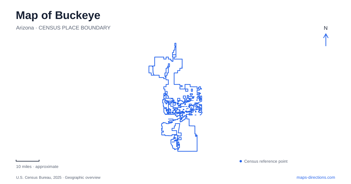
Street tiles load from OpenStreetMap when opened. The blue line shows the 2025 Census boundary.
- State
- Arizona
- Population · July 2025
- 125,445
- Land area
- 395.8 sq mi
- Water area
- 0.2 sq mi
Buckeye brings together an older valley town, newer planned neighborhoods, mountain recreation, and the Gila River landscape. These settings are spread across a broad area, so the city name alone is a weak description of where a destination sits. Monroe Avenue, Verrado, Watson Road, and Highway 85 provide more useful geographic anchors. Each points toward a different part of the local landscape, with different relationships between streets, buildings, and open land.
Monroe Avenue and the historic town
Monroe Avenue is a central reference for the historic downtown. The city uses Sixth Street Plaza and Monroe Avenue to locate downtown community events, and the surrounding numbered streets make the area legible at a neighborhood scale. The downtown library is at 310 North Sixth Street. The valley museum is at 116 East MC 85, adding another address associated with the older town rather than the newer neighborhoods near the mountains.
The museum's interpretation includes the early twentieth-century businesses that occupied Monroe Avenue. That historical focus helps explain why this street remains important to the city's identity. Downtown is not simply an arbitrary central point on a modern boundary map; it is an inherited commercial and civic setting with its own institutions and public spaces.
For a map of Buckeye, the useful first step is to keep this historic town cluster identifiable. A library visit, a museum stop, and an event on Monroe Avenue belong to the same broad local context. They should not be confused with a business described as being on Main Street in Verrado, which refers to a separate neighborhood center.
Verrado and a second Main Street setting
Verrado occupies a foothill setting associated with the southeastern White Tank Mountains. The city's description identifies a Main Street with shops serving the surrounding community. Its planned neighborhood structure and mountain relationship distinguish it from the older Monroe Avenue district.
The phrase “Main Street” can therefore create a genuine map ambiguity. It may be used conversationally to describe a traditional downtown shopping street, but in Verrado it is part of a specific neighborhood destination. Retaining the neighborhood name alongside the street or business resolves that ambiguity more effectively than relying on the city name alone.
This contrast reveals an important feature of Buckeye: several centers can coexist within the same municipality. The older valley streets preserve one development pattern, while the foothill community has another. Neither should be treated as a substitute for the other when arranging a meeting or comparing nearby destinations. On a map, the surrounding neighborhood and the mountain edge provide context that a single city marker cannot supply.
Watson Road and the southern White Tanks
Skyline Regional Park occupies approximately 8,700 acres in the southern White Tank Mountains. Its principal address is 2600 North Watson Road, about two miles north of the Interstate 10 and Watson Road interchange. This gives the park a clear approach relationship: the freeway interchange and Watson Road locate the main arrival area, while the mountains explain the terrain beyond it.
The park's trail map names routes such as Quartz Mine, Turnbuckle, Mountain Wash, and Skyline Crest. Those labels reveal a branching system with different terrain relationships rather than one uniform walking circuit. The map also identifies Watson Overlook, Discovery Point, and summit destinations. These names are useful for understanding whether a proposed outing follows a wash, approaches an overlook, or heads toward higher ground.
Skyline adds a mountain scale to the Buckeye map. The road journey ends at an organized trailhead, after which the route is described by trail junctions and terrain rather than neighborhood streets. A trail marked toward Verrado's Lost Creek area is a pedestrian connection in the mountain network, not evidence of a public road through the preserve. Keeping road and trail lines distinct is especially important here because both lead toward recognizable community names.
Highway 85 and the Gila River corridor
Robbins Butte Wildlife Area lies southwest of the city, on both sides of Highway 85 where it crosses the Gila River. The Arizona Game and Fish Department describes a mixture of river-bottom vegetation, mesquite terraces, desert uplands, and agricultural areas managed for wildlife. This is a different open-space environment from Skyline's mountain slopes.
The river corridor helps explain that variety. Willows, cottonwoods, cattails, and dense salt cedar occur near the water, while upland areas support desert vegetation. Managed fields add another component to the habitat. The result is a landscape where the relationship to the river matters more than a simple division between “developed” and “undeveloped” land.
A complete map of Buckeye should preserve these contrasts. Monroe Avenue identifies the historic town, Verrado identifies a foothill community, Watson Road leads toward a mountain preserve, and Highway 85 crosses a river-associated wildlife area. Reading those four settings together gives a practical understanding of the city's surroundings without treating every open space or commercial center as the same kind of destination.
Map and statistics: U.S. Census Bureau, 2025 Gazetteer, January 2025 generalized place boundaries and Vintage 2025 population estimates. Local references: City of Buckeye; Arizona Game and Fish Department. Article prepared by Maps & Directions.