Map of Brownsville
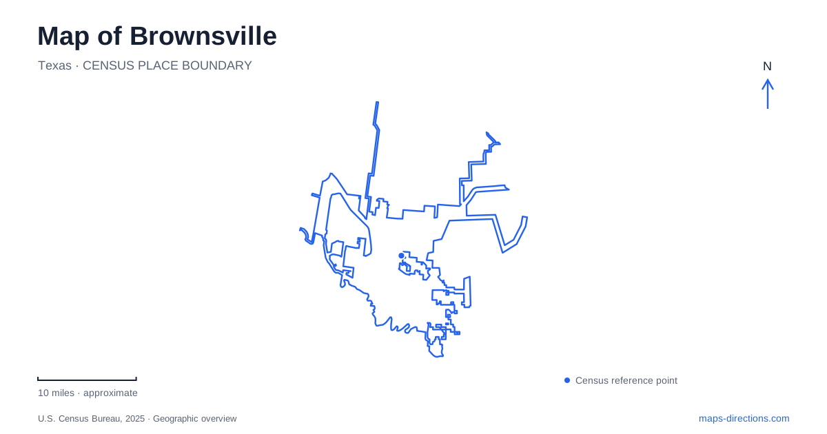
Street tiles load from OpenStreetMap when opened. The blue line shows the 2025 Census boundary.
- State
- Texas
- Population · July 2025
- 192,957
- Land area
- 122.0 sq mi
- Water area
- 6.4 sq mi
Brownsville's map preserves the traces of a river that has moved across its delta. The present Rio Grande forms the international boundary, while curved inland waterways called resacas record earlier channels. Downtown streets, historic buildings, battlefield grounds and nature preserves occupy this changing landscape. Reading the waterways alongside the street grid gives the city a more coherent shape than treating its museums and parks as disconnected points.
Market Square and buildings with two fronts
The historic market district reveals how commerce and municipal government once shared the same compact setting. Market Square was built in 1850 and opened as an open-air market in 1852. Vendors occupied the lower level while city offices used the upper floor. Despite damage from the 1867 hurricane, the building continued serving both functions.
Its later uses included enclosed stalls and a bus station. The historical association subsequently made the building a home for collections and archives, with research access by appointment. That sequence links food distribution, government, public transport and historical preservation within one site.
Surrounding buildings make the square's geometry especially interesting. The Olvera/Fernandez Building occupies a narrow parcel between the square and East Washington Street, with a public face toward each. Nearby commercial buildings combined shops below with family living quarters above. A walking map of Brownsville therefore benefits from attention to the spaces between buildings: the square was a commercial interior to the neighborhood, while the surrounding streets supplied additional frontages and approaches.
A house shaped by more than one family
The Stillman House belongs to the early domestic landscape along East Washington Street. Although associated with Charles Stillman, its present form also reflects additions made during the Treviño family's long ownership. Original windows, shutters and doors survive alongside courtyards that respond to the local climate.
The house is consequently more than a founder's memorial. Its layers show successive households adapting a building over time, and its courtyard arrangement provides a useful contrast with the nearby market's public activity. Its early-1850s origins place it within the same formative period as the market. Together, the two sites show domestic life and public exchange taking shape within a small group of adjoining downtown blocks.
Resacas explain the curves on the map
The National Park Service describes resacas as former channels left behind as the Rio Grande shifted. They are not naturally flowing branches still connected to the river. Rainfall and managed water supplies affect their appearance, making a blue line on a map an incomplete description of conditions on the ground.
Resaca de la Palma Battlefield offers a particularly direct introduction to this geography. Located at 1024 Paredes Line Road, it preserves the setting of the second major battle of the U.S.–Mexican War. A roughly three-quarter-mile interpretive circuit and an overlook allow visitors to examine both the historical site and its namesake channel.
The battlefield is about five miles south of Palo Alto Battlefield and lies near the Historic Battlefield Trail. These are connected historical places but separate visitor stops. Their arrangement helps a Brownsville map explain the movement between battle sites instead of collapsing the campaign into a single park marker.
Similar names, different outdoor experiences
Resaca de la Palma State Park is another destination, at 1000 New Carmen Avenue. Its focus is habitat and wildlife observation rather than the battlefield interpretation offered by the national park unit. More than eight miles of trails and four viewing decks provide access to its resaca, woodland and savannah settings.
Private cars stay at the visitor center; movement inside is by foot, bicycle or tram. That rule changes how the internal roads should be interpreted on a map. A visible paved route through the park does not automatically mean a drive-through wildlife tour.
Within residential Brownsville, the Paseo de la Resaca system offers a third approach to the waterways. Opened in 2000 on former Hudson Ranch land, it includes seven miles of paved walking and cycling trails and connects with the Historic Battlefield Trail. Here, the channels organize neighborhood recreation rather than a single protected natural area.
Native palms beside the river
Sabal Palm Sanctuary, at 8435 Sabal Palm Grove Road, protects a remnant of native palm habitat and provides more than three miles of nature trails. The 1892 Rabb Plantation House serves as its visitor center. Its position on high ground overlooking the river connects the preserved house with the plantation and river-commerce landscape that once surrounded it.
The sanctuary's native Sabal mexicana palms represent a surviving core of a habitat much reduced by agriculture and development. They should not be confused with ornamental palms planted along city streets. For a Brownsville outing, the sanctuary adds an ecological dimension to the historic center and resaca parks: all are shaped by the river, but each preserves a different consequence of its water, soils and changing course.
Map and statistics: U.S. Census Bureau, 2025 Gazetteer, January 2025 generalized place boundaries and Vintage 2025 population estimates. Local references: Brownsville Historical Association; National Park Service; Texas Parks and Wildlife Department; City of Brownsville; Gorgas Science Foundation. Article prepared by Maps & Directions.