Map of Broomfield
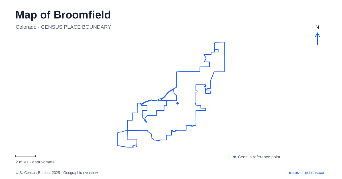
Street tiles load from OpenStreetMap when opened. The blue line shows the 2025 Census boundary.
- State
- Colorado
- Population · July 2025
- 79,174
- Land area
- 33.0 sq mi
- Water area
- 0.6 sq mi
Broomfield's public landscapes form a useful alternative to reading the city only through its major highways. The civic center, County Commons, and the open spaces around Lac Amora create distinct local reference points, while trails connect ponds, neighborhoods, and neighboring communities. Several historical sites also require a little context: the depot has moved from its original rail location, and Metzger Farm lies in Westminster despite its close connection with the city's open-space network.
A depot with two locations in its story
The Depot Museum stands at 2201 West 10th Avenue in Zang Spur Park. Built in 1909 for the Colorado and Southern Railway and the Denver and Interurban Railroad, the building combined railway functions with living quarters. That arrangement reflected a small settlement where providing a home helped the railroad accommodate its station agent and family.
The original depot site was near 120th Avenue and Wadsworth. Its relocation to the park means that the museum's present surroundings do not reproduce its working railway setting. The building still explains that transportation history, but a historical map and a modern visitor map place it in different contexts.
The neighboring Crawford Honey House adds a different local industry to the story. Its exhibit describes a family apiary with more than 500 hives and honey shipped around Colorado. Together, the depot and honey house reveal a smaller-scale Broomfield of rail service and agricultural enterprise, preceding the much larger suburban community visible on today's road map.
Civic facilities and The Field
The George Di Ciero City and County Building is at 1 DesCombes Drive. The library and auditorium share the 3 Community Park Road address, while the Community Center and Bay Aquatic Park occupy nearby Spader Way addresses. This concentration creates a recognizable civic and recreation area with several different public destinations.
The Field Open Space extends the relationship between civic buildings and outdoor routes. Official trail maps describe a loop running north from the library and city building through The Field, as well as routes northeast of Midway Boulevard and Main Street. These connections make the open land part of the civic area's everyday geography rather than a separate park reached only by a special trip.
At this scale, the map is organized by short roads, public grounds, and walking loops. It presents a different experience from traveling along US 36, where the bikeway follows a major regional transportation corridor. Both types of route are important, but they serve different patterns of movement through Broomfield.
County Commons combines playing fields and habitat
County Commons Park is at 13200 Sheridan Boulevard. The city identifies approaches from Sheridan and through the Paul Derda Recreation Center parking area at 13201 Lowell Boulevard, both between Midway and 136th avenues. These roads frame a substantial recreation landscape rather than a single small neighborhood park.
Playing fields and playgrounds occupy one part of the Commons, while the adjoining open space includes Le Gault and Tom Frost reservoirs. The city's open-space inventory describes wetlands, irrigation ditches, a wildlife-viewing deck, and a prairie dog preserve. Water and habitat therefore play as much a part in the broader site's identity as organized sport.
The Commons is particularly useful for understanding how Broomfield places different public uses beside one another. A field complex, indoor recreation center, and reservoir trails can share a broad destination name while presenting very different surroundings. The reservoirs and road edges provide the physical references that tie those parts together.
Lake Link and neighboring open spaces
The mostly soft-surface Lake Link Trail runs approximately 11 miles between Lac Amora Open Space in the west and McKay Lake near the community's eastern edge. Its name describes its organizing idea: linking water features and open lands rather than following a single arterial road. Around Lac Amora, the route relates to Josh's Pond, while Ridgeview adds hillier terrain and views toward the Front Range.
McKay Lake is owned and operated by Westminster. That detail is useful because the broader trail network crosses municipal relationships that are not obvious from a lake label alone. Nearby Metzger Farm offers another example. The historic property lies northeast of Lowell Boulevard and West 120th Avenue, within Westminster, and was acquired through cooperation between the two communities.
Metzger's farmstead and open land connect with the Big Dry Creek trail system. The regional creek route extends from Standley Lake beyond Interstate 25, while the separate Rock Creek and Coal Creek routes serve areas to the north and west. These corridors place the local open spaces within a larger landscape of streams, former farms, reservoirs, and neighboring towns.
A map of Broomfield becomes more informative when those relationships remain visible. The depot records an earlier railway geography, the civic grounds concentrate public services, and County Commons combines recreation with habitat. The trail network then carries the map outward, connecting these local places with landscapes that extend beyond the city boundary.
Map and statistics: U.S. Census Bureau, 2025 Gazetteer, January 2025 generalized place boundaries and Vintage 2025 population estimates. Local references: City and County of Broomfield. Article prepared by Maps & Directions.