Map of Brooklyn Park
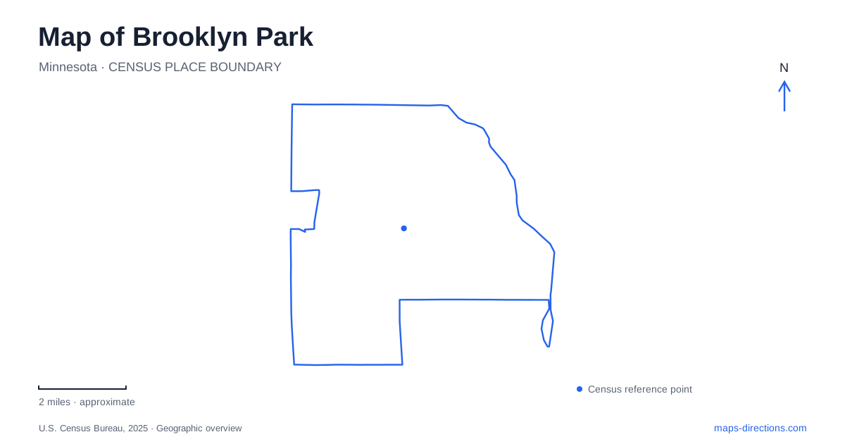
Street tiles load from OpenStreetMap when opened. The blue line shows the 2025 Census boundary.
- State
- Minnesota
- Population · July 2025
- 83,543
- Land area
- 26.1 sq mi
- Water area
- 0.5 sq mi
Brooklyn Park has two useful geographical frameworks: its numbered avenues and its river-and-trail connections. The first helps locate civic facilities and historic sites across the developed city. The second connects the Mississippi River with parks well beyond the municipal boundary. Understanding both prevents a map from becoming merely a list of recreation destinations. The dam crossing, the west-bank trail and the inland creek corridor each lead somewhere different.
Mississippi Gateway explains an older park name
Mississippi Gateway Regional Park was formerly known as Coon Rapids Dam Regional Park. Three Rivers Park District's redevelopment account explains that the regional park and the city's Environmental Nature Area were brought together through a joint plan. Older references to the dam park or nature area can therefore describe parts of the landscape now presented under the Gateway name.
For a Brooklyn Park map search, this naming history is more useful than assuming the older places have vanished. It explains why historic documents and contemporary visitor information can use different labels around the same river setting. The dam remains a geographical feature, while the regional park name describes the broader visitor landscape. Match the reference to its era and purpose before interpreting it as a separate destination.
The dam is a trail crossing, not a road shortcut
The regional park is at 10360 West River Road. Its walkway across the dam connects walking and cycling routes with trails operated by Anoka County on the other side of the Mississippi. That crossing belongs to the recreational network. It should not be interpreted as another vehicle bridge simply because a line spans the river on a small map.
The park also connects westward toward Elm Creek Park Reserve through Rush Creek Regional Trail. West Mississippi River Regional Trail leads toward North Mississippi Regional Park in Brooklyn Center. These connections give the riverfront three distinct travel ideas: crossing the river, following its west side, or leaving it for an inland route. Choose the corridor that matches the intended destination before calculating an outing's length.
Shingle Creek creates a separate inland route south
Shingle Creek Regional Trail begins at its connection with Rush Creek Regional Trail and continues south through Brooklyn Center, connecting with Shingle Creek Parkway and Minneapolis trails. Three Rivers describes much of its route through the neighboring city as passing parks and wetlands, with access to civic facilities, the Brookdale Library and businesses.
On a Brooklyn Park trail map, this is an important distinction from the west-bank river route. Both can form part of a southbound outing, but they organize movement around different landscapes. One follows a Mississippi corridor; the other uses an inland creek-and-wetland system. The shared Rush Creek connection is therefore a junction between route families rather than a guarantee that all southbound trails lead to the same places.
River Park is a different Mississippi destination
River Park's address is 101 83rd Avenue North. The city identifies approaches from 81st or 83rd avenues off West River Road. It is distinct from Mississippi Gateway's address farther along the river road, even though both appear in descriptions of public access to the Mississippi.
This difference is helpful when planning a Brooklyn Park meeting by the water. “The river park” could be understood generically, while River Park is a specific municipal place name. The avenue number resolves that ambiguity. For a two-park outing, retain each destination's full name and street reference; the river provides continuity, but it does not make their arrival points interchangeable.
Two public buildings share 85th Avenue
City Hall is at 5200 85th Avenue North, while the Community Activity Center is at 5600 85th Avenue North. The latter houses recreation and parks functions and serves as a gathering place for activities. Their shared avenue helps locate a civic cluster, but the different building numbers distinguish the administrative destination from the recreation destination.
This is a useful way to read the local address system without assuming every public service is in one complex. A City Hall appointment and an activity-center program need different destination selections. The avenue gives the broader east-west reference, while the building number and facility name identify the particular stop. Keep the directional suffix “North” with the address when comparing it with other numbered streets in the metropolitan area.
Eidem Farm preserves an earlier land use
Historic Eidem Farm occupies a 19-acre site at 4345 101st Avenue North. The city's interpretation focuses on farm life during the 1905–1920 period and the area's market-farming history. Its gardens, grounds and historic setting provide another way to understand land that might otherwise appear only as part of a suburban street map.
A Brooklyn Park itinerary can therefore connect several different layers of place: river infrastructure at the dam, regional travel corridors at the trail junctions, public facilities along 85th Avenue and agricultural history at Eidem Farm. The most informative map keeps those roles distinct. It shows not just where destinations sit, but why their addresses, crossings and landscape connections matter.
Map and statistics: U.S. Census Bureau, 2025 Gazetteer, January 2025 generalized place boundaries and Vintage 2025 population estimates. Local references: Three Rivers Park District; City of Brooklyn Park. Article prepared by Maps & Directions.