Map of Brookfield
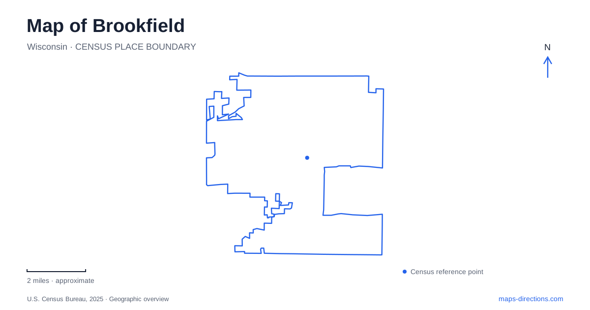
Street tiles load from OpenStreetMap when opened. The blue line shows the 2025 Census boundary.
- State
- Wisconsin
- Population · July 2025
- 41,448
- Land area
- 27.4 sq mi
- Water area
- 0.4 sq mi
Brookfield contains several landscapes that do not share a single center. The historic village area grew around a railway junction, later commercial development follows major road corridors, and substantial parks preserve or reuse land shaped by water. Fox Brook's quarry lake, Mitchell Park's river setting and Wirth Park's wetland corridor each have a different origin. Reading these places together makes the city more understandable than treating every green area or commercial district as interchangeable suburban space.
The railway village came first
The Milwaukee and Mississippi Railroad arrived in 1850, followed by a depot in 1853. The junction became a trading center for the surrounding farms. A second depot was constructed in 1867. This railway history predates the city government: Brookfield incorporated in 1954 after postwar development began changing an area that had remained largely agricultural.
The village area is associated with the crossing of Brookfield Road and the rail line, near River Road. It preserves the idea of a small commercial nucleus within a much broader community. The location helps explain why the historic center does not coincide with every later shopping destination or municipal facility. Its position was determined by the transport network and agricultural trade of the nineteenth century.
The junction story also provides a way to read the surrounding roads. A place that developed around rail access can retain a concentrated cluster even after residential growth spreads outward. Later development does not erase that older pattern; it adds other centers with different scales and relationships to the road system.
Fox Brook's water began as a quarry
Fox Brook Park is a county park on Barker Road, west of the Fox River. Its main lake occupies a former gravel quarry. The water is therefore not simply a natural lake left untouched within the city: excavation helped produce the setting that later became a recreation destination.
A paved loop follows the quarry lake, with viewing decks, fishing access and a sandy swimming beach among the park's features. Wetlands occupy another substantial part of the property. The combination creates two kinds of landscape in one park: a heavily used lake edge and a broader habitat area beyond it.
This distinction is useful when looking at aerial imagery. The conspicuous open water can dominate the view, yet it represents only part of the protected ground. A lakeside walk reveals the former quarry's new use, while the wetland areas explain why the park's value extends beyond its beach and picnic facilities. The county's listed approach is 2925 North Barker Road.
Mitchell Park follows the river
Mitchell Park lies south of Capitol Drive between Barker Road and the road through the historic village. Entries are provided from Capitol Drive and River Road. Its trails pass along the Fox River and through woodland, giving the park a flowing-water setting distinct from the quarry lake nearby.
The park also includes a canoe and kayak launch and an outdoor archery range. It serves as a connection point for the city's greenway system and the county's Fox River Trail. That role makes it part of a larger network: the park is both a destination with its own facilities and a place where longer outdoor routes meet.
A map of Brookfield should therefore distinguish the similar-sounding water destinations. Fox Brook Park centers much of its recreation around excavated open water, whereas Mitchell Park follows the river and its wooded surroundings. Their proximity does not make their terrain, activities or access arrangements identical.
Wirth Park combines playing fields and habitat
Franklin Wirth Park is at 2585 Pilgrim Road near North Avenue. The city acquired the site in 1961 and named it for its first mayor. The park includes upland recreation grounds as well as wetland, woodland and surface-water resources within the Underwood Creek environmental corridor.
Its facilities range from an aquatic center and athletic fields to nature trails, bike paths and winter recreation areas. This mixture explains the park's varied appearance on a map. Large regular playing surfaces occupy one part of the grounds, while less geometric natural areas follow the drainage landscape. The entire property is neither a sports complex nor an undisturbed preserve; its design accommodates both kinds of public use.
Commercial corridors add another layer
The city's planning documents identify the Bluemound Road corridor and Executive Drive area separately from the historic village. Capitol Drive and other major intersections also organize development. These references describe a community with several commercial and civic concentrations rather than one downtown that contains every major destination.
The most useful map of Brookfield keeps those layers visible. The railway explains the older village, major roads explain later development, and the parks reveal distinct relationships with a river, a quarry and a creek corridor. Each offers a concrete clue to how the surrounding land acquired its present form.
Map and statistics: U.S. Census Bureau, 2025 Gazetteer, January 2025 generalized place boundaries and Vintage 2025 population estimates. Local references: City of Brookfield; Waukesha County. Article prepared by Maps & Directions.