Map of Broken Arrow
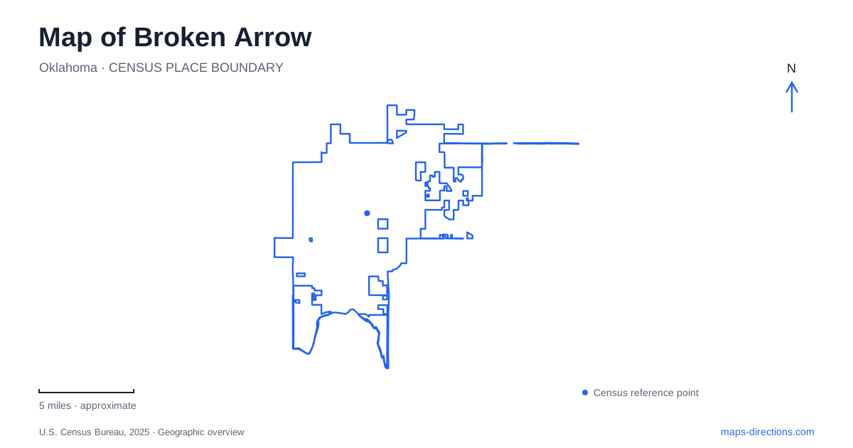
Street tiles load from OpenStreetMap when opened. The blue line shows the 2025 Census boundary.
- State
- Oklahoma
- Population · July 2025
- 124,991
- Land area
- 63.0 sq mi
- Water area
- 0.6 sq mi
Broken Arrow has more than one commercial center, and its local street names sometimes sit alongside regional numbered-road names. The Rose District follows historic Main Street, while New Orleans Square occupies a major intersection farther south. Ray Harral Nature Park adds a wooded setting near another road with two commonly used names. These relationships give a map reader concrete ways to distinguish downtown exploration, shopping around a crossroads, and a nature-center outing.
Main Street and the meaning of the Rose District
The Rose District is the downtown arts and entertainment area centered on Main Street. The name refers to a local history of planting rather than to a botanical garden. City information describes early civic leaders encouraging residents to add trees, bushes, and flowers to the sparse prairie landscape. Roses became a particularly recognizable part of that effort, and the later district name recalled the community's “City of Roses” identity.
This history matters geographically because a search for the Rose District should lead to a downtown street environment. Shops, galleries, dining, historic buildings, and public art are the relevant features. A visitor looking for a large rose garden would be interpreting the name too literally. The tourism office's downtown walking tour emphasizes museums, historic buildings, and art along the Main Street setting.
The district gives Broken Arrow a recognizable central corridor. It can be explored as a sequence of blocks and cultural stops, with the street itself providing continuity. This is a different pattern from a shopping area arranged around a large intersection. The value of the map lies partly in showing those differences: the same activity, such as visiting a restaurant, can take place in very different urban surroundings.
Main Street also extends beyond the arts district. The city's community garden is at 1500 South Main Street, behind the basketball courts. This separate address is a useful reminder that a street name is longer than the destination district most often associated with it. A place described as being on South Main should be located by its number and facility name rather than automatically placed among the downtown boutiques.
New Orleans Square and the numbered-road system
New Orleans Square is centered on West New Orleans Street and South Elm Place. The city identifies New Orleans Street as 101st Street, giving a direct translation between the local and regional naming systems. These are two names for the same corridor in this context, not two separate roads that a traveler must connect.
The square's identity is tied to the surrounding shopping area. Municipal planning describes the intersection as an earlier focus of commercial activity that lost some prominence as the community expanded outward. The name New Orleans Square was adopted in 2020, and the revitalization effort addressed the existing shopping centers and nearby land. Its history therefore differs from the Rose District's older Main Street setting.
On a map of Broken Arrow, this crossroads offers a second clear commercial anchor. The important coordinates in ordinary language are New Orleans and Elm, with 101st serving as the alternate east–west road name. Understanding that equivalence is especially helpful when one set of directions uses local names and another uses numbered streets.
The Rose District and New Orleans Square should consequently remain separate destinations in an itinerary. Both contain shopping and dining, but one follows a historic downtown corridor while the other is organized around a major intersection. Choosing a district first gives the subsequent business search a more useful geographic frame.
Tucson Street and the woodland park
Ray Harral Nature Center and Park is at 7101 South Third Street. The city locates it off Tucson Street, also identified as 121st Street, west of Lynn Lane and behind Childers and Spring Creek schools. This is another practical example of the dual road vocabulary used around Broken Arrow. Tucson and 121st refer to the same approach corridor in the municipal description.
The forty-acre park contains a natural spring system, a suspension bridge, pollinator gardens, an outdoor classroom, and approximately three miles of trails with varying grades. These features describe a compact woodland learning landscape rather than a large regional wilderness. The nature center provides an indoor component, while the trails and bridge organize the outdoor experience.
Ray Harral, the former assistant city manager for whom the park is named, helped develop the Indian Springs Sports Complex. The naming history connects the preserve with the city's wider recreation program, but the sports complex and the nature park are separate places. Their relationship is historical rather than a shared entrance or a continuous recreation campus.
The map of Broken Arrow becomes clearer when these three destination patterns are kept distinct. Main Street organizes a downtown arts corridor; New Orleans and Elm organize a commercial crossroads; Tucson, Lynn Lane, and South Third Street locate the wooded park. The paired names New Orleans/101st and Tucson/121st then make directions easier to interpret across local descriptions and regional maps.
Map and statistics: U.S. Census Bureau, 2025 Gazetteer, January 2025 generalized place boundaries and Vintage 2025 population estimates. Local references: City of Broken Arrow; Visit Broken Arrow. Article prepared by Maps & Directions.