Map of Brockton
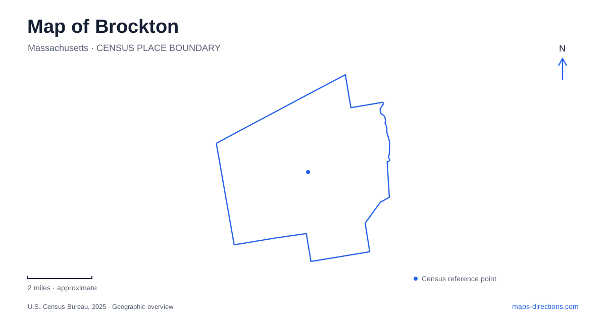
Street tiles load from OpenStreetMap when opened. The blue line shows the 2025 Census boundary.
- State
- Massachusetts
- Population · July 2025
- 106,134
- Land area
- 21.3 sq mi
- Water area
- 0.2 sq mi
Brockton combines a dense industrial-city landscape with a remarkably extensive park built around water. The two settings are connected by the city's history: wealth from shoe manufacturing helped create public institutions and landscapes whose addresses still organize local travel. School Street identifies the civic center, while Oak Street introduces a different environment of ponds, woods, golf, and museum grounds. A useful map should show both scales. The downtown blocks explain the working city, and the northern park landscape explains a substantial part of its recreational geography.
School Street and the manufacturing legacy
City Hall stands at 45 School Street. The municipal parks inventory places City Hall Park, also called G.A.R. Park, on School Street, giving the civic building an associated outdoor space. This is a useful downtown reference because the government address and the park name describe neighboring parts of the same civic setting.
The city's downtown green-space plan describes a manufacturing economy dominated by shoes during the nineteenth and twentieth centuries. Rail, electricity, workers, and the headwaters of the Taunton watershed all contributed to that industrial development. The resulting landscape was not simply a collection of factories: it involved transport, water, housing, and public buildings arranged around a working urban center.
For Brockton, that history explains why redevelopment and environmental restoration often appear together in planning documents. Former industrial activity left both buildings and affected waterways. A river or green-space proposal on a downtown map can therefore represent work on an inherited industrial landscape, rather than the creation of a park on previously untouched land. Understanding that context gives more meaning to the small public spaces between established streets.
A park assembled around ponds
D.W. Field Park was assembled through gifts of land by Daniel Waldo Field, whose business success included the shoe industry. His initial 1925 donation covered land in the Montello section. Further gifts added Cross Pond and the golf-course area, followed by land in neighboring Avon in 1930.
This makes the park's municipal geography important. Its landscape extends beyond a single city boundary, and its development occurred through several acquisitions rather than one uniform subdivision. Most construction took place between 1925 and 1934. Field followed the work closely, drawing inspiration from plans by landscape architects and the city engineer.
The park became part of Brockton's public identity through a naturalistic arrangement of water, roads, and vegetation. It was listed on the National Register of Historic Places in 2000. That recognition concerns the designed landscape as a whole, including its role in the urban park movement and the development of local water resources.
Reading the parkway and its water sequence
The park's contemporary trail map distinguishes paved paths, unpaved paths, and the parkway used by vehicles. It also marks one-way and two-way automobile sections. Those symbols are significant because a loop visible on a broad map does not have the same meaning for every traveler: a walking route and a driving circuit follow different rules within the same landscape.
Named waters provide a clearer way to follow the park than an undifferentiated green area. Cross Pond, Ellis Brett Pond, Thirty Acre Pond, Lower Porter Pond, Upper Porter Pond, Waldo Lake, and the reservoir appear along the elongated grounds. Oak Street crosses the landscape near the Porter ponds. Tower Hill adds a vertical landmark, with a fieldstone observation tower described in the city's open-space plan.
A map of Brockton should retain these individual names. They help separate the southern pond sequence from the larger waters farther north and explain why the park has several parking areas. The experience is organized around a chain of settings rather than a single central lawn.
Art and golf along Oak Street
Fuller Craft Museum occupies 455 Oak Street beside Upper Porter Pond. It opened in 1969, supported by a trust established by geologist and hydrologist Myron Leslie Fuller. Its wooded property and views toward the pond are integral to the building's architecture, which connects gallery spaces with views of the surrounding landscape.
The museum therefore provides an indoor counterpart to the park's outdoor scenery. Its contemporary-craft focus and its relationship to woods and water make it a distinct destination within the broader recreation area. Nearby on the same street, the municipal golf course uses 331 Oak Street. Established in 1927, the course was designed by Stiles and Van Kleek.
Beyond this northern concentration, Brockton's parks inventory identifies smaller spaces across other streets: Keith Park on South Main, Snow Park on Crescent, and the Salisbury River Plain on Pine Avenue. Those locations round out the map with neighborhood-scale recreation. The civic center, the linked ponds, the museum, and these smaller green spaces show several different ways public life occupies the city's inherited street network.
Map and statistics: U.S. Census Bureau, 2025 Gazetteer, January 2025 generalized place boundaries and Vintage 2025 population estimates. Local references: City of Brockton; D.W. Field Park Initiative; Wildlands Trust; Fuller Craft Museum; D.W. Field Golf Course. Article prepared by Maps & Directions.