Map of Brighton
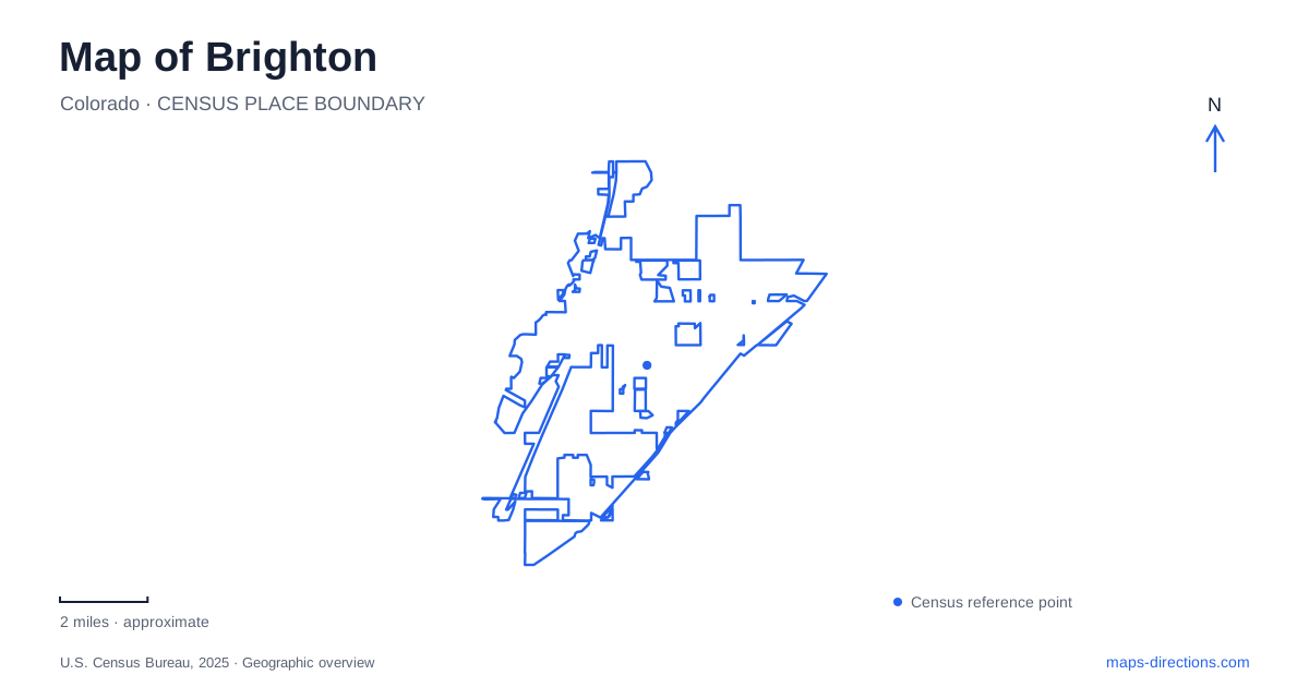
Street tiles load from OpenStreetMap when opened. The blue line shows the 2025 Census boundary.
- State
- Colorado
- Population · July 2025
- 45,395
- Land area
- 21.7 sq mi
- Water area
- 0.3 sq mi
Brighton grew where farming, irrigation, and rail transportation reinforced one another. The South Platte supplied the setting for early agricultural settlement, while rail connections carried produce beyond the immediate valley. Those relationships explain why a map of this part of Colorado contains historic farm properties alongside downtown commercial blocks and a substantial reservoir landscape. Bridge Street, South Fourth Avenue, and Bromley Lane provide useful reference points for exploring that history without treating every surviving landmark as part of a single compact district.
From river bottomland to irrigated farms
The municipal history traces local agricultural settlement to five men who claimed ranches along the Platte in July 1859. They had come seeking gold, but supplying food to mining communities offered another livelihood. Initially, the river bottomland supported crops and livestock. Irrigation ditches then extended cultivation into land beyond that naturally favorable strip.
This sequence helps explain the larger landscape around Brighton. Water distribution mattered as much as the roads between farms. Fields farther from the river depended on organized irrigation, and the resulting agricultural economy included vegetables destined for regional markets. When viewing historic maps, ditch alignments therefore deserve attention alongside property boundaries. They reveal how apparently separate fields belonged to a shared working system, with water moving across a landscape that later acquired additional streets and development.
The depot changed position
The surviving Union Pacific depot dates from 1907. Its original surroundings included cabbage loading docks along Second Avenue, giving rise to the name Cabbage Avenue. Passenger and freight activity connected the town with Denver to the south and Greeley and Cheyenne to the north. Passenger service ended in 1964, but the building's story continued beyond its railway use.
In 1981, the depot was moved across the tracks to 269 Bridge Street. This relocation matters when comparing present-day Brighton with an old railway photograph: the building survives, but its position relative to the rails changed. The historic loading area and the current landmark should be understood as successive chapters of the same place. Bridge Street provides the modern address, while the former trackside setting explains the structure's original purpose and its relationship to agricultural shipments.
Bromley Lane and Japanese American farming
At 1594 East Bromley Lane, the Bromley/Koizuma-Hishinuma Farm preserves another part of that agricultural story. Emmet Bromley purchased 200 acres in 1883 near present-day South Fifteenth Avenue and Bromley Lane. His holdings eventually exceeded 1,100 acres, extending well beyond the surviving farm complex. Cattle, sheep, and horses were important to the early operation.
The Hishinuma and Koizuma families bought the property in 1947 after earlier farming around Barr Lake and Fort Lupton. Their crops included sugar beets, cabbage, alfalfa, and corn. The city acquired the property in 2006 to prevent demolition of its buildings.
For Brighton, the compound makes agricultural history visible at the scale of a particular property. Its address marks a preserved remnant of a much larger farming landscape. The family names also keep Japanese American agricultural participation in view, giving the site a fuller identity than the Bromley street name alone conveys. Looking at both the property and its former extent helps explain how a historic farm can remain legible within a changed urban setting.
Strong Street's military building became an arts venue
The Armory Performing Arts Center occupies 300 Strong Street. The historic building was designed by John James Huddart, with plans completed in 1921 and a formal opening in March 1922. Locally manufactured hydrastone blocks gave it a distinctive construction material. Its original facilities included a drill hall, stage, and even a basement swimming pool.
Those features show that the building accommodated recreation and assembly as well as military functions. Its present arts role continues that gathering-place thread. On a downtown itinerary, the Armory adds a different architectural and institutional story to the commercial and railway sites. The city museum, meanwhile, is on the second floor at 22 South Fourth Avenue; municipal offices at 500 South Fourth Avenue are a separate address.
Barr Lake extends the picture beyond downtown
Bromley Lane also figures in the state park approach: from Interstate 76, the park directs visitors east along the lane and south on Piccadilly Road. Barr Lake's southern half is a wildlife refuge, and the nature center sits near the south parking area. These features place habitat protection at the center of the reservoir visit.
Before adding the lake to a Brighton outing, review park conditions. Boating arrangements and trails around the dam are separate questions, and park maintenance can affect each differently. The reservoir's mapped shoreline remains a geographic reference, but it does not establish which activities or paths are available on a particular day.
Map and statistics: U.S. Census Bureau, 2025 Gazetteer, January 2025 generalized place boundaries and Vintage 2025 population estimates. Local references: City of Brighton; Colorado Parks and Wildlife. Article prepared by Maps & Directions.